Size of this preview:
792 × 600 pixels. Other resolutions:
317 × 240 pixels |
634 × 480 pixels |
1,014 × 768 pixels |
1,280 × 969 pixels |
1,999 × 1,514 pixels.
Original file (1,999 × 1,514 pixels, file size: 320 KB, MIME type: image/jpeg)
| This is a file from the
Wikimedia Commons. Information from its
description page there is shown below. Commons is a freely licensed media file repository. You can help. |
| Description |
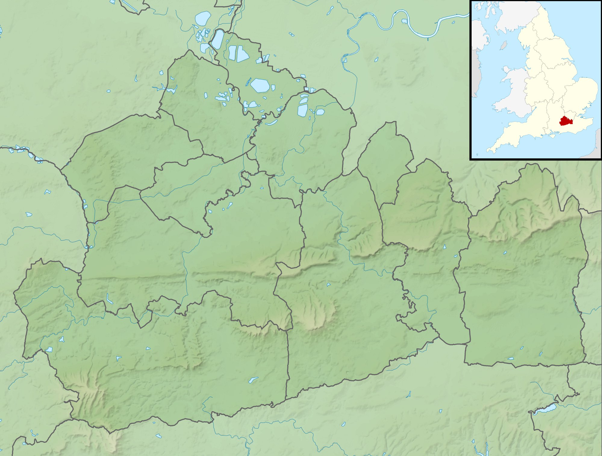
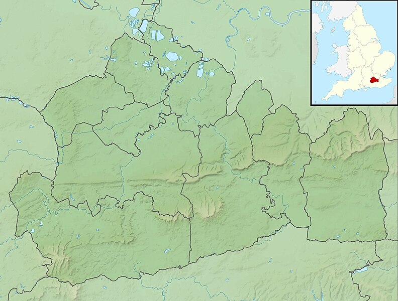
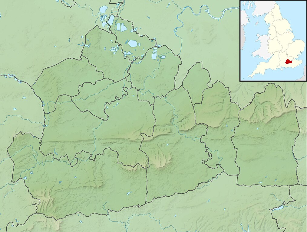
Relief map of Surrey, UK. Equirectangular map projection on WGS 84 datum, with N/S stretched 160% Geographic limits:
|
| Date | |
| Source |
|
| Author | Nilfanion, created using Ordnance Survey data |
| Permission ( Reusing this file) |
This file is licensed under the
Creative Commons
Attribution-Share Alike 3.0 Unported license. Attribution: Contains Ordnance Survey data © Crown copyright and database right
|
| Other versions | File:Surrey UK district map (blank).svg - Blank map |
.svg)
File history
Click on a date/time to view the file as it appeared at that time.
| Date/Time | Thumbnail | Dimensions | User | Comment | |
|---|---|---|---|---|---|
| current | 01:57, 29 November 2011 |
| 1,999 × 1,514 (320 KB) | Nilfanion | {{Information |Description=Relief map of Surrey, UK. Equirectangular map projection on WGS 84 datum, with N/S stretched 160% Geographic limits: *West: 0.87W *East: 0.08E *North: 51.50N *South: 51.05N |Source=[[w:Ordnance Survey|Ordnance Sur |
File usage
The following pages on the English Wikipedia use this file (pages on other projects are not listed):
- 1956 Canada Cup
- 1990 Volvo PGA Championship
- 1991 European Ladies' Team Championship
- 1991 Volvo PGA Championship
- 1992 Volvo PGA Championship
- 1993 Volvo PGA Championship
- 1994 Volvo PGA Championship
- 1995 Volvo PGA Championship
- 1996 Volvo PGA Championship
- 1997 Volvo PGA Championship
- 1998 Volvo PGA Championship
- 1999 Volvo PGA Championship
- 2001 Volvo PGA Championship
- 2002 Volvo PGA Championship
- 2003 Volvo PGA Championship
- 2004 Volvo PGA Championship
- 2005 BMW Championship
- 2006 BMW Championship
- 2007 BMW PGA Championship
- 2008 BMW PGA Championship
- 2009 BMW PGA Championship
- 2010 BMW PGA Championship
- 2011 BMW PGA Championship
- 2011 Senior Open Championship
- 2012 BMW PGA Championship
- 2013 BMW PGA Championship
- 2014 BMW PGA Championship
- 2015 BMW PGA Championship
- 2016 BMW PGA Championship
- 2017 BMW PGA Championship
- 2018 BMW PGA Championship
- 2019 BMW PGA Championship
- 2020 BMW PGA Championship
- 2021 BMW PGA Championship
- BMW PGA Championship
- Bessborough Reservoir
- Blackwell Farm
- Botley Hill
- Box Hill, Surrey
- Colley Hill
- Gibbet Hill, Hindhead
- Guildford Synagogue
- Hog's Back
- Island Barn Reservoir
- King George VI Reservoir
- Knight Reservoir
- Leith Hill
- Mercers Lake
- North West Surrey Synagogue
- Queen Elizabeth II Reservoir
- Queen Mary Reservoir
- Silent Pool
- Silvermere
- Staines Reservoirs
- Surrey Hills National Landscape
- Wentworth Senior Masters
- Windlesham Moor
- Wraysbury Reservoir
- User:Mertbiol/Template:Surrey Hills AONB
- User:Mertbiol/sandbox
- Module:Location map/data/Surrey
- Module:Location map/data/United Kingdom Surrey
- Module:Location map/data/United Kingdom Surrey/doc
Global file usage
The following other wikis use this file:
- Usage on ar.wikipedia.org
- Usage on bg.wikipedia.org
- Usage on ceb.wikipedia.org
- Usage on es.wikipedia.org
- Usage on fr.wikipedia.org
- Usage on ja.wikipedia.org
- Usage on kn.wikipedia.org
- Usage on la.wikipedia.org
- Usage on lv.wikipedia.org
- Usage on mk.wikipedia.org
- Usage on nl.wikipedia.org
- Usage on os.wikipedia.org
- Usage on pl.wikipedia.org
- Usage on pl.wikibooks.org
- Usage on sco.wikipedia.org
- Usage on sh.wikipedia.org
- Usage on simple.wikipedia.org
- Usage on si.wikipedia.org
- Usage on sv.wikipedia.org
- Usage on tr.wikipedia.org
- Usage on ur.wikipedia.org
- Usage on war.wikipedia.org
- Usage on yi.wikipedia.org
- Usage on zh.wikipedia.org
Size of this preview:
792 × 600 pixels. Other resolutions:
317 × 240 pixels |
634 × 480 pixels |
1,014 × 768 pixels |
1,280 × 969 pixels |
1,999 × 1,514 pixels.
Original file (1,999 × 1,514 pixels, file size: 320 KB, MIME type: image/jpeg)
| This is a file from the
Wikimedia Commons. Information from its
description page there is shown below. Commons is a freely licensed media file repository. You can help. |
| Description |
Relief map of Surrey, UK. Equirectangular map projection on WGS 84 datum, with N/S stretched 160% Geographic limits:
|
| Date | |
| Source |
|
| Author | Nilfanion, created using Ordnance Survey data |
| Permission ( Reusing this file) |
This file is licensed under the
Creative Commons
Attribution-Share Alike 3.0 Unported license. Attribution: Contains Ordnance Survey data © Crown copyright and database right
|
| Other versions | File:Surrey UK district map (blank).svg - Blank map |
File history
Click on a date/time to view the file as it appeared at that time.
| Date/Time | Thumbnail | Dimensions | User | Comment | |
|---|---|---|---|---|---|
| current | 01:57, 29 November 2011 |
| 1,999 × 1,514 (320 KB) | Nilfanion | {{Information |Description=Relief map of Surrey, UK. Equirectangular map projection on WGS 84 datum, with N/S stretched 160% Geographic limits: *West: 0.87W *East: 0.08E *North: 51.50N *South: 51.05N |Source=[[w:Ordnance Survey|Ordnance Sur |
File usage
The following pages on the English Wikipedia use this file (pages on other projects are not listed):
- 1956 Canada Cup
- 1990 Volvo PGA Championship
- 1991 European Ladies' Team Championship
- 1991 Volvo PGA Championship
- 1992 Volvo PGA Championship
- 1993 Volvo PGA Championship
- 1994 Volvo PGA Championship
- 1995 Volvo PGA Championship
- 1996 Volvo PGA Championship
- 1997 Volvo PGA Championship
- 1998 Volvo PGA Championship
- 1999 Volvo PGA Championship
- 2001 Volvo PGA Championship
- 2002 Volvo PGA Championship
- 2003 Volvo PGA Championship
- 2004 Volvo PGA Championship
- 2005 BMW Championship
- 2006 BMW Championship
- 2007 BMW PGA Championship
- 2008 BMW PGA Championship
- 2009 BMW PGA Championship
- 2010 BMW PGA Championship
- 2011 BMW PGA Championship
- 2011 Senior Open Championship
- 2012 BMW PGA Championship
- 2013 BMW PGA Championship
- 2014 BMW PGA Championship
- 2015 BMW PGA Championship
- 2016 BMW PGA Championship
- 2017 BMW PGA Championship
- 2018 BMW PGA Championship
- 2019 BMW PGA Championship
- 2020 BMW PGA Championship
- 2021 BMW PGA Championship
- BMW PGA Championship
- Bessborough Reservoir
- Blackwell Farm
- Botley Hill
- Box Hill, Surrey
- Colley Hill
- Gibbet Hill, Hindhead
- Guildford Synagogue
- Hog's Back
- Island Barn Reservoir
- King George VI Reservoir
- Knight Reservoir
- Leith Hill
- Mercers Lake
- North West Surrey Synagogue
- Queen Elizabeth II Reservoir
- Queen Mary Reservoir
- Silent Pool
- Silvermere
- Staines Reservoirs
- Surrey Hills National Landscape
- Wentworth Senior Masters
- Windlesham Moor
- Wraysbury Reservoir
- User:Mertbiol/Template:Surrey Hills AONB
- User:Mertbiol/sandbox
- Module:Location map/data/Surrey
- Module:Location map/data/United Kingdom Surrey
- Module:Location map/data/United Kingdom Surrey/doc
Global file usage
The following other wikis use this file:
- Usage on ar.wikipedia.org
- Usage on bg.wikipedia.org
- Usage on ceb.wikipedia.org
- Usage on es.wikipedia.org
- Usage on fr.wikipedia.org
- Usage on ja.wikipedia.org
- Usage on kn.wikipedia.org
- Usage on la.wikipedia.org
- Usage on lv.wikipedia.org
- Usage on mk.wikipedia.org
- Usage on nl.wikipedia.org
- Usage on os.wikipedia.org
- Usage on pl.wikipedia.org
- Usage on pl.wikibooks.org
- Usage on sco.wikipedia.org
- Usage on sh.wikipedia.org
- Usage on simple.wikipedia.org
- Usage on si.wikipedia.org
- Usage on sv.wikipedia.org
- Usage on tr.wikipedia.org
- Usage on ur.wikipedia.org
- Usage on war.wikipedia.org
- Usage on yi.wikipedia.org
- Usage on zh.wikipedia.org