Photos • Location


Size of this preview:
800 × 480 pixels. Other resolutions:
320 × 192 pixels |
1,024 × 614 pixels |
1,280 × 768 pixels |
2,560 × 1,536 pixels |
4,800 × 2,880 pixels.
Original file (4,800 × 2,880 pixels, file size: 6.32 MB, MIME type: image/jpeg)
| This is a file from the
Wikimedia Commons. Information from its
description page there is shown below. Commons is a freely licensed media file repository. You can help. |
Summary
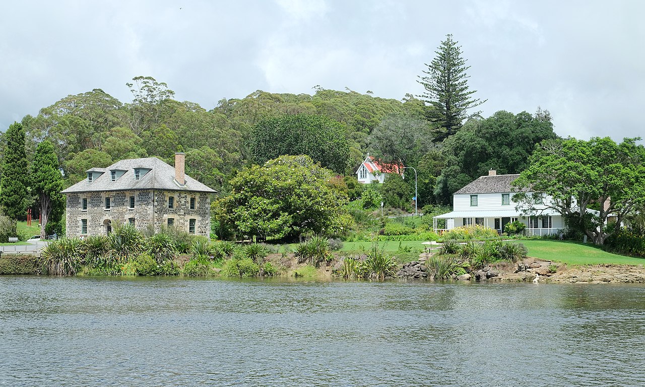
| Description | The historic Stone Store and Kemp House in Kerikeri from across Kerikeri River |
| Date | |
| Source | Own work |
| Author | Pseudopanax at English Wikipedia |
| Camera location |
| View this and other nearby images on: OpenStreetMap |
|
|---|
Licensing
| I, the copyright holder of this work, release this work into the
public domain. This applies worldwide. In some countries this may not be legally possible; if so: I grant anyone the right to use this work for any purpose, without any conditions, unless such conditions are required by law. |
File history
Click on a date/time to view the file as it appeared at that time.
| Date/Time | Thumbnail | Dimensions | User | Comment | |
|---|---|---|---|---|---|
| current | 02:40, 26 June 2018 |
| 4,800 × 2,880 (6.32 MB) | Pseudopanax | == {{int:filedesc}} == {{Information |Description=The historic Stone Store and Kemp House in Kerikeri from across Kerikeri River |Source={{Own}} |Date=2018-01-23 |Author={{user at project|Pseudopanax|wikipedia|en}} }} {{location|35|13|1|S|173|57|48|E}} == {{int:license-header}} == {{PD-self}} Category:Stone Store, Kerikeri Category:Kerikeri Mission House |
File usage
The following pages on the English Wikipedia use this file (pages on other projects are not listed):
Global file usage
The following other wikis use this file:
- Usage on ary.wikipedia.org
- Usage on fr.wikipedia.org
- Usage on it.wikipedia.org
- Usage on simple.wikipedia.org
Metadata
Size of this preview:
800 × 480 pixels. Other resolutions:
320 × 192 pixels |
1,024 × 614 pixels |
1,280 × 768 pixels |
2,560 × 1,536 pixels |
4,800 × 2,880 pixels.
Original file (4,800 × 2,880 pixels, file size: 6.32 MB, MIME type: image/jpeg)
| This is a file from the
Wikimedia Commons. Information from its
description page there is shown below. Commons is a freely licensed media file repository. You can help. |
Summary
| Description | The historic Stone Store and Kemp House in Kerikeri from across Kerikeri River |
| Date | |
| Source | Own work |
| Author | Pseudopanax at English Wikipedia |
| Camera location |
| View this and other nearby images on: OpenStreetMap |
|
|---|
Licensing
| I, the copyright holder of this work, release this work into the
public domain. This applies worldwide. In some countries this may not be legally possible; if so: I grant anyone the right to use this work for any purpose, without any conditions, unless such conditions are required by law. |
File history
Click on a date/time to view the file as it appeared at that time.
| Date/Time | Thumbnail | Dimensions | User | Comment | |
|---|---|---|---|---|---|
| current | 02:40, 26 June 2018 |
| 4,800 × 2,880 (6.32 MB) | Pseudopanax | == {{int:filedesc}} == {{Information |Description=The historic Stone Store and Kemp House in Kerikeri from across Kerikeri River |Source={{Own}} |Date=2018-01-23 |Author={{user at project|Pseudopanax|wikipedia|en}} }} {{location|35|13|1|S|173|57|48|E}} == {{int:license-header}} == {{PD-self}} Category:Stone Store, Kerikeri Category:Kerikeri Mission House |
File usage
The following pages on the English Wikipedia use this file (pages on other projects are not listed):
Global file usage
The following other wikis use this file:
- Usage on ary.wikipedia.org
- Usage on fr.wikipedia.org
- Usage on it.wikipedia.org
- Usage on simple.wikipedia.org