Photos • Location


Size of this preview:
800 × 600 pixels. Other resolutions:
320 × 240 pixels |
640 × 480 pixels |
1,024 × 768 pixels.
Original file (1,024 × 768 pixels, file size: 197 KB, MIME type: image/jpeg)
| This is a file from the
Wikimedia Commons. Information from its
description page there is shown below. Commons is a freely licensed media file repository. You can help. |
| Description |
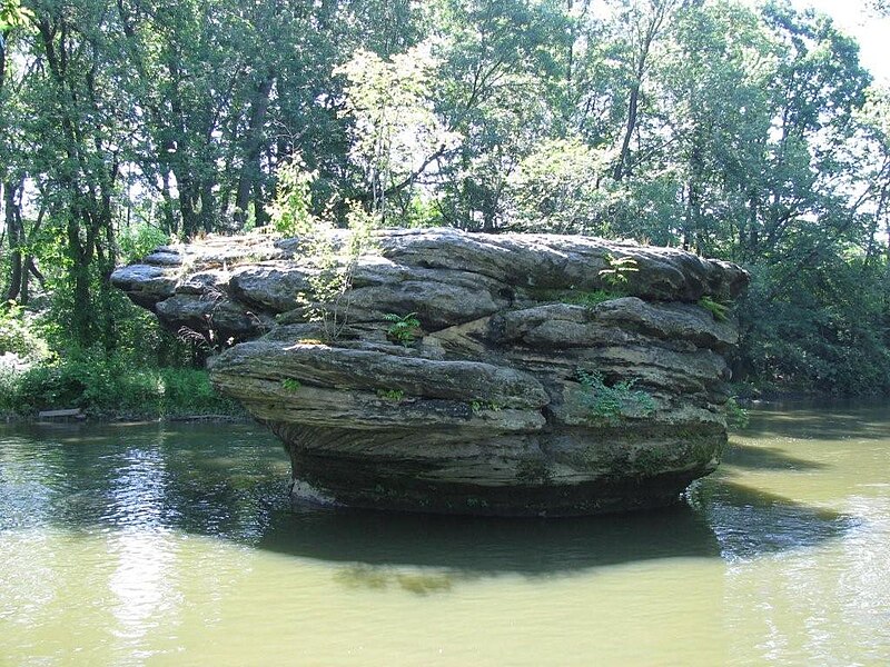
English: Picture of Standing Rock in
Kent, Ohio in the
Cuyahoga River. Standing Rock was also known as "Standing Stone" and "Council Rock" as it was a meeting place for some Native tribes who inhabited the area prior to European settlement in the late 1700s and early 1800s. |
| Date | |
| Source | Own work |
| Author | JonRidinger, taken by my grandfather Barton Derby |
| Permission ( Reusing this file) |
This file is licensed under the
Creative Commons
Attribution 3.0 Unported license.
|
| Object location |
| View this and other nearby images on: OpenStreetMap |
|
|---|
File history
Click on a date/time to view the file as it appeared at that time.
| Date/Time | Thumbnail | Dimensions | User | Comment | |
|---|---|---|---|---|---|
| current | 17:06, 19 April 2010 |
| 1,024 × 768 (197 KB) | JonRidinger | {{Information |Description={{en|1=Picture of Standing Rock in Kent, Ohio in the Cuyahoga River. Standing Rock was also known as "Standing Stone" and "Council Rock" as it was a meeting place for some Native tribes who |
File usage
The following pages on the English Wikipedia use this file (pages on other projects are not listed):
Global file usage
The following other wikis use this file:
- Usage on en.wikivoyage.org
- Usage on zh.wikipedia.org
Metadata
Size of this preview:
800 × 600 pixels. Other resolutions:
320 × 240 pixels |
640 × 480 pixels |
1,024 × 768 pixels.
Original file (1,024 × 768 pixels, file size: 197 KB, MIME type: image/jpeg)
| This is a file from the
Wikimedia Commons. Information from its
description page there is shown below. Commons is a freely licensed media file repository. You can help. |
| Description |
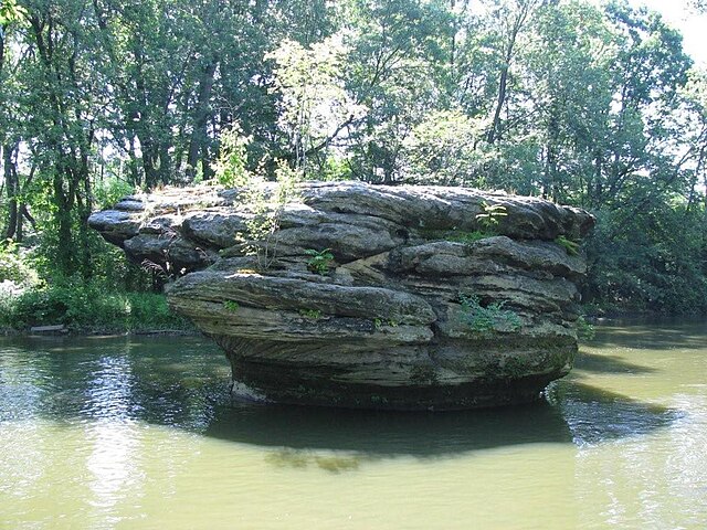
English: Picture of Standing Rock in
Kent, Ohio in the
Cuyahoga River. Standing Rock was also known as "Standing Stone" and "Council Rock" as it was a meeting place for some Native tribes who inhabited the area prior to European settlement in the late 1700s and early 1800s. |
| Date | |
| Source | Own work |
| Author | JonRidinger, taken by my grandfather Barton Derby |
| Permission ( Reusing this file) |
This file is licensed under the
Creative Commons
Attribution 3.0 Unported license.
|
| Object location |
| View this and other nearby images on: OpenStreetMap |
|
|---|
File history
Click on a date/time to view the file as it appeared at that time.
| Date/Time | Thumbnail | Dimensions | User | Comment | |
|---|---|---|---|---|---|
| current | 17:06, 19 April 2010 |
| 1,024 × 768 (197 KB) | JonRidinger | {{Information |Description={{en|1=Picture of Standing Rock in Kent, Ohio in the Cuyahoga River. Standing Rock was also known as "Standing Stone" and "Council Rock" as it was a meeting place for some Native tribes who |
File usage
The following pages on the English Wikipedia use this file (pages on other projects are not listed):
Global file usage
The following other wikis use this file:
- Usage on en.wikivoyage.org
- Usage on zh.wikipedia.org