
Original file (SVG file, nominally 512 × 695 pixels, file size: 538 KB)
| This is a file from the
Wikimedia Commons. Information from its
description page there is shown below. Commons is a freely licensed media file repository. You can help. |
Summary
| Description |
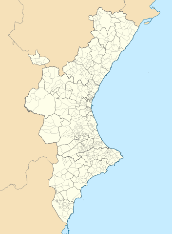
Català: Mapa de localització del
País Valencià
Projecció equirrectangular, N/S estirada 130 %. Extrems geogràfics al mapa:
English: Location map of the
Land of Valencia
Equirectangular projection, N/S stretching 130 %. Geographic limits of the map:
Español: Mapa de localización de la
Comunidad Valenciana
Proyección equirrectangular, N/S estirada 130 %. Límites geográficos del mapa:
|
|
| Date | ||
| Source | Own work based on: EspañaLoc.svg by HansenBCN, and Own work based on: Mapa de localització a les comarques valencianes.svg by Martorell | |
| Author | Miguillen and Martorell | |
| SVG development | This
locator map was created with
Inkscape.
|
Licensing
- You are free:
- to share – to copy, distribute and transmit the work
- to remix – to adapt the work
- Under the following conditions:
- attribution – You must give appropriate credit, provide a link to the license, and indicate if changes were made. You may do so in any reasonable manner, but not in any way that suggests the licensor endorses you or your use.
- share alike – If you remix, transform, or build upon the material, you must distribute your contributions under the same or compatible license as the original.
File history
Click on a date/time to view the file as it appeared at that time.
| Date/Time | Thumbnail | Dimensions | User | Comment | |
|---|---|---|---|---|---|
| current | 07:29, 9 September 2022 |
| 512 × 695 (538 KB) | Martorell | Added borders of comarques. |
| 14:39, 25 May 2010 |
 | 512 × 695 (494 KB) | Miguillen | == {{int:filedesc}} == {{Information |Description={{en|Location map of Valencian Community}} Equirectangular projection, N/S stretching 130 %. Geographic limits of the map: * N: 40.885909° N * S: 37.698098° N * W: 1.95368 |
File usage
More than 100 pages use this file. The following list shows the first 100 pages that use this file only. A full list is available.
- Ademuz
- Agres
- Alcalalí
- Alcocer de Planes
- Alcoleja
- Alcàsser
- Alfafara
- Alfauir
- Alicante
- Almassora
- Almudaina
- Altea
- Alzira, Valencia
- Balones
- Barx
- Benasau
- Benejúzar
- Beniarrés
- Benicàssim
- Benidorm
- Benifairó de la Valldigna
- Benigànim
- Benilloba
- Benillup
- Benissa
- Burjassot
- Burriana, Castellón
- Buñol
- Calpe
- Carcaixent
- Carlet
- Casas Altas
- Casas Bajas
- Castell de Castells
- Castellonet de la Conquesta
- Castellón de la Plana
- Castielfabib
- Chera, Valencia
- Cocentaina
- Cofrentes
- Cullera
- Daimús
- Dos Aguas
- Dénia
- El Bosque Open
- Elche
- Elda
- Foios
- Gandia
- Guardamar del Segura
- Ibi, Spain
- L'Alqueria d'Asnar
- La Font de la Figuera
- La Vall de Gallinera
- Llombai
- Llutxent
- Lorcha, Spain
- Lucentum
- Mislata
- Mogente/Moixent
- Moncada, Valencia
- Moraira
- Muro de Alcoy
- Novelda
- Nules
- Oliva
- Ontinyent
- Open Mediterrania
- Orihuela
- Oropesa del Mar
- Paterna
- Peniscola
- Pilar de la Horadada
- Pinoso
- Puebla de San Miguel
- Puçol
- Quart de Poblet
- Sagunto
- Salem, Valencia
- Santa Pola
- Segorbe
- Seniors Tour Championship
- Simat de la Valldigna
- Sinarcas
- Tavernes de la Valldigna
- Teulada, Spain
- Torrebaja
- Torrent, Valencia
- Torrevieja
- Utiel
- Valencia
- Vallanca
- Villajoyosa
- Villamartin
- Villarreal
- Villena
- Vinaròs
- Xeraco
- Xeresa
- Xirivella
View more links to this file.
Global file usage
The following other wikis use this file:
- Usage on ar.wikipedia.org
- Usage on ast.wikipedia.org
- Usage on azb.wikipedia.org
- Usage on ba.wikipedia.org
- Usage on bg.wikipedia.org
- Usage on bn.wikipedia.org
- Usage on ca.wikipedia.org
- Usuari:PereBot/cobertura/País Valencià 2/ranking
- Usuari:PereBot/cobertura/País Valencià 2/an
- Usuari:PereBot/cobertura/País Valencià 2/ca
- Usuari:PereBot/cobertura/País Valencià 2/de
- Usuari:PereBot/cobertura/País Valencià 2/en
- Usuari:PereBot/cobertura/País Valencià 2/es
- Usuari:PereBot/cobertura/País Valencià 2/eu
- Usuari:PereBot/cobertura/País Valencià 2/fr
- Usuari:PereBot/cobertura/País Valencià 2/nl
View more global usage of this file.
Metadata
Original file (SVG file, nominally 512 × 695 pixels, file size: 538 KB)
| This is a file from the
Wikimedia Commons. Information from its
description page there is shown below. Commons is a freely licensed media file repository. You can help. |
Summary
| Description |
Català: Mapa de localització del
País Valencià
Projecció equirrectangular, N/S estirada 130 %. Extrems geogràfics al mapa:
English: Location map of the
Land of Valencia
Equirectangular projection, N/S stretching 130 %. Geographic limits of the map:
Español: Mapa de localización de la
Comunidad Valenciana
Proyección equirrectangular, N/S estirada 130 %. Límites geográficos del mapa:
|
|
| Date | ||
| Source | Own work based on: EspañaLoc.svg by HansenBCN, and Own work based on: Mapa de localització a les comarques valencianes.svg by Martorell | |
| Author | Miguillen and Martorell | |
| SVG development | This
locator map was created with
Inkscape.
|
Licensing
- You are free:
- to share – to copy, distribute and transmit the work
- to remix – to adapt the work
- Under the following conditions:
- attribution – You must give appropriate credit, provide a link to the license, and indicate if changes were made. You may do so in any reasonable manner, but not in any way that suggests the licensor endorses you or your use.
- share alike – If you remix, transform, or build upon the material, you must distribute your contributions under the same or compatible license as the original.
File history
Click on a date/time to view the file as it appeared at that time.
| Date/Time | Thumbnail | Dimensions | User | Comment | |
|---|---|---|---|---|---|
| current | 07:29, 9 September 2022 |
| 512 × 695 (538 KB) | Martorell | Added borders of comarques. |
| 14:39, 25 May 2010 |
| 512 × 695 (494 KB) | Miguillen | == {{int:filedesc}} == {{Information |Description={{en|Location map of Valencian Community}} Equirectangular projection, N/S stretching 130 %. Geographic limits of the map: * N: 40.885909° N * S: 37.698098° N * W: 1.95368 |
File usage
More than 100 pages use this file. The following list shows the first 100 pages that use this file only. A full list is available.
- Ademuz
- Agres
- Alcalalí
- Alcocer de Planes
- Alcoleja
- Alcàsser
- Alfafara
- Alfauir
- Alicante
- Almassora
- Almudaina
- Altea
- Alzira, Valencia
- Balones
- Barx
- Benasau
- Benejúzar
- Beniarrés
- Benicàssim
- Benidorm
- Benifairó de la Valldigna
- Benigànim
- Benilloba
- Benillup
- Benissa
- Burjassot
- Burriana, Castellón
- Buñol
- Calpe
- Carcaixent
- Carlet
- Casas Altas
- Casas Bajas
- Castell de Castells
- Castellonet de la Conquesta
- Castellón de la Plana
- Castielfabib
- Chera, Valencia
- Cocentaina
- Cofrentes
- Cullera
- Daimús
- Dos Aguas
- Dénia
- El Bosque Open
- Elche
- Elda
- Foios
- Gandia
- Guardamar del Segura
- Ibi, Spain
- L'Alqueria d'Asnar
- La Font de la Figuera
- La Vall de Gallinera
- Llombai
- Llutxent
- Lorcha, Spain
- Lucentum
- Mislata
- Mogente/Moixent
- Moncada, Valencia
- Moraira
- Muro de Alcoy
- Novelda
- Nules
- Oliva
- Ontinyent
- Open Mediterrania
- Orihuela
- Oropesa del Mar
- Paterna
- Peniscola
- Pilar de la Horadada
- Pinoso
- Puebla de San Miguel
- Puçol
- Quart de Poblet
- Sagunto
- Salem, Valencia
- Santa Pola
- Segorbe
- Seniors Tour Championship
- Simat de la Valldigna
- Sinarcas
- Tavernes de la Valldigna
- Teulada, Spain
- Torrebaja
- Torrent, Valencia
- Torrevieja
- Utiel
- Valencia
- Vallanca
- Villajoyosa
- Villamartin
- Villarreal
- Villena
- Vinaròs
- Xeraco
- Xeresa
- Xirivella
View more links to this file.
Global file usage
The following other wikis use this file:
- Usage on ar.wikipedia.org
- Usage on ast.wikipedia.org
- Usage on azb.wikipedia.org
- Usage on ba.wikipedia.org
- Usage on bg.wikipedia.org
- Usage on bn.wikipedia.org
- Usage on ca.wikipedia.org
- Usuari:PereBot/cobertura/País Valencià 2/ranking
- Usuari:PereBot/cobertura/País Valencià 2/an
- Usuari:PereBot/cobertura/País Valencià 2/ca
- Usuari:PereBot/cobertura/País Valencià 2/de
- Usuari:PereBot/cobertura/País Valencià 2/en
- Usuari:PereBot/cobertura/País Valencià 2/es
- Usuari:PereBot/cobertura/País Valencià 2/eu
- Usuari:PereBot/cobertura/País Valencià 2/fr
- Usuari:PereBot/cobertura/País Valencià 2/nl
View more global usage of this file.