Photos • Location


Size of this preview:
800 × 571 pixels. Other resolutions:
320 × 228 pixels |
640 × 456 pixels |
1,024 × 730 pixels |
1,280 × 913 pixels |
2,560 × 1,826 pixels |
2,912 × 2,077 pixels.
Original file (2,912 × 2,077 pixels, file size: 3.96 MB, MIME type: image/jpeg)
| This is a file from the
Wikimedia Commons. Information from its
description page there is shown below. Commons is a freely licensed media file repository. You can help. |
Summary
| Description |
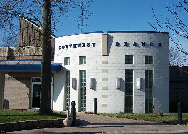
English: Southwest Branch Library of the
Rock Island Public Library system |
| Date | 10 April 2007 (according to Exif data) |
| Source | Own work |
| Author | Jacksonbs |
| Permission ( Reusing this file) |
I took the photo |
| Camera location |
| View this and other nearby images on: OpenStreetMap |
|
|---|
Licensing
| I, the copyright holder of this work, release this work into the
public domain. This applies worldwide. In some countries this may not be legally possible; if so: I grant anyone the right to use this work for any purpose, without any conditions, unless such conditions are required by law. |
File history
Click on a date/time to view the file as it appeared at that time.
| Date/Time | Thumbnail | Dimensions | User | Comment | |
|---|---|---|---|---|---|
| current | 19:55, 25 November 2008 |
| 2,912 × 2,077 (3.96 MB) | Jacksonbs | {{Information |Description={{en|1=Library}} |Source=Own work by uploader |Author= Jacksonbs |Date= |Permission=I took the photo |other_versions= }} <!--{{ImageUpload|full}}--> |
File usage
The following pages on the English Wikipedia use this file (pages on other projects are not listed):
Metadata
Size of this preview:
800 × 571 pixels. Other resolutions:
320 × 228 pixels |
640 × 456 pixels |
1,024 × 730 pixels |
1,280 × 913 pixels |
2,560 × 1,826 pixels |
2,912 × 2,077 pixels.
Original file (2,912 × 2,077 pixels, file size: 3.96 MB, MIME type: image/jpeg)
| This is a file from the
Wikimedia Commons. Information from its
description page there is shown below. Commons is a freely licensed media file repository. You can help. |
Summary
| Description |
English: Southwest Branch Library of the
Rock Island Public Library system |
| Date | 10 April 2007 (according to Exif data) |
| Source | Own work |
| Author | Jacksonbs |
| Permission ( Reusing this file) |
I took the photo |
| Camera location |
| View this and other nearby images on: OpenStreetMap |
|
|---|
Licensing
| I, the copyright holder of this work, release this work into the
public domain. This applies worldwide. In some countries this may not be legally possible; if so: I grant anyone the right to use this work for any purpose, without any conditions, unless such conditions are required by law. |
File history
Click on a date/time to view the file as it appeared at that time.
| Date/Time | Thumbnail | Dimensions | User | Comment | |
|---|---|---|---|---|---|
| current | 19:55, 25 November 2008 |
| 2,912 × 2,077 (3.96 MB) | Jacksonbs | {{Information |Description={{en|1=Library}} |Source=Own work by uploader |Author= Jacksonbs |Date= |Permission=I took the photo |other_versions= }} <!--{{ImageUpload|full}}--> |
File usage
The following pages on the English Wikipedia use this file (pages on other projects are not listed):