
Original file (SVG file, nominally 1,373 × 777 pixels, file size: 60 KB)
| This is a file from the
Wikimedia Commons. Information from its
description page there is shown below. Commons is a freely licensed media file repository. You can help. |
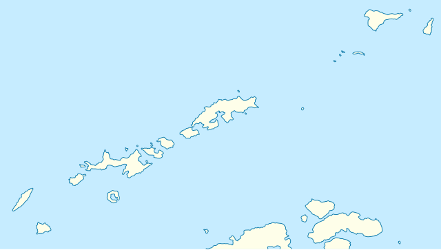
Summary
| Description |
Deutsch: Positionskarte der
Südlichen Shetlandinseln
Quadratische Plattkarte, N-S-Streckung 200 %. Geographische Begrenzung der Karte:
English: Location map of the
South Shetland Islands
Equirectangular projection, N/S stretching 200 %. Geographic limits of the map:
|
| Date | |
| Source | own work, using United States National Imagery and Mapping Agency data |
| Author | NordNordWest |

|
This map has been made or improved in the German
Kartenwerkstatt (Map Lab). You can
propose maps to improve as well.
|
Licensing

|
Permission is granted to copy, distribute and/or modify this document under the terms of the GNU Free Documentation License, Version 1.2 or any later version published by the Free Software Foundation; with no Invariant Sections, no Front-Cover Texts, and no Back-Cover Texts. A copy of the license is included in the section entitled GNU Free Documentation License. |
- You are free:
- to share – to copy, distribute and transmit the work
- to remix – to adapt the work
- Under the following conditions:
- attribution – You must give appropriate credit, provide a link to the license, and indicate if changes were made. You may do so in any reasonable manner, but not in any way that suggests the licensor endorses you or your use.
- share alike – If you remix, transform, or build upon the material, you must distribute your contributions under the same or compatible license as the original.
File history
Click on a date/time to view the file as it appeared at that time.
| Date/Time | Thumbnail | Dimensions | User | Comment | |
|---|---|---|---|---|---|
| current | 07:52, 31 March 2009 |
| 1,373 × 777 (60 KB) | NordNordWest | corr |
| 21:23, 28 March 2009 |
 | 1,379 × 777 (57 KB) | NordNordWest | corr | |
| 21:18, 28 March 2009 |
 | 1,379 × 777 (56 KB) | NordNordWest | {{Information |Description= {{de|Positionskarte der Südlichen Shetlandinseln}} Quadratische Plattkarte, N-S-Streckung 200 %. Geographische Begrenzung der Karte: * N: 75.9° S * S: 78.5° S * W: 62.5° W * O: 54.8° W {{en |
File usage
More than 100 pages use this file. The following list shows the first 100 pages that use this file only. A full list is available.
- Aitcho Islands (South Shetland Islands)
- Anna Glacier
- Argentina Glacier
- Armira Glacier
- Baranowski Glacier
- Barrientos Island
- Basalt Lake
- Berkovitsa Glacier
- Bistra Glacier
- Boyana Glacier
- Bravo Glacier
- Charity Glacier
- Chuprene Glacier
- Clarence Island (South Shetland Islands)
- Contell Glacier
- Cornwallis Island (South Shetland Islands)
- Cove Rock
- Dalgopol Glacier
- Debelt Glacier
- Deception Island
- Dobrodan Glacier
- Dobrudzha Glacier
- Domeyko Glacier
- Dragoman Glacier
- Ecology Glacier
- Eldred Glacier
- Elephant Island
- Endurance Glacier
- Flagstaff Glacier
- Fourcade Glacier
- Fuerza Aérea Glacier
- Furness Glacier
- Goetel Glacier
- Gramada Glacier
- Greenwich Island
- Highton Glacier
- Huntress Glacier
- Huron Glacier
- Iskar Glacier
- Italia Valley
- Johnsons Glacier
- Kaliakra Glacier
- Kamchiya Glacier
- King George Island (South Shetland Islands)
- Kongur Glacier
- Krak Glacier
- Krivodol Glacier
- Landreth Glacier
- Lange Glacier
- Las Palmas Glacier
- Letnitsa Glacier
- Livingston Island
- Low Island (South Shetland Islands)
- Macy Glacier
- Magura Glacier
- Medven Glacier
- Murgash Glacier
- Musala Glacier
- Nelson Island (South Shetland Islands)
- Noble Glacier
- Ovech Glacier
- Panega Glacier
- Pashuk Glacier
- Pautalia Glacier
- Perunika Glacier
- Peshtera Glacier
- Pimpirev Glacier
- Poetry Glacier
- Polar Club Glacier
- Prespa Glacier
- Quito Glacier
- Radnevo Peak
- Research stations in Antarctica
- Robert Island
- Ropotamo Glacier
- Rose Valley Glacier
- Rupite Glacier
- Sea Lion Glacier
- Sea Lion Tarn
- Skaplizo Glacier
- Smith Island (South Shetland Islands)
- Snow Island (South Shetland Islands)
- Solis Glacier
- Sopot Ice Piedmont
- Srebarna Glacier
- Stenhouse Glacier
- Strandzha Glacier
- Struma Glacier
- Sultan Glacier
- Targovishte Glacier
- Teteven Glacier
- Traub Glacier
- Tundzha Glacier
- Urdoviza Glacier
- Usher Glacier
- Verila Glacier
- Vetrino Glacier
- Wulfila Glacier
- Yablanitsa Glacier
- Yakoruda Glacier
View more links to this file.
Global file usage
The following other wikis use this file:
- Usage on ar.wikipedia.org
- Usage on az.wikipedia.org
- Cənubi Şetland adaları
- Antarktikada yerləşən qütb stansiyalarının siyahısı
- Fil adası
- Neqra burnu
- Robert burnu
- Somovit burnu
- Batuliya burnu
- Sadala burnu
- Kitçen burnu
- Smirnenski burnu
- Divotino burnu
- Smilets burnu
- Retamales burnu
- Pinqvin (ada)
- Qrinviç adası
- Bricmen
- Misnomer burnu
- Debelyanov burnu
- Hammer burnu
- Katarina burnu
- Perelik burnu
- Lavrenov burnu
- Uqarçi burnu
- Nelson adası
- Lou adası
- Smit adası
- Skesa burnu
- Sparadok burnu
- Klarens adası
- Livinqston adası
- Kinq-Corc adası
- Aypara adası
- Qibbs adası
- Lakatnik burnu
- Lista burnu
- Kokalyane burnu
- Uqain burnu
- İrnik burnu
- Mezdra burnu
- Byevoter burnu
- Esteverena burnu
- Monroye burnu
- Vokil burnu
- Desepşen
- Karpoş burnu
- Qostun burnu
- Şablon:Yer xəritəsi Cənubi Şetland adaları
- Smolensk boğazı
View more global usage of this file.
Original file (SVG file, nominally 1,373 × 777 pixels, file size: 60 KB)
| This is a file from the
Wikimedia Commons. Information from its
description page there is shown below. Commons is a freely licensed media file repository. You can help. |
Summary
| Description |
Deutsch: Positionskarte der
Südlichen Shetlandinseln
Quadratische Plattkarte, N-S-Streckung 200 %. Geographische Begrenzung der Karte:
English: Location map of the
South Shetland Islands
Equirectangular projection, N/S stretching 200 %. Geographic limits of the map:
|
| Date | |
| Source | own work, using United States National Imagery and Mapping Agency data |
| Author | NordNordWest |
|
|
This map has been made or improved in the German
Kartenwerkstatt (Map Lab). You can
propose maps to improve as well.
|
Licensing
|
|
Permission is granted to copy, distribute and/or modify this document under the terms of the GNU Free Documentation License, Version 1.2 or any later version published by the Free Software Foundation; with no Invariant Sections, no Front-Cover Texts, and no Back-Cover Texts. A copy of the license is included in the section entitled GNU Free Documentation License. |
- You are free:
- to share – to copy, distribute and transmit the work
- to remix – to adapt the work
- Under the following conditions:
- attribution – You must give appropriate credit, provide a link to the license, and indicate if changes were made. You may do so in any reasonable manner, but not in any way that suggests the licensor endorses you or your use.
- share alike – If you remix, transform, or build upon the material, you must distribute your contributions under the same or compatible license as the original.
File history
Click on a date/time to view the file as it appeared at that time.
| Date/Time | Thumbnail | Dimensions | User | Comment | |
|---|---|---|---|---|---|
| current | 07:52, 31 March 2009 |
| 1,373 × 777 (60 KB) | NordNordWest | corr |
| 21:23, 28 March 2009 |
| 1,379 × 777 (57 KB) | NordNordWest | corr | |
| 21:18, 28 March 2009 |
| 1,379 × 777 (56 KB) | NordNordWest | {{Information |Description= {{de|Positionskarte der Südlichen Shetlandinseln}} Quadratische Plattkarte, N-S-Streckung 200 %. Geographische Begrenzung der Karte: * N: 75.9° S * S: 78.5° S * W: 62.5° W * O: 54.8° W {{en |
File usage
More than 100 pages use this file. The following list shows the first 100 pages that use this file only. A full list is available.
- Aitcho Islands (South Shetland Islands)
- Anna Glacier
- Argentina Glacier
- Armira Glacier
- Baranowski Glacier
- Barrientos Island
- Basalt Lake
- Berkovitsa Glacier
- Bistra Glacier
- Boyana Glacier
- Bravo Glacier
- Charity Glacier
- Chuprene Glacier
- Clarence Island (South Shetland Islands)
- Contell Glacier
- Cornwallis Island (South Shetland Islands)
- Cove Rock
- Dalgopol Glacier
- Debelt Glacier
- Deception Island
- Dobrodan Glacier
- Dobrudzha Glacier
- Domeyko Glacier
- Dragoman Glacier
- Ecology Glacier
- Eldred Glacier
- Elephant Island
- Endurance Glacier
- Flagstaff Glacier
- Fourcade Glacier
- Fuerza Aérea Glacier
- Furness Glacier
- Goetel Glacier
- Gramada Glacier
- Greenwich Island
- Highton Glacier
- Huntress Glacier
- Huron Glacier
- Iskar Glacier
- Italia Valley
- Johnsons Glacier
- Kaliakra Glacier
- Kamchiya Glacier
- King George Island (South Shetland Islands)
- Kongur Glacier
- Krak Glacier
- Krivodol Glacier
- Landreth Glacier
- Lange Glacier
- Las Palmas Glacier
- Letnitsa Glacier
- Livingston Island
- Low Island (South Shetland Islands)
- Macy Glacier
- Magura Glacier
- Medven Glacier
- Murgash Glacier
- Musala Glacier
- Nelson Island (South Shetland Islands)
- Noble Glacier
- Ovech Glacier
- Panega Glacier
- Pashuk Glacier
- Pautalia Glacier
- Perunika Glacier
- Peshtera Glacier
- Pimpirev Glacier
- Poetry Glacier
- Polar Club Glacier
- Prespa Glacier
- Quito Glacier
- Radnevo Peak
- Research stations in Antarctica
- Robert Island
- Ropotamo Glacier
- Rose Valley Glacier
- Rupite Glacier
- Sea Lion Glacier
- Sea Lion Tarn
- Skaplizo Glacier
- Smith Island (South Shetland Islands)
- Snow Island (South Shetland Islands)
- Solis Glacier
- Sopot Ice Piedmont
- Srebarna Glacier
- Stenhouse Glacier
- Strandzha Glacier
- Struma Glacier
- Sultan Glacier
- Targovishte Glacier
- Teteven Glacier
- Traub Glacier
- Tundzha Glacier
- Urdoviza Glacier
- Usher Glacier
- Verila Glacier
- Vetrino Glacier
- Wulfila Glacier
- Yablanitsa Glacier
- Yakoruda Glacier
View more links to this file.
Global file usage
The following other wikis use this file:
- Usage on ar.wikipedia.org
- Usage on az.wikipedia.org
- Cənubi Şetland adaları
- Antarktikada yerləşən qütb stansiyalarının siyahısı
- Fil adası
- Neqra burnu
- Robert burnu
- Somovit burnu
- Batuliya burnu
- Sadala burnu
- Kitçen burnu
- Smirnenski burnu
- Divotino burnu
- Smilets burnu
- Retamales burnu
- Pinqvin (ada)
- Qrinviç adası
- Bricmen
- Misnomer burnu
- Debelyanov burnu
- Hammer burnu
- Katarina burnu
- Perelik burnu
- Lavrenov burnu
- Uqarçi burnu
- Nelson adası
- Lou adası
- Smit adası
- Skesa burnu
- Sparadok burnu
- Klarens adası
- Livinqston adası
- Kinq-Corc adası
- Aypara adası
- Qibbs adası
- Lakatnik burnu
- Lista burnu
- Kokalyane burnu
- Uqain burnu
- İrnik burnu
- Mezdra burnu
- Byevoter burnu
- Esteverena burnu
- Monroye burnu
- Vokil burnu
- Desepşen
- Karpoş burnu
- Qostun burnu
- Şablon:Yer xəritəsi Cənubi Şetland adaları
- Smolensk boğazı
View more global usage of this file.