
Size of this preview:
480 × 599 pixels. Other resolutions:
192 × 240 pixels |
384 × 480 pixels |
615 × 768 pixels |
820 × 1,024 pixels |
1,641 × 2,048 pixels |
2,733 × 3,411 pixels.
Original file (2,733 × 3,411 pixels, file size: 208 KB, MIME type: image/png)
| This is a file from the
Wikimedia Commons. Information from its
description page there is shown below. Commons is a freely licensed media file repository. You can help. |
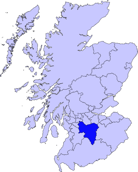
| Description | map of South Lanarkshire | ||||||||
| Date | |||||||||
| Source |
Barryob, the copyright holder of this work, hereby publishes it under the following license:
|
||||||||
| Author | User:Barryob |

File history
Click on a date/time to view the file as it appeared at that time.
| Date/Time | Thumbnail | Dimensions | User | Comment | |
|---|---|---|---|---|---|
| current | 04:57, 10 April 2007 |
| 2,733 × 3,411 (208 KB) | Barryob | |
| 21:55, 8 April 2007 |
 | 2,733 × 3,411 (209 KB) | Barryob | ||
| 00:09, 3 April 2007 |
 | 2,733 × 3,411 (209 KB) | Barryob | {{Information |Description=map of South Lanarkshire |Source={{GFDL-user|Barryob}} |Date=2006-03-31 |Author= User:Barryob |Permission= |other_versions= }} Category:Maps of unitary councils of Scotland |
File usage
The following pages on the English Wikipedia use this file (pages on other projects are not listed):
- Abington, South Lanarkshire
- Ashgill
- Auchengray
- Auchenheath
- Auchlochan
- Auldhouse, South Lanarkshire
- Bankend, South Lanarkshire
- Biggar, South Lanarkshire
- Biggar High School
- Blackwood, South Lanarkshire
- Blantyre, South Lanarkshire
- Bothwell
- Braidwood, South Lanarkshire
- Burnbank
- Calderglen High School
- Caldermill
- Calderside Academy
- Cambuslang
- Carluke
- Carluke High School
- Carnwath
- Carstairs
- Carstairs Junction
- Cartland, South Lanarkshire
- Cathkin High School
- Chapelton, South Lanarkshire
- Coalburn
- Coulter, South Lanarkshire
- Crawford, South Lanarkshire
- Crawfordjohn
- Dalserf
- Dolphinton
- Douglas, South Lanarkshire
- Duncanrig Secondary School
- East Kilbride
- Elsrickle
- Fernhill School, Rutherglen
- Forth, South Lanarkshire
- Garrion Bridge
- Hamilton, South Lanarkshire
- Hamilton College, South Lanarkshire
- Hamilton Grammar School
- Holy Cross High School, Hamilton
- Kilncadzow
- Kirkfieldbank
- Kirkmuirhill
- Lanark
- Lanark Grammar School
- Larkhall
- Larkhall Academy
- Law, South Lanarkshire
- Leadhills
- Lesmahagow
- Lesmahagow High School
- Libberton
- List of Category A listed buildings in South Lanarkshire
- Nerston
- Netherburn
- Newbigging, South Lanarkshire
- Pettinain
- Quarter, South Lanarkshire
- Quothquan
- Ravenstruther
- Rigside
- Roberton, South Lanarkshire
- Rosebank, South Lanarkshire
- Rutherglen
- Rutherglen High School
- Saint John Ogilvie High School
- Sanderson High School, East Kilbride
- Sandford, South Lanarkshire
- Scheduled monuments in South Lanarkshire
- South Lanarkshire
- South Lanarkshire College
- St Andrew's and St Bride's High School
- Stonehouse, South Lanarkshire
- Stonelaw High School
- Strathaven
- Strathaven Academy
- Symington, South Lanarkshire
- Tarbrax
- Thankerton
- Tillietudlem
- Trinity High School, Rutherglen
- Uddingston
- Uddingston Grammar School
- University of the West of Scotland
- Walston, South Lanarkshire
- Wiston, South Lanarkshire
- Woolfords
- Yieldshields
- User:Tblack93/Template:South Lanarkshire
- Wikipedia talk:WikiProject UK Parliament constituencies/Archive 4
- Template:South Lanarkshire Schools
- Template:South Lanarkshire settlements
Global file usage
The following other wikis use this file:
- Usage on eu.wikipedia.org
- Hegoaldeko Lanarkshire
- East Kilbride
- Hamilton (Hegoaldeko Lanarkshire)
- Lankide:Euskaldunaa
- New Lanark
- Rutherglen
- Cambuslang
- Lanark
- Txantiloi:Hegoaldeko Lanarkshire
- Wikiproiektu:Irlanda, Gales eta Eskoziako udalerriak
- Garrion Bridge
- Biggar (Hegoaldeko Lanarkshire)
- Blantyre (Hegoaldeko Lanarkshire)
- Bothwell
- Carluke
- Cartland (Hegoaldeko Lanarkshire)
- Larkhall
- Lesmahagow
- Kirkfieldbank
- Owenstown
- Ravenstruther
- Rigside
- Roberton (Lanarkshire)
- Stonehouse (Hegoaldeko Lanarkshire)
- Strathaven
- Uddingston
- Abington (Hegoaldeko Lanarkshire)
- Allanton (Hegoaldeko Lanarkshire)
- Ashgill
- Auchengray
- Auchenheath
- Auchinraith
- Auldhouse (Hegoaldeko Lanarkshire)
- Blackwood (Hegoaldeko Lanarkshire)
- Boghead
- Braehead (Hegoaldeko Lanarkshire)
- Braidwood (Hegoaldeko Lanarkshire)
- Brownsbank
- Carmichael (Hegoaldeko Lanarkshire)
- Caldermill
- Carnwath
- Carstairs
- Chapelton (Hegoaldeko Lanarkshire)
- Coalburn
- Coulter (Hegoaldeko Lanarkshire)
- Crawford (Hegoaldeko Lanarkshire)
- Crawfordjohn
- Crossford (Hegoaldeko Lanarkshire)
- Dalserf
- Dolphinton
View more global usage of this file.
Size of this preview:
480 × 599 pixels. Other resolutions:
192 × 240 pixels |
384 × 480 pixels |
615 × 768 pixels |
820 × 1,024 pixels |
1,641 × 2,048 pixels |
2,733 × 3,411 pixels.
Original file (2,733 × 3,411 pixels, file size: 208 KB, MIME type: image/png)
| This is a file from the
Wikimedia Commons. Information from its
description page there is shown below. Commons is a freely licensed media file repository. You can help. |
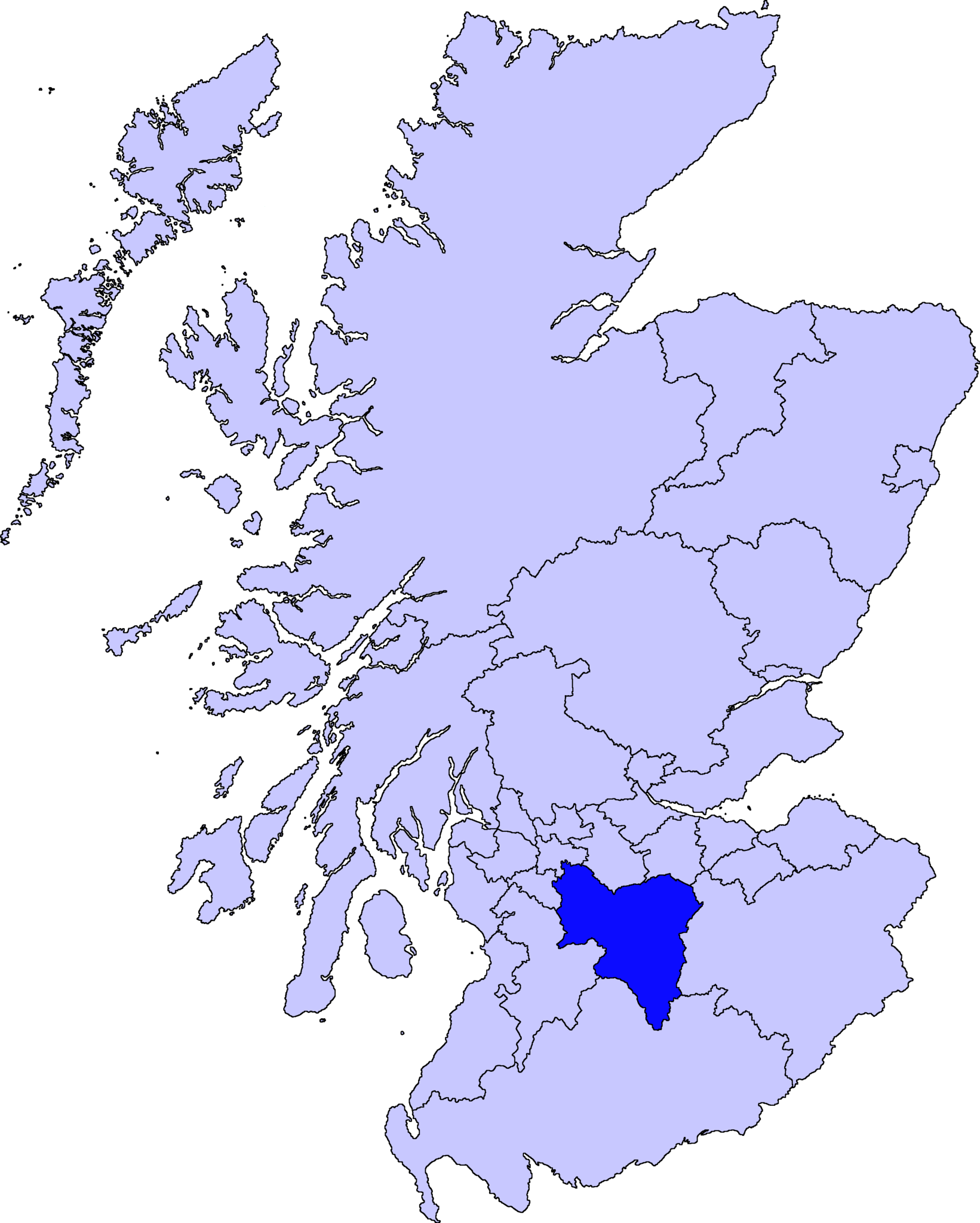
| Description | map of South Lanarkshire | ||||||||
| Date | |||||||||
| Source |
Barryob, the copyright holder of this work, hereby publishes it under the following license:
|
||||||||
| Author | User:Barryob |
File history
Click on a date/time to view the file as it appeared at that time.
| Date/Time | Thumbnail | Dimensions | User | Comment | |
|---|---|---|---|---|---|
| current | 04:57, 10 April 2007 |
| 2,733 × 3,411 (208 KB) | Barryob | |
| 21:55, 8 April 2007 |
| 2,733 × 3,411 (209 KB) | Barryob | ||
| 00:09, 3 April 2007 |
| 2,733 × 3,411 (209 KB) | Barryob | {{Information |Description=map of South Lanarkshire |Source={{GFDL-user|Barryob}} |Date=2006-03-31 |Author= User:Barryob |Permission= |other_versions= }} Category:Maps of unitary councils of Scotland |
File usage
The following pages on the English Wikipedia use this file (pages on other projects are not listed):
- Abington, South Lanarkshire
- Ashgill
- Auchengray
- Auchenheath
- Auchlochan
- Auldhouse, South Lanarkshire
- Bankend, South Lanarkshire
- Biggar, South Lanarkshire
- Biggar High School
- Blackwood, South Lanarkshire
- Blantyre, South Lanarkshire
- Bothwell
- Braidwood, South Lanarkshire
- Burnbank
- Calderglen High School
- Caldermill
- Calderside Academy
- Cambuslang
- Carluke
- Carluke High School
- Carnwath
- Carstairs
- Carstairs Junction
- Cartland, South Lanarkshire
- Cathkin High School
- Chapelton, South Lanarkshire
- Coalburn
- Coulter, South Lanarkshire
- Crawford, South Lanarkshire
- Crawfordjohn
- Dalserf
- Dolphinton
- Douglas, South Lanarkshire
- Duncanrig Secondary School
- East Kilbride
- Elsrickle
- Fernhill School, Rutherglen
- Forth, South Lanarkshire
- Garrion Bridge
- Hamilton, South Lanarkshire
- Hamilton College, South Lanarkshire
- Hamilton Grammar School
- Holy Cross High School, Hamilton
- Kilncadzow
- Kirkfieldbank
- Kirkmuirhill
- Lanark
- Lanark Grammar School
- Larkhall
- Larkhall Academy
- Law, South Lanarkshire
- Leadhills
- Lesmahagow
- Lesmahagow High School
- Libberton
- List of Category A listed buildings in South Lanarkshire
- Nerston
- Netherburn
- Newbigging, South Lanarkshire
- Pettinain
- Quarter, South Lanarkshire
- Quothquan
- Ravenstruther
- Rigside
- Roberton, South Lanarkshire
- Rosebank, South Lanarkshire
- Rutherglen
- Rutherglen High School
- Saint John Ogilvie High School
- Sanderson High School, East Kilbride
- Sandford, South Lanarkshire
- Scheduled monuments in South Lanarkshire
- South Lanarkshire
- South Lanarkshire College
- St Andrew's and St Bride's High School
- Stonehouse, South Lanarkshire
- Stonelaw High School
- Strathaven
- Strathaven Academy
- Symington, South Lanarkshire
- Tarbrax
- Thankerton
- Tillietudlem
- Trinity High School, Rutherglen
- Uddingston
- Uddingston Grammar School
- University of the West of Scotland
- Walston, South Lanarkshire
- Wiston, South Lanarkshire
- Woolfords
- Yieldshields
- User:Tblack93/Template:South Lanarkshire
- Wikipedia talk:WikiProject UK Parliament constituencies/Archive 4
- Template:South Lanarkshire Schools
- Template:South Lanarkshire settlements
Global file usage
The following other wikis use this file:
- Usage on eu.wikipedia.org
- Hegoaldeko Lanarkshire
- East Kilbride
- Hamilton (Hegoaldeko Lanarkshire)
- Lankide:Euskaldunaa
- New Lanark
- Rutherglen
- Cambuslang
- Lanark
- Txantiloi:Hegoaldeko Lanarkshire
- Wikiproiektu:Irlanda, Gales eta Eskoziako udalerriak
- Garrion Bridge
- Biggar (Hegoaldeko Lanarkshire)
- Blantyre (Hegoaldeko Lanarkshire)
- Bothwell
- Carluke
- Cartland (Hegoaldeko Lanarkshire)
- Larkhall
- Lesmahagow
- Kirkfieldbank
- Owenstown
- Ravenstruther
- Rigside
- Roberton (Lanarkshire)
- Stonehouse (Hegoaldeko Lanarkshire)
- Strathaven
- Uddingston
- Abington (Hegoaldeko Lanarkshire)
- Allanton (Hegoaldeko Lanarkshire)
- Ashgill
- Auchengray
- Auchenheath
- Auchinraith
- Auldhouse (Hegoaldeko Lanarkshire)
- Blackwood (Hegoaldeko Lanarkshire)
- Boghead
- Braehead (Hegoaldeko Lanarkshire)
- Braidwood (Hegoaldeko Lanarkshire)
- Brownsbank
- Carmichael (Hegoaldeko Lanarkshire)
- Caldermill
- Carnwath
- Carstairs
- Chapelton (Hegoaldeko Lanarkshire)
- Coalburn
- Coulter (Hegoaldeko Lanarkshire)
- Crawford (Hegoaldeko Lanarkshire)
- Crawfordjohn
- Crossford (Hegoaldeko Lanarkshire)
- Dalserf
- Dolphinton
View more global usage of this file.