
Original file (SVG file, nominally 1,031 × 1,067 pixels, file size: 175 KB)
| This is a file from the
Wikimedia Commons. Information from its
description page there is shown below. Commons is a freely licensed media file repository. You can help. |
Summary
| Description |
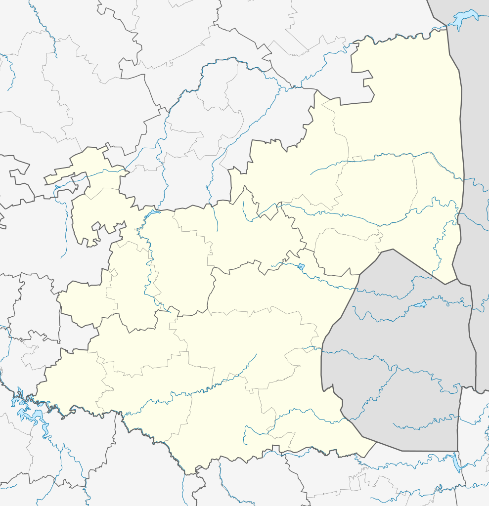
English: Location map of
Mpumalanga
Equirectangular projection, N/S stretching 110%. Geographic limits of the map:
|
| Date | |
| Source |
|
| Author | Htonl |
| Permission ( Reusing this file) |
I, the copyright holder of this work, hereby publish it under the following license: This file is licensed under the
Creative Commons
Attribution-Share Alike 3.0 Unported license.
|
| Other versions | File:South Africa Mpumalanga relief location map.svg, File:Blank map of Mpumalanga (2011).svg |
.svg)
File history
Click on a date/time to view the file as it appeared at that time.
| Date/Time | Thumbnail | Dimensions | User | Comment | |
|---|---|---|---|---|---|
| current | 20:21, 6 January 2013 |
| 1,031 × 1,067 (175 KB) | Htonl | == {{int:filedesc}} == {{Information |Description ={{en|Location map of en:Mpumalanga Equirectangular projection, N/S stretching 110%. Geographic limits of the map: * N: 23.75° S * S: 27.75° S * W: 28° E * E: 32.25° E}} |Source = *... |
File usage
More than 100 pages use this file. The following list shows the first 100 pages that use this file only. A full list is available.
- Allemansdrift
- Amersfoort, Mpumalanga
- Amsterdam, South Africa
- Badplaas
- Balfour, Mpumalanga
- Barberton, South Africa
- Belfast, Mpumalanga
- Bethal
- Blaauboschkraal stone ruins
- Botshabelo, Mpumalanga
- Breyten
- Buffelspruit
- Carolina, South Africa
- Casteel
- Charl Cilliers, Mpumalanga
- Chrissiesmeer
- Davel
- Delmas, South Africa
- Diepdale
- Diepgezet
- Driefontein, Mpumalanga
- Dullstroom
- Edinburgh, Mpumalanga
- Eerstehoek
- Ermelo, South Africa
- Evander, South Africa
- Graskop
- Greenside, Mpumalanga
- Greylingstad
- Grootvlei
- Hazyview
- Hectorspruit
- Hendrina
- Jeppes Reef
- Kaapmuiden
- Kaapsehoop
- Kabokweni
- Kameelrivier
- Kildare, Mpumalanga
- Kinross, Mpumalanga
- Klarinet, Emalahleni
- Klipfontein, Mpumalanga
- Komatipoort
- Kriel, Mpumalanga
- Kruger Mpumalanga International Airport
- KwaMhlanga
- KwaNgema
- Langeloop
- Leandra, South Africa
- Leslie, Mpumalanga
- Lillydale, Mpumalanga
- Lochiel, Mpumalanga
- Loopspruit
- Lothair, Mpumalanga
- Ludlow, Mpumalanga
- Lydenburg
- Machadodorp
- Madras, Mpumalanga
- Magudu
- Mala Mala Airport
- Malalane
- Marloth Park
- Mbibana
- Mbombela
- Mbuzini
- Middelburg, Mpumalanga
- Mooiplaas, Mpumalanga
- Morgenzon
- Nelspruit Airport
- Newington, Mpumalanga
- Ogies
- Pankop
- Perdekop
- Piet Retief, South Africa
- Pilgrim's Rest, South Africa
- Rolle, Mpumalanga
- Ronaldsey
- Rooiboklaagte
- Sabie
- Schoemansdal, Mpumalanga
- Schulzendal
- Secunda, South Africa
- Sheepmoor
- Siyabuswa
- Skukuza
- Somerset, Mpumalanga
- Standerton
- Steynsdorp
- Tonga, Mpumalanga
- Trichardt
- Vaalbank
- Verloren Valei Nature Reserve
- Vlakfontein
- Volksrust
- Wakkerstroom
- Waterval Boven
- Waterval Onder
- Welverdiend, Ehlanzeni
- White River, Mpumalanga
- Witbank
View more links to this file.
Global file usage
The following other wikis use this file:
- Usage on af.wikipedia.org
- Nelspruit
- Ermelo, Mpumalanga
- Witbank
- Pelgrimsrus
- Graskop
- Marlothpark
- Dullstroom
- Breyten
- Carolina
- Amsterdam, Mpumalanga
- Amersfoort, Mpumalanga
- Badplaas
- Chrissiesmeer
- Perdekop
- Piet Retief, Mpumalanga
- Morgenzon
- Volksrust
- Wakkerstroom
- Lydenburg
- Barberton
- Standerton
- Evander
- Sabie
- Secunda
- Middelburg, Mpumalanga
- Machadodorp
- Greylingstad
- Delmas
- Kaapsehoop
- Balfour, Mpumalanga
- Hazyview
- Bethal
- Nelspruit-lughawe
- Loopspruit
- Kinross
- Hectorspruit
- Kaapmuiden
- Vaalbank
- Komatipoort
- Waterval-Boven
- Sjabloon:Liggingkaart Mpumalanga
- Malalane
- Hendrina
- Trichardt
- Ogies
- Kriel
- Mashishing
- Sheepmoor
- Witrivier
- Mac-Macwaterval
View more global usage of this file.
Metadata
Original file (SVG file, nominally 1,031 × 1,067 pixels, file size: 175 KB)
| This is a file from the
Wikimedia Commons. Information from its
description page there is shown below. Commons is a freely licensed media file repository. You can help. |
Summary
| Description |
English: Location map of
Mpumalanga
Equirectangular projection, N/S stretching 110%. Geographic limits of the map:
|
| Date | |
| Source |
|
| Author | Htonl |
| Permission ( Reusing this file) |
I, the copyright holder of this work, hereby publish it under the following license: This file is licensed under the
Creative Commons
Attribution-Share Alike 3.0 Unported license.
|
| Other versions | File:South Africa Mpumalanga relief location map.svg, File:Blank map of Mpumalanga (2011).svg |
File history
Click on a date/time to view the file as it appeared at that time.
| Date/Time | Thumbnail | Dimensions | User | Comment | |
|---|---|---|---|---|---|
| current | 20:21, 6 January 2013 |
| 1,031 × 1,067 (175 KB) | Htonl | == {{int:filedesc}} == {{Information |Description ={{en|Location map of en:Mpumalanga Equirectangular projection, N/S stretching 110%. Geographic limits of the map: * N: 23.75° S * S: 27.75° S * W: 28° E * E: 32.25° E}} |Source = *... |
File usage
More than 100 pages use this file. The following list shows the first 100 pages that use this file only. A full list is available.
- Allemansdrift
- Amersfoort, Mpumalanga
- Amsterdam, South Africa
- Badplaas
- Balfour, Mpumalanga
- Barberton, South Africa
- Belfast, Mpumalanga
- Bethal
- Blaauboschkraal stone ruins
- Botshabelo, Mpumalanga
- Breyten
- Buffelspruit
- Carolina, South Africa
- Casteel
- Charl Cilliers, Mpumalanga
- Chrissiesmeer
- Davel
- Delmas, South Africa
- Diepdale
- Diepgezet
- Driefontein, Mpumalanga
- Dullstroom
- Edinburgh, Mpumalanga
- Eerstehoek
- Ermelo, South Africa
- Evander, South Africa
- Graskop
- Greenside, Mpumalanga
- Greylingstad
- Grootvlei
- Hazyview
- Hectorspruit
- Hendrina
- Jeppes Reef
- Kaapmuiden
- Kaapsehoop
- Kabokweni
- Kameelrivier
- Kildare, Mpumalanga
- Kinross, Mpumalanga
- Klarinet, Emalahleni
- Klipfontein, Mpumalanga
- Komatipoort
- Kriel, Mpumalanga
- Kruger Mpumalanga International Airport
- KwaMhlanga
- KwaNgema
- Langeloop
- Leandra, South Africa
- Leslie, Mpumalanga
- Lillydale, Mpumalanga
- Lochiel, Mpumalanga
- Loopspruit
- Lothair, Mpumalanga
- Ludlow, Mpumalanga
- Lydenburg
- Machadodorp
- Madras, Mpumalanga
- Magudu
- Mala Mala Airport
- Malalane
- Marloth Park
- Mbibana
- Mbombela
- Mbuzini
- Middelburg, Mpumalanga
- Mooiplaas, Mpumalanga
- Morgenzon
- Nelspruit Airport
- Newington, Mpumalanga
- Ogies
- Pankop
- Perdekop
- Piet Retief, South Africa
- Pilgrim's Rest, South Africa
- Rolle, Mpumalanga
- Ronaldsey
- Rooiboklaagte
- Sabie
- Schoemansdal, Mpumalanga
- Schulzendal
- Secunda, South Africa
- Sheepmoor
- Siyabuswa
- Skukuza
- Somerset, Mpumalanga
- Standerton
- Steynsdorp
- Tonga, Mpumalanga
- Trichardt
- Vaalbank
- Verloren Valei Nature Reserve
- Vlakfontein
- Volksrust
- Wakkerstroom
- Waterval Boven
- Waterval Onder
- Welverdiend, Ehlanzeni
- White River, Mpumalanga
- Witbank
View more links to this file.
Global file usage
The following other wikis use this file:
- Usage on af.wikipedia.org
- Nelspruit
- Ermelo, Mpumalanga
- Witbank
- Pelgrimsrus
- Graskop
- Marlothpark
- Dullstroom
- Breyten
- Carolina
- Amsterdam, Mpumalanga
- Amersfoort, Mpumalanga
- Badplaas
- Chrissiesmeer
- Perdekop
- Piet Retief, Mpumalanga
- Morgenzon
- Volksrust
- Wakkerstroom
- Lydenburg
- Barberton
- Standerton
- Evander
- Sabie
- Secunda
- Middelburg, Mpumalanga
- Machadodorp
- Greylingstad
- Delmas
- Kaapsehoop
- Balfour, Mpumalanga
- Hazyview
- Bethal
- Nelspruit-lughawe
- Loopspruit
- Kinross
- Hectorspruit
- Kaapmuiden
- Vaalbank
- Komatipoort
- Waterval-Boven
- Sjabloon:Liggingkaart Mpumalanga
- Malalane
- Hendrina
- Trichardt
- Ogies
- Kriel
- Mashishing
- Sheepmoor
- Witrivier
- Mac-Macwaterval
View more global usage of this file.