
Original file (SVG file, nominally 1,061 × 1,046 pixels, file size: 97 KB)
| This is a file from the
Wikimedia Commons. Information from its
description page there is shown below. Commons is a freely licensed media file repository. You can help. |
Summary
| Description |
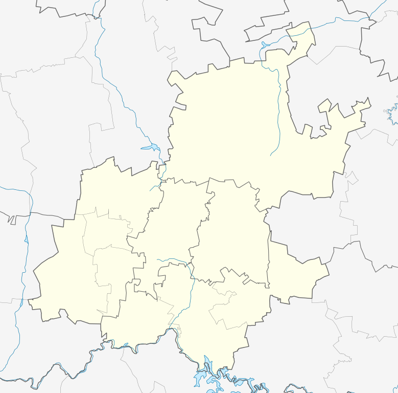
English: Location map of
Gauteng
Equirectangular projection, N/S stretching 111%. Geographic limits of the map:
|
| Date | |
| Source |
|
| Author | Htonl |
| Permission ( Reusing this file) |
I, the copyright holder of this work, hereby publish it under the following license: This file is licensed under the
Creative Commons
Attribution-Share Alike 3.0 Unported license.
|
| Other versions | File:South Africa Gauteng relief location map.svg, File:Blank map of Gauteng (2011).svg |
.svg)
File history
Click on a date/time to view the file as it appeared at that time.
| Date/Time | Thumbnail | Dimensions | User | Comment | |
|---|---|---|---|---|---|
| current | 20:22, 5 January 2013 |
| 1,061 × 1,046 (97 KB) | Htonl | == {{int:filedesc}} == {{Information |Description ={{en|Location map of en:Gauteng Equirectangular projection, N/S stretching 111%. Geographic limits of the map: * N: 25° S * S: 27° S * W: 27° E * E: 29.25° E}} |Source = * Boundari... |
File usage
More than 100 pages use this file. The following list shows the first 100 pages that use this file only. A full list is available.
- Aeroton
- Air Force Base Waterkloof
- Alan Manor
- Alberton, South Africa
- Alexandra, South Africa
- Auckland Park
- Bapsfontein
- Bedfordview
- Benoni, South Africa
- Boksburg
- Booysens, Pretoria
- Brakpan
- Bronkhorstspruit
- Bruma, Gauteng
- Bryanston, Gauteng
- Carletonville
- Centurion, South Africa
- City Deep, Gauteng
- Constantia Kloof
- Crown, Gauteng
- Crown Gardens
- Crown North
- Cullinan, South Africa
- Diepsloot
- Dobsonville
- Doornkop
- Douglasdale, Gauteng
- Eastcliff, Johannesburg
- Edenvale, South Africa
- Elandspark
- Electron, Gauteng
- Elladoone
- Ennerdale, South Africa
- Evans Park
- Fairway, Gauteng
- Fairwood, Gauteng
- Florida, Gauteng
- Fochville
- Forest Hill, Gauteng
- Fourways
- Framton
- Germiston
- Gillview
- Glenanda
- Glenvista
- Haddon, Gauteng
- Hammanskraal
- Heidelberg, Gauteng
- Heriotdale
- Hillbrow
- Hyde Park, Gauteng
- Illovo, Gauteng
- Irene, Gauteng
- Johannesburg
- Katlehong
- Kempton Park, South Africa
- Kenilworth, Johannesburg
- Kibler Park
- Klipriviersberg
- Klipriviersberg Estate
- Krugersdorp
- Kya Sand
- La Rochelle, Johannesburg
- Lake View Estate
- Laudium
- Lenasia
- Magaliesburg
- Mamelodi
- Marabastad, Pretoria
- Meadowlands, Gauteng
- Melville, Johannesburg
- Menlyn Park
- Meyerton, Gauteng
- Midrand
- Nigel, Gauteng
- Northcliff
- Northgate, Gauteng
- Orange Farm
- Pretoria
- Protea Glen
- Randburg
- Randfontein
- River Club, Gauteng
- Roodepoort
- Rosebank, Gauteng
- Sandton
- Sebokeng
- Sharpeville
- Sophiatown
- Soweto
- Springs, South Africa
- Sunninghill, Gauteng
- Thaba Tshwane
- Tswaing crater
- Union Buildings
- Vanderbijlpark
- Vereeniging
- Weltevredenpark
- Westonaria
- Woodmead
View more links to this file.
Global file usage
The following other wikis use this file:
- Usage on af.wikipedia.org
- Johannesburg
- Pretoria
- Heidelberg, Gauteng
- Suikerbosrand-natuurreservaat
- Roodepoort
- Sharpeville
- Centurion
- Cullinan
- Krugersdorp
- Springs
- Brakpan
- Kliptown
- Alberton
- Germiston
- Boksburg
- Benoni
- Carletonville
- Petervale, Johannesburg
- Marabastad
- Waterkloof
- Groenkloof
- Arcadia, Pretoria
- Vereeniging
- Kemptonpark
- Edenvale
- Nigel
- Meyerton
- Vanderbijlpark
- Elarduspark
- Soweto
- Wonderboomlughawe
- Irene
- Bapsfontein
- Bronkhorstspruit
- Randfontein
- Randburg
- Ennerdale
- Magaliesburg
- Sophiatown
- Rosettenville
- Kleinfontein
- Linden
- Woodmead, Johannesburg
- Mabopane
- Rosebank, Johannesburg
- Atteridgeville
- Capital Park
- Hammanskraal
- Westonaria
- Rayton
View more global usage of this file.
Metadata
Original file (SVG file, nominally 1,061 × 1,046 pixels, file size: 97 KB)
| This is a file from the
Wikimedia Commons. Information from its
description page there is shown below. Commons is a freely licensed media file repository. You can help. |
Summary
| Description |
English: Location map of
Gauteng
Equirectangular projection, N/S stretching 111%. Geographic limits of the map:
|
| Date | |
| Source |
|
| Author | Htonl |
| Permission ( Reusing this file) |
I, the copyright holder of this work, hereby publish it under the following license: This file is licensed under the
Creative Commons
Attribution-Share Alike 3.0 Unported license.
|
| Other versions | File:South Africa Gauteng relief location map.svg, File:Blank map of Gauteng (2011).svg |
File history
Click on a date/time to view the file as it appeared at that time.
| Date/Time | Thumbnail | Dimensions | User | Comment | |
|---|---|---|---|---|---|
| current | 20:22, 5 January 2013 |
| 1,061 × 1,046 (97 KB) | Htonl | == {{int:filedesc}} == {{Information |Description ={{en|Location map of en:Gauteng Equirectangular projection, N/S stretching 111%. Geographic limits of the map: * N: 25° S * S: 27° S * W: 27° E * E: 29.25° E}} |Source = * Boundari... |
File usage
More than 100 pages use this file. The following list shows the first 100 pages that use this file only. A full list is available.
- Aeroton
- Air Force Base Waterkloof
- Alan Manor
- Alberton, South Africa
- Alexandra, South Africa
- Auckland Park
- Bapsfontein
- Bedfordview
- Benoni, South Africa
- Boksburg
- Booysens, Pretoria
- Brakpan
- Bronkhorstspruit
- Bruma, Gauteng
- Bryanston, Gauteng
- Carletonville
- Centurion, South Africa
- City Deep, Gauteng
- Constantia Kloof
- Crown, Gauteng
- Crown Gardens
- Crown North
- Cullinan, South Africa
- Diepsloot
- Dobsonville
- Doornkop
- Douglasdale, Gauteng
- Eastcliff, Johannesburg
- Edenvale, South Africa
- Elandspark
- Electron, Gauteng
- Elladoone
- Ennerdale, South Africa
- Evans Park
- Fairway, Gauteng
- Fairwood, Gauteng
- Florida, Gauteng
- Fochville
- Forest Hill, Gauteng
- Fourways
- Framton
- Germiston
- Gillview
- Glenanda
- Glenvista
- Haddon, Gauteng
- Hammanskraal
- Heidelberg, Gauteng
- Heriotdale
- Hillbrow
- Hyde Park, Gauteng
- Illovo, Gauteng
- Irene, Gauteng
- Johannesburg
- Katlehong
- Kempton Park, South Africa
- Kenilworth, Johannesburg
- Kibler Park
- Klipriviersberg
- Klipriviersberg Estate
- Krugersdorp
- Kya Sand
- La Rochelle, Johannesburg
- Lake View Estate
- Laudium
- Lenasia
- Magaliesburg
- Mamelodi
- Marabastad, Pretoria
- Meadowlands, Gauteng
- Melville, Johannesburg
- Menlyn Park
- Meyerton, Gauteng
- Midrand
- Nigel, Gauteng
- Northcliff
- Northgate, Gauteng
- Orange Farm
- Pretoria
- Protea Glen
- Randburg
- Randfontein
- River Club, Gauteng
- Roodepoort
- Rosebank, Gauteng
- Sandton
- Sebokeng
- Sharpeville
- Sophiatown
- Soweto
- Springs, South Africa
- Sunninghill, Gauteng
- Thaba Tshwane
- Tswaing crater
- Union Buildings
- Vanderbijlpark
- Vereeniging
- Weltevredenpark
- Westonaria
- Woodmead
View more links to this file.
Global file usage
The following other wikis use this file:
- Usage on af.wikipedia.org
- Johannesburg
- Pretoria
- Heidelberg, Gauteng
- Suikerbosrand-natuurreservaat
- Roodepoort
- Sharpeville
- Centurion
- Cullinan
- Krugersdorp
- Springs
- Brakpan
- Kliptown
- Alberton
- Germiston
- Boksburg
- Benoni
- Carletonville
- Petervale, Johannesburg
- Marabastad
- Waterkloof
- Groenkloof
- Arcadia, Pretoria
- Vereeniging
- Kemptonpark
- Edenvale
- Nigel
- Meyerton
- Vanderbijlpark
- Elarduspark
- Soweto
- Wonderboomlughawe
- Irene
- Bapsfontein
- Bronkhorstspruit
- Randfontein
- Randburg
- Ennerdale
- Magaliesburg
- Sophiatown
- Rosettenville
- Kleinfontein
- Linden
- Woodmead, Johannesburg
- Mabopane
- Rosebank, Johannesburg
- Atteridgeville
- Capital Park
- Hammanskraal
- Westonaria
- Rayton
View more global usage of this file.