Photos • Location


Size of this preview:
750 × 600 pixels. Other resolutions:
300 × 240 pixels |
600 × 480 pixels |
960 × 768 pixels |
1,280 × 1,024 pixels.
Original file (1,280 × 1,024 pixels, file size: 249 KB, MIME type: image/jpeg)
| This is a file from the
Wikimedia Commons. Information from its
description page there is shown below. Commons is a freely licensed media file repository. You can help. |
Summary
| Description |
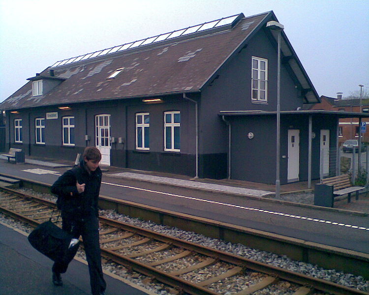
English: Snedsted Station, Thy, Denmark
Dansk: Snedsted Station, Thy, Danmark
Italiano: Stazione di Snedsted, Thy, Danimarca |
| Date | |
| Source | Eget værk |
| Author | Poul Krogsgård |
| Permission ( Reusing this file) |
Ubegrænset |
| Camera location |
| View this and other nearby images on: OpenStreetMap |
|
|---|
Licensing
| I, the copyright holder of this work, release this work into the
public domain. This applies worldwide. In some countries this may not be legally possible; if so: I grant anyone the right to use this work for any purpose, without any conditions, unless such conditions are required by law. |
File history
Click on a date/time to view the file as it appeared at that time.
| Date/Time | Thumbnail | Dimensions | User | Comment | |
|---|---|---|---|---|---|
| current | 15:21, 9 November 2008 |
| 1,280 × 1,024 (249 KB) | Alicudi | {{Information |Description={{en|1=Snedsted Station, Thy, Denmark}} {{da|1=Snedsted Station, Thy, Danmark}} {{it|1=Stazione di Snedsted, Thy, Danimarca}} |Source=Eget værk |Author=Poul Krogsgård |Date=8. november 2008 |Permission=Ubegrænset |other_versi |
File usage
The following pages on the English Wikipedia use this file (pages on other projects are not listed):
Global file usage
The following other wikis use this file:
- Usage on arz.wikipedia.org
- Usage on da.wikipedia.org
- Usage on hu.wikipedia.org
- Usage on nl.wikipedia.org
- Usage on www.wikidata.org
Metadata
Size of this preview:
750 × 600 pixels. Other resolutions:
300 × 240 pixels |
600 × 480 pixels |
960 × 768 pixels |
1,280 × 1,024 pixels.
Original file (1,280 × 1,024 pixels, file size: 249 KB, MIME type: image/jpeg)
| This is a file from the
Wikimedia Commons. Information from its
description page there is shown below. Commons is a freely licensed media file repository. You can help. |
Summary
| Description |
English: Snedsted Station, Thy, Denmark
Dansk: Snedsted Station, Thy, Danmark
Italiano: Stazione di Snedsted, Thy, Danimarca |
| Date | |
| Source | Eget værk |
| Author | Poul Krogsgård |
| Permission ( Reusing this file) |
Ubegrænset |
| Camera location |
| View this and other nearby images on: OpenStreetMap |
|
|---|
Licensing
| I, the copyright holder of this work, release this work into the
public domain. This applies worldwide. In some countries this may not be legally possible; if so: I grant anyone the right to use this work for any purpose, without any conditions, unless such conditions are required by law. |
File history
Click on a date/time to view the file as it appeared at that time.
| Date/Time | Thumbnail | Dimensions | User | Comment | |
|---|---|---|---|---|---|
| current | 15:21, 9 November 2008 |
| 1,280 × 1,024 (249 KB) | Alicudi | {{Information |Description={{en|1=Snedsted Station, Thy, Denmark}} {{da|1=Snedsted Station, Thy, Danmark}} {{it|1=Stazione di Snedsted, Thy, Danimarca}} |Source=Eget værk |Author=Poul Krogsgård |Date=8. november 2008 |Permission=Ubegrænset |other_versi |
File usage
The following pages on the English Wikipedia use this file (pages on other projects are not listed):
Global file usage
The following other wikis use this file:
- Usage on arz.wikipedia.org
- Usage on da.wikipedia.org
- Usage on hu.wikipedia.org
- Usage on nl.wikipedia.org
- Usage on www.wikidata.org