
Original file (SVG file, nominally 1,032 × 533 pixels, file size: 100 KB)
| This is a file from the
Wikimedia Commons. Information from its
description page there is shown below. Commons is a freely licensed media file repository. You can help. |
Summary
| Description |
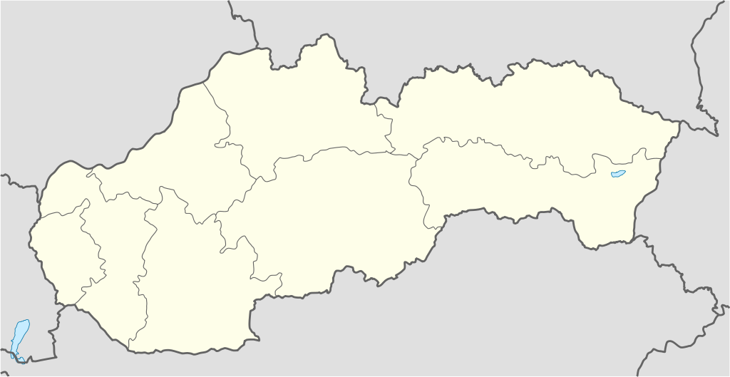
Deutsch: Positionskarte der
Slowakei
Quadratische Plattkarte, N-S-Streckung 150 %. Geographische Begrenzung der Karte:
English: Location map of
Slovakia
Equirectangular projection, N/S stretching 150 %. Geographic limits of the map:
Français : Carte localisant la
Slovaquie
Projection cylindrique équidistante, N/S étendue 150 %. Limites géographiques de la carte :
|
| Date | 06-08-2008 |
| Source |
Own work, using
|
| Author | NordNordWest |
| Other versions |
File:Slovakia location map white.svg:
 |

|
This map has been made or improved in the German
Kartenwerkstatt (Map Lab). You can
propose maps to improve as well.
|
Licensing

|
Permission is granted to copy, distribute and/or modify this document under the terms of the GNU Free Documentation License, Version 1.2 or any later version published by the Free Software Foundation; with no Invariant Sections, no Front-Cover Texts, and no Back-Cover Texts. A copy of the license is included in the section entitled GNU Free Documentation License. |
- You are free:
- to share – to copy, distribute and transmit the work
- to remix – to adapt the work
- Under the following conditions:
- attribution – You must give appropriate credit, provide a link to the license, and indicate if changes were made. You may do so in any reasonable manner, but not in any way that suggests the licensor endorses you or your use.
- share alike – If you remix, transform, or build upon the material, you must distribute your contributions under the same or compatible license as the original.
File history
Click on a date/time to view the file as it appeared at that time.
| Date/Time | Thumbnail | Dimensions | User | Comment | |
|---|---|---|---|---|---|
| current | 09:01, 2 September 2008 |
| 1,032 × 533 (100 KB) | NordNordWest | |
| 20:52, 6 August 2008 |
 | 516 × 266 (99 KB) | NordNordWest | {{Information |Description= {{de|Positionskarte der Slowakei}} Quadratische Plattkarte, N-S-Streckung 150 %. Geographische Begrenzung der Karte: * N: 49.8° N * S: 47.6° N * W: 16.6° O * O: 23.0° O {{en|Location map of [[:en:Slovakia|S |
File usage
More than 100 pages use this file. The following list shows the first 100 pages that use this file only. A full list is available.
- 2000 UEFA European Under-21 Championship
- 2001–02 Slovak Superliga
- 2002–03 Slovak Superliga
- 2003–04 Slovak Superliga
- 2004–05 Slovak Superliga
- Alekšince
- Banská Belá
- Betliar
- Blatnica, Slovakia
- Blatnica Valley
- Bojnice Castle
- Borský Svätý Jur
- Bratislava Airport
- Brdárka
- Bretka
- Brhlovce
- Brzotín
- Comenius University
- Dargov
- Dedina Mládeže
- Diakovce
- Diaková
- Dobšiná
- Gabčíkovo
- Gader Valley
- Gelnica
- House of Schwarzenberg
- Hozelec
- Hranovnica
- Hronská Dúbrava
- Ilija, Slovakia
- Jastrabá
- Jelenec
- Jánovce
- Kazimír
- Komjatice
- Komárno
- Kosorín
- Košice International Airport
- Krahule
- Kravany, Poprad District
- Kremnické Bane
- Kráľovský Chlmec
- Kysucké Nové Mesto
- Lastovce
- Leles
- Liptovský Hrádok
- List of national parks of Slovakia
- List of top-division football clubs in UEFA countries
- Lukavica, Zvolen District
- Látky
- Margecany
- Mošovce
- Muráň Castle
- Nálepkovo
- Orava Castle
- Perín-Chym
- Pitelová
- Podbrezová
- Poprad–Tatry Airport
- Považská Bystrica
- Prochot
- Rad (village)
- Rozhanovce
- Sabinov
- Sirk, Revúca District
- Skýcov
- Slatina, Levice District
- Slatinské Lazy
- Slivník
- Slovak Extraliga
- Slovak First Football League
- Spiš Castle
- Spišské Podhradie
- Spišské Vlachy
- Spišský Hrhov
- St. Emmeram's Cathedral, Nitra
- Stankovce
- Stožok
- Streda nad Bodrogom
- Strečno
- Svinia
- Sídlisko Ťahanovce
- Tematín
- Terchová
- Veľký Šariš
- Vlkolínec
- Vrbov
- Vráble
- Vrútky
- Vysoké Tatry
- Vígľašská Huta-Kalinka
- Zlaté Moravce
- Zvolen Castle
- Čabraď Castle
- Čachtice Castle
- Čierne Kľačany
- Čičmany
- Číž
- Šaca
View more links to this file.
Global file usage
The following other wikis use this file:
- Usage on af.wikipedia.org
- Usage on als.wikipedia.org
- Usage on an.wikipedia.org
- Usage on ar.wikipedia.org
- Usage on ast.wikipedia.org
- Usage on az.wikipedia.org
View more global usage of this file.
Original file (SVG file, nominally 1,032 × 533 pixels, file size: 100 KB)
| This is a file from the
Wikimedia Commons. Information from its
description page there is shown below. Commons is a freely licensed media file repository. You can help. |
Summary
| Description |
Deutsch: Positionskarte der
Slowakei
Quadratische Plattkarte, N-S-Streckung 150 %. Geographische Begrenzung der Karte:
English: Location map of
Slovakia
Equirectangular projection, N/S stretching 150 %. Geographic limits of the map:
Français : Carte localisant la
Slovaquie
Projection cylindrique équidistante, N/S étendue 150 %. Limites géographiques de la carte :
|
| Date | 06-08-2008 |
| Source |
Own work, using
|
| Author | NordNordWest |
| Other versions |
File:Slovakia location map white.svg:
|
|
|
This map has been made or improved in the German
Kartenwerkstatt (Map Lab). You can
propose maps to improve as well.
|
Licensing
|
|
Permission is granted to copy, distribute and/or modify this document under the terms of the GNU Free Documentation License, Version 1.2 or any later version published by the Free Software Foundation; with no Invariant Sections, no Front-Cover Texts, and no Back-Cover Texts. A copy of the license is included in the section entitled GNU Free Documentation License. |
- You are free:
- to share – to copy, distribute and transmit the work
- to remix – to adapt the work
- Under the following conditions:
- attribution – You must give appropriate credit, provide a link to the license, and indicate if changes were made. You may do so in any reasonable manner, but not in any way that suggests the licensor endorses you or your use.
- share alike – If you remix, transform, or build upon the material, you must distribute your contributions under the same or compatible license as the original.
File history
Click on a date/time to view the file as it appeared at that time.
| Date/Time | Thumbnail | Dimensions | User | Comment | |
|---|---|---|---|---|---|
| current | 09:01, 2 September 2008 |
| 1,032 × 533 (100 KB) | NordNordWest | |
| 20:52, 6 August 2008 |
| 516 × 266 (99 KB) | NordNordWest | {{Information |Description= {{de|Positionskarte der Slowakei}} Quadratische Plattkarte, N-S-Streckung 150 %. Geographische Begrenzung der Karte: * N: 49.8° N * S: 47.6° N * W: 16.6° O * O: 23.0° O {{en|Location map of [[:en:Slovakia|S |
File usage
More than 100 pages use this file. The following list shows the first 100 pages that use this file only. A full list is available.
- 2000 UEFA European Under-21 Championship
- 2001–02 Slovak Superliga
- 2002–03 Slovak Superliga
- 2003–04 Slovak Superliga
- 2004–05 Slovak Superliga
- Alekšince
- Banská Belá
- Betliar
- Blatnica, Slovakia
- Blatnica Valley
- Bojnice Castle
- Borský Svätý Jur
- Bratislava Airport
- Brdárka
- Bretka
- Brhlovce
- Brzotín
- Comenius University
- Dargov
- Dedina Mládeže
- Diakovce
- Diaková
- Dobšiná
- Gabčíkovo
- Gader Valley
- Gelnica
- House of Schwarzenberg
- Hozelec
- Hranovnica
- Hronská Dúbrava
- Ilija, Slovakia
- Jastrabá
- Jelenec
- Jánovce
- Kazimír
- Komjatice
- Komárno
- Kosorín
- Košice International Airport
- Krahule
- Kravany, Poprad District
- Kremnické Bane
- Kráľovský Chlmec
- Kysucké Nové Mesto
- Lastovce
- Leles
- Liptovský Hrádok
- List of national parks of Slovakia
- List of top-division football clubs in UEFA countries
- Lukavica, Zvolen District
- Látky
- Margecany
- Mošovce
- Muráň Castle
- Nálepkovo
- Orava Castle
- Perín-Chym
- Pitelová
- Podbrezová
- Poprad–Tatry Airport
- Považská Bystrica
- Prochot
- Rad (village)
- Rozhanovce
- Sabinov
- Sirk, Revúca District
- Skýcov
- Slatina, Levice District
- Slatinské Lazy
- Slivník
- Slovak Extraliga
- Slovak First Football League
- Spiš Castle
- Spišské Podhradie
- Spišské Vlachy
- Spišský Hrhov
- St. Emmeram's Cathedral, Nitra
- Stankovce
- Stožok
- Streda nad Bodrogom
- Strečno
- Svinia
- Sídlisko Ťahanovce
- Tematín
- Terchová
- Veľký Šariš
- Vlkolínec
- Vrbov
- Vráble
- Vrútky
- Vysoké Tatry
- Vígľašská Huta-Kalinka
- Zlaté Moravce
- Zvolen Castle
- Čabraď Castle
- Čachtice Castle
- Čierne Kľačany
- Čičmany
- Číž
- Šaca
View more links to this file.
Global file usage
The following other wikis use this file:
- Usage on af.wikipedia.org
- Usage on als.wikipedia.org
- Usage on an.wikipedia.org
- Usage on ar.wikipedia.org
- Usage on ast.wikipedia.org
- Usage on az.wikipedia.org
View more global usage of this file.