
Size of this PNG preview of this SVG file:
772 × 600 pixels. Other resolutions:
309 × 240 pixels |
618 × 480 pixels |
989 × 768 pixels |
1,280 × 994 pixels |
2,560 × 1,989 pixels |
1,425 × 1,107 pixels.
Original file (SVG file, nominally 1,425 × 1,107 pixels, file size: 1.68 MB)
| This is a file from the
Wikimedia Commons. Information from its
description page there is shown below. Commons is a freely licensed media file repository. You can help. |
| Description |
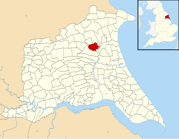
English: Map of the
East Riding of Yorkshire, England, with
Skerne and Wansford parish highlighted.
Equirectangular map projection on WGS 84 datum, with N/S stretched 165% Geographic limits:
|
| Date | |
| Source | File:East Riding of Yorkshire UK parish map (blank).svg |
| Author |
|
| Permission ( Reusing this file) |
This file is licensed under the
Creative Commons
Attribution-Share Alike 3.0 Unported license. Attribution: Contains Ordnance Survey data © Crown copyright and database right
|
.svg)
File history
Click on a date/time to view the file as it appeared at that time.
| Date/Time | Thumbnail | Dimensions | User | Comment | |
|---|---|---|---|---|---|
| current | 18:47, 27 February 2011 |
| 1,425 × 1,107 (1.68 MB) | Keith D | Typos fixed in parish names |
| 00:03, 12 February 2011 |
 | 1,425 × 1,107 (1.68 MB) | Keith D | {{Information |Description={{en|1=Map of the East Riding of Yorkshire, England, with Skerne and Wansford parish highlighted. Equirectangular map projection on WGS 84 datum, with N/S stretched 1 |
File usage
The following pages on the English Wikipedia use this file (pages on other projects are not listed):
Global file usage
The following other wikis use this file:
- Usage on fr.wikipedia.org
- Usage on www.wikidata.org
Size of this PNG preview of this SVG file:
772 × 600 pixels. Other resolutions:
309 × 240 pixels |
618 × 480 pixels |
989 × 768 pixels |
1,280 × 994 pixels |
2,560 × 1,989 pixels |
1,425 × 1,107 pixels.
Original file (SVG file, nominally 1,425 × 1,107 pixels, file size: 1.68 MB)
| This is a file from the
Wikimedia Commons. Information from its
description page there is shown below. Commons is a freely licensed media file repository. You can help. |
| Description |
English: Map of the
East Riding of Yorkshire, England, with
Skerne and Wansford parish highlighted.
Equirectangular map projection on WGS 84 datum, with N/S stretched 165% Geographic limits:
|
| Date | |
| Source | File:East Riding of Yorkshire UK parish map (blank).svg |
| Author |
|
| Permission ( Reusing this file) |
This file is licensed under the
Creative Commons
Attribution-Share Alike 3.0 Unported license. Attribution: Contains Ordnance Survey data © Crown copyright and database right
|
File history
Click on a date/time to view the file as it appeared at that time.
| Date/Time | Thumbnail | Dimensions | User | Comment | |
|---|---|---|---|---|---|
| current | 18:47, 27 February 2011 |
| 1,425 × 1,107 (1.68 MB) | Keith D | Typos fixed in parish names |
| 00:03, 12 February 2011 |
| 1,425 × 1,107 (1.68 MB) | Keith D | {{Information |Description={{en|1=Map of the East Riding of Yorkshire, England, with Skerne and Wansford parish highlighted. Equirectangular map projection on WGS 84 datum, with N/S stretched 1 |
File usage
The following pages on the English Wikipedia use this file (pages on other projects are not listed):
Global file usage
The following other wikis use this file:
- Usage on fr.wikipedia.org
- Usage on www.wikidata.org