
Original file (SVG file, nominally 592 × 772 pixels, file size: 168 KB)
| This is a file from the
Wikimedia Commons. Information from its
description page there is shown below. Commons is a freely licensed media file repository. You can help. |
Summary
| Description |
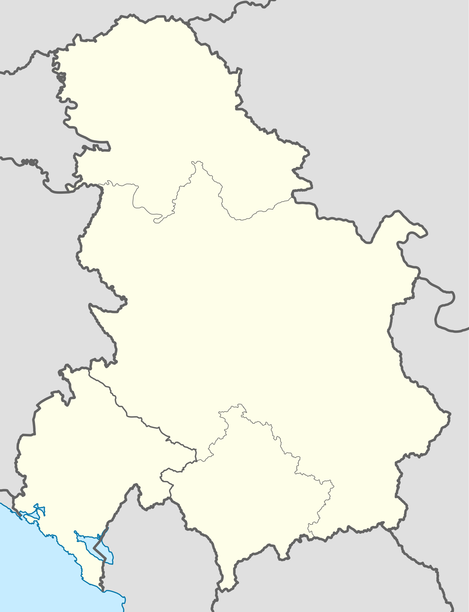
Deutsch: Positionskarte von
Serbien und Montenegro (2003–2006)
Quadratische Plattkarte, N-S-Streckung 139 %. Geographische Begrenzung der Karte:
English: Location map of
Serbia and Montenegro (2003–2006)
Equirectangular projection, N/S stretching 139 %. Geographic limits of the map:
|
|
| Date | ||
| Source | Own work | |
| Author | NordNordWest | |
| Permission ( Reusing this file) |
This file is licensed under the
Creative Commons
Attribution-Share Alike 3.0 Germany license.
 |

_location_map.svg)

|
This map has been made or improved in the German
Kartenwerkstatt (Map Lab). You can
propose maps to improve as well.
|
Licensing
- You are free:
- to share – to copy, distribute and transmit the work
- to remix – to adapt the work
- Under the following conditions:
- attribution – You must give appropriate credit, provide a link to the license, and indicate if changes were made. You may do so in any reasonable manner, but not in any way that suggests the licensor endorses you or your use.
- share alike – If you remix, transform, or build upon the material, you must distribute your contributions under the same or compatible license as the original.
File history
Click on a date/time to view the file as it appeared at that time.
| Date/Time | Thumbnail | Dimensions | User | Comment | |
|---|---|---|---|---|---|
| current | 21:22, 9 January 2013 |
| 592 × 772 (168 KB) | NordNordWest | == {{int:filedesc}} == {{Information |Description= {{de|Positionskarte von Serbien und Montenegro (2003–2006)}} Quadratische Plattkarte, N-S-Streckung 139 %. Geographische Begrenzung der Karte: * N: 46.3° N * S: 41.7°... |
File usage
- 1992–93 First League of FR Yugoslavia
- 1993–94 First League of FR Yugoslavia
- 1993–94 YUBA League
- 1994–95 First League of FR Yugoslavia
- 1994–95 YUBA League
- 1996–97 First League of FR Yugoslavia
- 1996–97 YUBA League
- 1997–98 First League of FR Yugoslavia
- 1997–98 YUBA League
- 1998–99 First League of FR Yugoslavia
- 1998–99 YUBA League
- 1999–2000 First League of FR Yugoslavia
- 1999–2000 YUBA League
- 2000–01 First League of FR Yugoslavia
- 2000–01 YUBA League
- 2000–01 Yugoslav Basketball Cup
- 2001–02 First League of FR Yugoslavia
- 2002–03 First League of Serbia and Montenegro
- 2002–03 Radivoj Korać Cup
- 2003–04 First League of Serbia and Montenegro
- 2003–04 Radivoj Korać Cup
- 2004–05 First League of Serbia and Montenegro
- 2004–05 Radivoj Korać Cup
- 2005–06 Radivoj Korać Cup
- 2005–06 Serbia and Montenegro SuperLiga
- Budućnost–Crvena Zvezda basketball rivalry
- December 14, 1998, Albanian–Yugoslav border ambush
- Prizren incident (1999)
- Module:Location map/data/Serbia and Montenegro
- Module:Location map/data/Serbia and Montenegro/doc
Global file usage
The following other wikis use this file:
- Usage on ar.wikipedia.org
- Usage on bs.wikipedia.org
- Usage on ceb.wikipedia.org
- Usage on de.wikipedia.org
- Usage on fr.wikipedia.org
- Usage on fr.wikinews.org
- Usage on hr.wikipedia.org
- Prva liga SR Jugoslavije u nogometu 1992./93.
- Prva liga SR Jugoslavije u nogometu 1993./94.
- Prva liga SR Jugoslavije u nogometu 1994./95.
- Prva liga SR Jugoslavije u nogometu 1995./96.
- Prva liga SR Jugoslavije u nogometu 1996./97.
- Prva liga SR Jugoslavije u nogometu 1997./98.
- Prva liga SR Jugoslavije u nogometu 1998./99.
- Prva liga SR Jugoslavije u nogometu 1999./00.
- Prva liga SR Jugoslavije u nogometu 2000./01.
- Prva liga SR Jugoslavije u nogometu 2001./02.
- Prva liga Srbije i Crne Gore u nogometu 2002./03.
- Prva liga Srbije i Crne Gore u nogometu 2003./04.
- Prva liga Srbije i Crne Gore u nogometu 2004./05.
- Prva liga Srbije i Crne Gore u nogometu 2005./06.
- Modul:Location map/data/Srbija i Crna Gora
- Modul:Location map/data/Srbija i Crna Gora/doc
- Modul:Location map/data/SCG
- Usage on it.wikipedia.org
- Campionato europeo maschile di pallacanestro 2005
- Prva liga Srbije i Crne Gore u fudbalu 2005-2006
- Prva liga Srbije i Crne Gore u fudbalu 2004-2005
- Prva liga Srbije i Crne Gore u fudbalu 2003-2004
- Prva liga Srbije i Crne Gore u fudbalu 2002-2003
- Prva liga SR Jugoslavije 2001-2002
- Prva liga SR Jugoslavije 1998-1999
- Prva liga SR Jugoslavije 1996-1997
- Prva liga SR Jugoslavije 2000-2001
- Prva liga SR Jugoslavije 1999-2000
- Prva liga SR Jugoslavije 1997-1998
- Prva liga SR Jugoslavije 1992-1993
- Prva liga SR Jugoslavije 1995-1996
- Prva liga SR Jugoslavije 1994-1995
- Prva liga SR Jugoslavije 1993-1994
- Druga liga SR Jugoslavije 1992-1993
- Druga liga SR Jugoslavije 1993-1994
- Druga liga SR Jugoslavije 1994-1995
- Druga liga SR Jugoslavije 1995-1996
- Template:Mappa di localizzazione/SCG
View more global usage of this file.
_location_map.svg)
Metadata
_location_map.svg)
Original file (SVG file, nominally 592 × 772 pixels, file size: 168 KB)
| This is a file from the
Wikimedia Commons. Information from its
description page there is shown below. Commons is a freely licensed media file repository. You can help. |
Summary
| Description |
Deutsch: Positionskarte von
Serbien und Montenegro (2003–2006)
Quadratische Plattkarte, N-S-Streckung 139 %. Geographische Begrenzung der Karte:
English: Location map of
Serbia and Montenegro (2003–2006)
Equirectangular projection, N/S stretching 139 %. Geographic limits of the map:
|
|
| Date | ||
| Source | Own work | |
| Author | NordNordWest | |
| Permission ( Reusing this file) |
This file is licensed under the
Creative Commons
Attribution-Share Alike 3.0 Germany license.
|
|
|
This map has been made or improved in the German
Kartenwerkstatt (Map Lab). You can
propose maps to improve as well.
|
Licensing
- You are free:
- to share – to copy, distribute and transmit the work
- to remix – to adapt the work
- Under the following conditions:
- attribution – You must give appropriate credit, provide a link to the license, and indicate if changes were made. You may do so in any reasonable manner, but not in any way that suggests the licensor endorses you or your use.
- share alike – If you remix, transform, or build upon the material, you must distribute your contributions under the same or compatible license as the original.
File history
Click on a date/time to view the file as it appeared at that time.
| Date/Time | Thumbnail | Dimensions | User | Comment | |
|---|---|---|---|---|---|
| current | 21:22, 9 January 2013 |
| 592 × 772 (168 KB) | NordNordWest | == {{int:filedesc}} == {{Information |Description= {{de|Positionskarte von Serbien und Montenegro (2003–2006)}} Quadratische Plattkarte, N-S-Streckung 139 %. Geographische Begrenzung der Karte: * N: 46.3° N * S: 41.7°... |
File usage
- 1992–93 First League of FR Yugoslavia
- 1993–94 First League of FR Yugoslavia
- 1993–94 YUBA League
- 1994–95 First League of FR Yugoslavia
- 1994–95 YUBA League
- 1996–97 First League of FR Yugoslavia
- 1996–97 YUBA League
- 1997–98 First League of FR Yugoslavia
- 1997–98 YUBA League
- 1998–99 First League of FR Yugoslavia
- 1998–99 YUBA League
- 1999–2000 First League of FR Yugoslavia
- 1999–2000 YUBA League
- 2000–01 First League of FR Yugoslavia
- 2000–01 YUBA League
- 2000–01 Yugoslav Basketball Cup
- 2001–02 First League of FR Yugoslavia
- 2002–03 First League of Serbia and Montenegro
- 2002–03 Radivoj Korać Cup
- 2003–04 First League of Serbia and Montenegro
- 2003–04 Radivoj Korać Cup
- 2004–05 First League of Serbia and Montenegro
- 2004–05 Radivoj Korać Cup
- 2005–06 Radivoj Korać Cup
- 2005–06 Serbia and Montenegro SuperLiga
- Budućnost–Crvena Zvezda basketball rivalry
- December 14, 1998, Albanian–Yugoslav border ambush
- Prizren incident (1999)
- Module:Location map/data/Serbia and Montenegro
- Module:Location map/data/Serbia and Montenegro/doc
Global file usage
The following other wikis use this file:
- Usage on ar.wikipedia.org
- Usage on bs.wikipedia.org
- Usage on ceb.wikipedia.org
- Usage on de.wikipedia.org
- Usage on fr.wikipedia.org
- Usage on fr.wikinews.org
- Usage on hr.wikipedia.org
- Prva liga SR Jugoslavije u nogometu 1992./93.
- Prva liga SR Jugoslavije u nogometu 1993./94.
- Prva liga SR Jugoslavije u nogometu 1994./95.
- Prva liga SR Jugoslavije u nogometu 1995./96.
- Prva liga SR Jugoslavije u nogometu 1996./97.
- Prva liga SR Jugoslavije u nogometu 1997./98.
- Prva liga SR Jugoslavije u nogometu 1998./99.
- Prva liga SR Jugoslavije u nogometu 1999./00.
- Prva liga SR Jugoslavije u nogometu 2000./01.
- Prva liga SR Jugoslavije u nogometu 2001./02.
- Prva liga Srbije i Crne Gore u nogometu 2002./03.
- Prva liga Srbije i Crne Gore u nogometu 2003./04.
- Prva liga Srbije i Crne Gore u nogometu 2004./05.
- Prva liga Srbije i Crne Gore u nogometu 2005./06.
- Modul:Location map/data/Srbija i Crna Gora
- Modul:Location map/data/Srbija i Crna Gora/doc
- Modul:Location map/data/SCG
- Usage on it.wikipedia.org
- Campionato europeo maschile di pallacanestro 2005
- Prva liga Srbije i Crne Gore u fudbalu 2005-2006
- Prva liga Srbije i Crne Gore u fudbalu 2004-2005
- Prva liga Srbije i Crne Gore u fudbalu 2003-2004
- Prva liga Srbije i Crne Gore u fudbalu 2002-2003
- Prva liga SR Jugoslavije 2001-2002
- Prva liga SR Jugoslavije 1998-1999
- Prva liga SR Jugoslavije 1996-1997
- Prva liga SR Jugoslavije 2000-2001
- Prva liga SR Jugoslavije 1999-2000
- Prva liga SR Jugoslavije 1997-1998
- Prva liga SR Jugoslavije 1992-1993
- Prva liga SR Jugoslavije 1995-1996
- Prva liga SR Jugoslavije 1994-1995
- Prva liga SR Jugoslavije 1993-1994
- Druga liga SR Jugoslavije 1992-1993
- Druga liga SR Jugoslavije 1993-1994
- Druga liga SR Jugoslavije 1994-1995
- Druga liga SR Jugoslavije 1995-1996
- Template:Mappa di localizzazione/SCG
View more global usage of this file.