Size of this preview:
600 × 600 pixels. Other resolutions:
240 × 240 pixels |
480 × 480 pixels |
900 × 900 pixels.
Original file (900 × 900 pixels, file size: 284 KB, MIME type: image/png)
| This is a file from the
Wikimedia Commons. Information from its
description page there is shown below. Commons is a freely licensed media file repository. You can help. |
Summary
| Description |
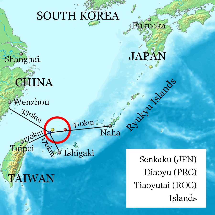
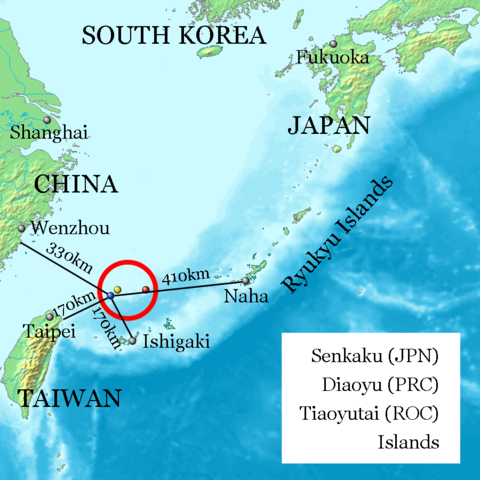
English: Uotsuri-shima /
Diaoyu Dao (Blue, west end and nearly south end, 25°44′33″N 123°28′17″E at
Mount Narahara), Kuba-shima / Huangwei Yu (Yellow, north end, 25°55′24″N 123°40′51″E at
Mount Chitose), Taishō-tō / Chiwei Yu (Red, east end, 25°55′21″N 124°33′36″E at the peek) referenced on
Geospatial Information Authority of Japan and distances referenced on
Ministry of Foreign Affairs of Japan. Every distances of the map show coast to coast, but distances of the coast of
Okinawa Island and Naha City, and the coast of Ishigaki-Island and Ishigaki City are quite near on the map. |
| Date | |
| Source | image:Topographic15deg_N20E120.png |
| Author | Jackopoid |

|
This map image could be re-created using
vector graphics as an
SVG file. This has several advantages; see
Commons:Media for cleanup for more information. If an SVG form of this image is available, please upload it and afterwards replace this template with
{{
vector version available|new image name}}
.
It is recommended to name the SVG file “Senkaku Diaoyu Tiaoyu Islands.svg”—then the template Vector version available (or Vva) does not need the new image name parameter. |
Licensing

|
Permission is granted to copy, distribute and/or modify this document under the terms of the GNU Free Documentation License, Version 1.2 or any later version published by the Free Software Foundation; with no Invariant Sections, no Front-Cover Texts, and no Back-Cover Texts. A copy of the license is included in the section entitled GNU Free Documentation License. |
| This file is licensed under the Creative Commons Attribution-Share Alike 3.0 Unported license. | ||
| ||
| This licensing tag was added to this file as part of the GFDL licensing update. |
File history
Click on a date/time to view the file as it appeared at that time.
| Date/Time | Thumbnail | Dimensions | User | Comment | |
|---|---|---|---|---|---|
| current | 17:31, 20 February 2013 |
| 900 × 900 (284 KB) | ジャコウネズミ | Diaoyutai (PRC) --> Diaoyu (PRC) |
| 02:04, 13 February 2013 |
 | 900 × 900 (284 KB) | ジャコウネズミ | Correct location | |
| 19:09, 12 February 2013 |
 | 900 × 900 (284 KB) | ジャコウネズミ | User created page with UploadWizard |
File usage
The following pages on the English Wikipedia use this file (pages on other projects are not listed):
Global file usage
The following other wikis use this file:
- Usage on af.wikipedia.org
- Usage on ar.wikipedia.org
- Usage on bg.wikipedia.org
- Usage on bn.wikipedia.org
- Usage on cdo.wikipedia.org
- Usage on cs.wikipedia.org
- Usage on cy.wikipedia.org
- Usage on da.wikipedia.org
- Usage on de.wikipedia.org
- Usage on es.wikipedia.org
- Usage on fa.wikipedia.org
- Usage on gl.wikipedia.org
- Usage on he.wikipedia.org
- Usage on id.wikipedia.org
- Usage on it.wikipedia.org
- Usage on ja.wikipedia.org
- Usage on ko.wikipedia.org
- Usage on mn.wikipedia.org
- Usage on ms.wikipedia.org
- Usage on nl.wikipedia.org
- Usage on nn.wikipedia.org
- Usage on no.wikipedia.org
- Usage on pl.wikipedia.org
- Usage on pt.wikipedia.org
- Usage on ro.wikipedia.org
- Usage on ru.wikipedia.org
- Usage on sco.wikipedia.org
- Usage on sr.wikipedia.org
- Usage on sv.wikipedia.org
- Usage on th.wikipedia.org
- Usage on tr.wikipedia.org
- Usage on ur.wikipedia.org
- Usage on vi.wikipedia.org
- Usage on zh-yue.wikipedia.org
- Usage on zh.wikipedia.org
View more global usage of this file.
Metadata
Size of this preview:
600 × 600 pixels. Other resolutions:
240 × 240 pixels |
480 × 480 pixels |
900 × 900 pixels.
Original file (900 × 900 pixels, file size: 284 KB, MIME type: image/png)
| This is a file from the
Wikimedia Commons. Information from its
description page there is shown below. Commons is a freely licensed media file repository. You can help. |
Summary
| Description |
English: Uotsuri-shima /
Diaoyu Dao (Blue, west end and nearly south end, 25°44′33″N 123°28′17″E at
Mount Narahara), Kuba-shima / Huangwei Yu (Yellow, north end, 25°55′24″N 123°40′51″E at
Mount Chitose), Taishō-tō / Chiwei Yu (Red, east end, 25°55′21″N 124°33′36″E at the peek) referenced on
Geospatial Information Authority of Japan and distances referenced on
Ministry of Foreign Affairs of Japan. Every distances of the map show coast to coast, but distances of the coast of
Okinawa Island and Naha City, and the coast of Ishigaki-Island and Ishigaki City are quite near on the map. |
| Date | |
| Source | image:Topographic15deg_N20E120.png |
| Author | Jackopoid |
|
|
This map image could be re-created using
vector graphics as an
SVG file. This has several advantages; see
Commons:Media for cleanup for more information. If an SVG form of this image is available, please upload it and afterwards replace this template with
{{
vector version available|new image name}}
.
It is recommended to name the SVG file “Senkaku Diaoyu Tiaoyu Islands.svg”—then the template Vector version available (or Vva) does not need the new image name parameter. |
Licensing
|
|
Permission is granted to copy, distribute and/or modify this document under the terms of the GNU Free Documentation License, Version 1.2 or any later version published by the Free Software Foundation; with no Invariant Sections, no Front-Cover Texts, and no Back-Cover Texts. A copy of the license is included in the section entitled GNU Free Documentation License. |
| This file is licensed under the Creative Commons Attribution-Share Alike 3.0 Unported license. | ||
| ||
| This licensing tag was added to this file as part of the GFDL licensing update. |
File history
Click on a date/time to view the file as it appeared at that time.
| Date/Time | Thumbnail | Dimensions | User | Comment | |
|---|---|---|---|---|---|
| current | 17:31, 20 February 2013 |
| 900 × 900 (284 KB) | ジャコウネズミ | Diaoyutai (PRC) --> Diaoyu (PRC) |
| 02:04, 13 February 2013 |
| 900 × 900 (284 KB) | ジャコウネズミ | Correct location | |
| 19:09, 12 February 2013 |
| 900 × 900 (284 KB) | ジャコウネズミ | User created page with UploadWizard |
File usage
The following pages on the English Wikipedia use this file (pages on other projects are not listed):
Global file usage
The following other wikis use this file:
- Usage on af.wikipedia.org
- Usage on ar.wikipedia.org
- Usage on bg.wikipedia.org
- Usage on bn.wikipedia.org
- Usage on cdo.wikipedia.org
- Usage on cs.wikipedia.org
- Usage on cy.wikipedia.org
- Usage on da.wikipedia.org
- Usage on de.wikipedia.org
- Usage on es.wikipedia.org
- Usage on fa.wikipedia.org
- Usage on gl.wikipedia.org
- Usage on he.wikipedia.org
- Usage on id.wikipedia.org
- Usage on it.wikipedia.org
- Usage on ja.wikipedia.org
- Usage on ko.wikipedia.org
- Usage on mn.wikipedia.org
- Usage on ms.wikipedia.org
- Usage on nl.wikipedia.org
- Usage on nn.wikipedia.org
- Usage on no.wikipedia.org
- Usage on pl.wikipedia.org
- Usage on pt.wikipedia.org
- Usage on ro.wikipedia.org
- Usage on ru.wikipedia.org
- Usage on sco.wikipedia.org
- Usage on sr.wikipedia.org
- Usage on sv.wikipedia.org
- Usage on th.wikipedia.org
- Usage on tr.wikipedia.org
- Usage on ur.wikipedia.org
- Usage on vi.wikipedia.org
- Usage on zh-yue.wikipedia.org
- Usage on zh.wikipedia.org
View more global usage of this file.