Size of this preview:
800 × 271 pixels. Other resolutions:
320 × 108 pixels |
640 × 217 pixels |
1,024 × 347 pixels |
2,482 × 841 pixels.
Original file (2,482 × 841 pixels, file size: 3.72 MB, MIME type: image/png)
| This is a file from the
Wikimedia Commons. Information from its
description page there is shown below. Commons is a freely licensed media file repository. You can help. |
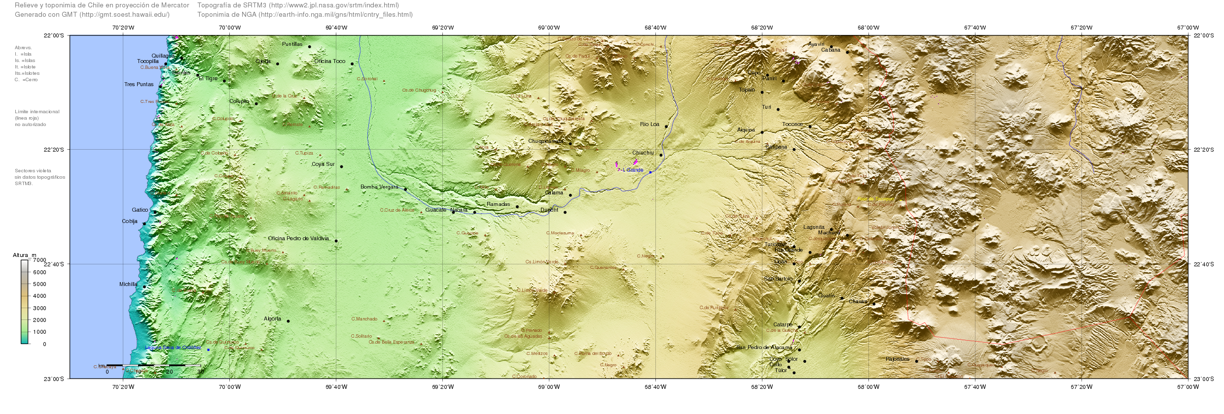
| Description | Map of Chile generated with GMT ( http://gmt.soest.hawaii.edu/), topography from SRTM ftp://e0srp01u.ecs.nasa.gov/srtm/version2/SRTM3/ and toponymy from http://earth-info.nga.mil/gns/html/cntry_files.html | ||||||||||
| Date | |||||||||||
| Source | self-compiled | ||||||||||
| Author | RAVL | ||||||||||
| Permission ( Reusing this file) |
|

File history
Click on a date/time to view the file as it appeared at that time.
| Date/Time | Thumbnail | Dimensions | User | Comment | |
|---|---|---|---|---|---|
| current | 13:56, 16 January 2008 |
| 2,482 × 841 (3.72 MB) | Keysanger | {{Information |Description=Map of Chile generated with GMT (http://gmt.soest.hawaii.edu/), topography from SRTM ftp://e0srp01u.ecs.nasa.gov/srtm/version2/SRTM3/ and toponymy from http://earth-info.nga.mil/gns/html/cntry_files.html |Source=self-compiled |D |
File usage
The following pages on the English Wikipedia use this file (pages on other projects are not listed):
Global file usage
The following other wikis use this file:
- Usage on es.wikipedia.org
- Usage on fa.wikipedia.org
- Usage on zh.wikipedia.org
Size of this preview:
800 × 271 pixels. Other resolutions:
320 × 108 pixels |
640 × 217 pixels |
1,024 × 347 pixels |
2,482 × 841 pixels.
Original file (2,482 × 841 pixels, file size: 3.72 MB, MIME type: image/png)
| This is a file from the
Wikimedia Commons. Information from its
description page there is shown below. Commons is a freely licensed media file repository. You can help. |
| Description | Map of Chile generated with GMT ( http://gmt.soest.hawaii.edu/), topography from SRTM ftp://e0srp01u.ecs.nasa.gov/srtm/version2/SRTM3/ and toponymy from http://earth-info.nga.mil/gns/html/cntry_files.html | ||||||||||
| Date | |||||||||||
| Source | self-compiled | ||||||||||
| Author | RAVL | ||||||||||
| Permission ( Reusing this file) |
|
File history
Click on a date/time to view the file as it appeared at that time.
| Date/Time | Thumbnail | Dimensions | User | Comment | |
|---|---|---|---|---|---|
| current | 13:56, 16 January 2008 |
| 2,482 × 841 (3.72 MB) | Keysanger | {{Information |Description=Map of Chile generated with GMT (http://gmt.soest.hawaii.edu/), topography from SRTM ftp://e0srp01u.ecs.nasa.gov/srtm/version2/SRTM3/ and toponymy from http://earth-info.nga.mil/gns/html/cntry_files.html |Source=self-compiled |D |
File usage
The following pages on the English Wikipedia use this file (pages on other projects are not listed):
Global file usage
The following other wikis use this file:
- Usage on es.wikipedia.org
- Usage on fa.wikipedia.org
- Usage on zh.wikipedia.org