Photos • Location


Size of this preview:
800 × 600 pixels. Other resolutions:
320 × 240 pixels |
640 × 480 pixels |
1,024 × 768 pixels |
1,280 × 960 pixels |
2,560 × 1,920 pixels |
4,032 × 3,024 pixels.
Original file (4,032 × 3,024 pixels, file size: 4.68 MB, MIME type: image/jpeg)
| This is a file from the
Wikimedia Commons. Information from its
description page there is shown below. Commons is a freely licensed media file repository. You can help. |
Summary
| Description |
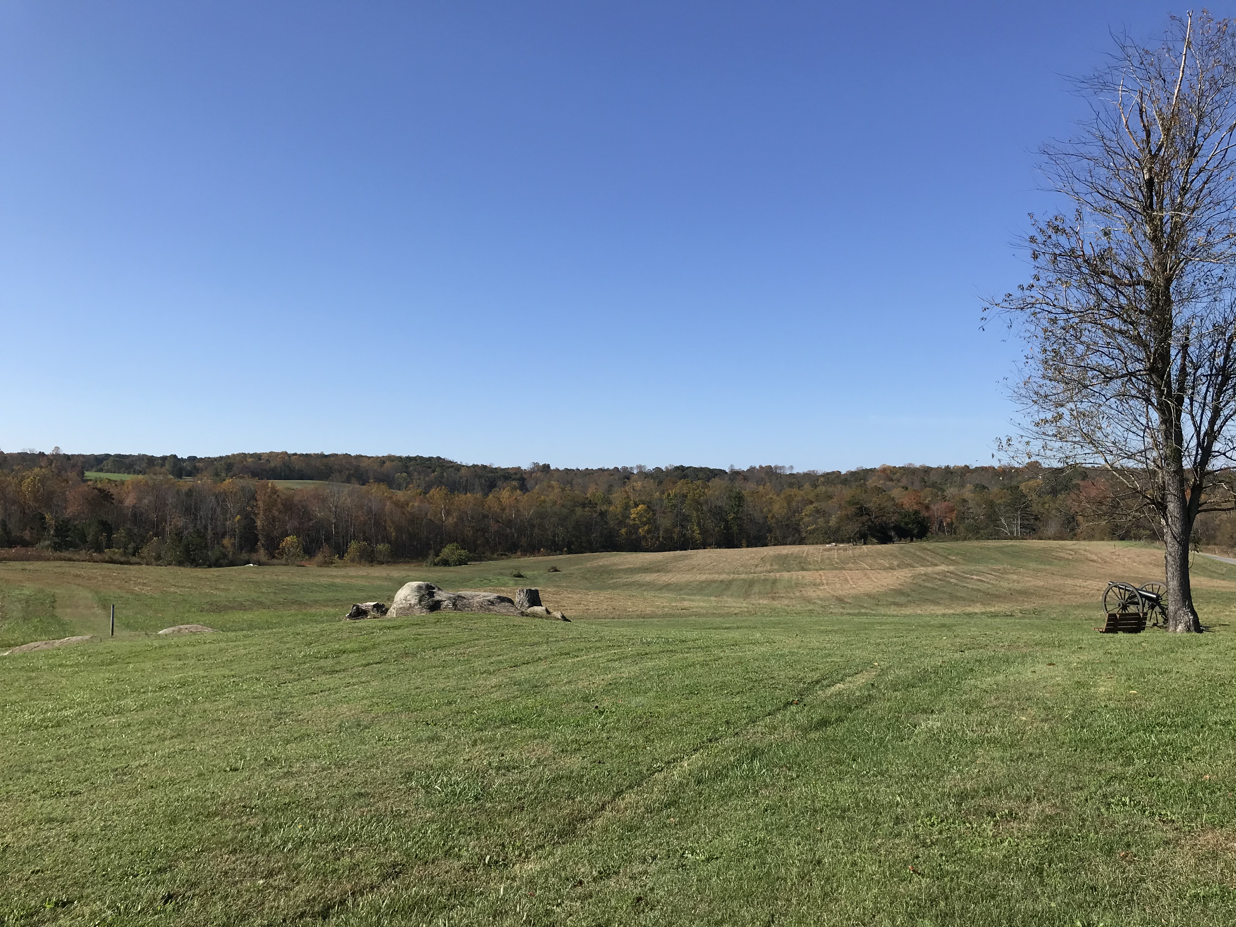
English: Looking south from behind the Hillsman House towards Sailor’s Creek which is just past the treeline in the foreground. Mixture of Oak, Maple, Black Walnut and Pine. It was here that General Horatio Wright’s Federal VI Corps formed into lines of battle and began marching towards the creek and the waiting enemy on the opposite ridge line. Photo taken at approximately 10:35am.
Sailor's Creek Battlefield State Park www.dcr.virginia.gov/state-parks/sailors-creek |
| Date | |
| Source | https://www.flickr.com/photos/37922399@N05/50540999586/ |
| Author | vastateparksstaff |
| Camera location | | View this and other nearby images on: OpenStreetMap |
|
|---|
Licensing
This file is licensed under the
Creative Commons
Attribution 2.0 Generic license.
- You are free:
- to share – to copy, distribute and transmit the work
- to remix – to adapt the work
- Under the following conditions:
- attribution – You must give appropriate credit, provide a link to the license, and indicate if changes were made. You may do so in any reasonable manner, but not in any way that suggests the licensor endorses you or your use.
| This image was originally posted to Flickr by vastateparksstaff at https://flickr.com/photos/37922399@N05/50540999586. It was reviewed on 2 November 2020 by FlickreviewR 2 and was confirmed to be licensed under the terms of the cc-by-2.0. |
File history
Click on a date/time to view the file as it appeared at that time.
| Date/Time | Thumbnail | Dimensions | User | Comment | |
|---|---|---|---|---|---|
| current | 20:40, 2 November 2020 |
| 4,032 × 3,024 (4.68 MB) | Ser Amantio di Nicolao | Uploaded a work by vastateparksstaff from https://www.flickr.com/photos/37922399@N05/50540999586/ with UploadWizard |
File usage
The following pages on the English Wikipedia use this file (pages on other projects are not listed):
Metadata
Size of this preview:
800 × 600 pixels. Other resolutions:
320 × 240 pixels |
640 × 480 pixels |
1,024 × 768 pixels |
1,280 × 960 pixels |
2,560 × 1,920 pixels |
4,032 × 3,024 pixels.
Original file (4,032 × 3,024 pixels, file size: 4.68 MB, MIME type: image/jpeg)
| This is a file from the
Wikimedia Commons. Information from its
description page there is shown below. Commons is a freely licensed media file repository. You can help. |
Summary
| Description |
English: Looking south from behind the Hillsman House towards Sailor’s Creek which is just past the treeline in the foreground. Mixture of Oak, Maple, Black Walnut and Pine. It was here that General Horatio Wright’s Federal VI Corps formed into lines of battle and began marching towards the creek and the waiting enemy on the opposite ridge line. Photo taken at approximately 10:35am.
Sailor's Creek Battlefield State Park www.dcr.virginia.gov/state-parks/sailors-creek |
| Date | |
| Source | https://www.flickr.com/photos/37922399@N05/50540999586/ |
| Author | vastateparksstaff |
| Camera location | | View this and other nearby images on: OpenStreetMap |
|
|---|
Licensing
This file is licensed under the
Creative Commons
Attribution 2.0 Generic license.
- You are free:
- to share – to copy, distribute and transmit the work
- to remix – to adapt the work
- Under the following conditions:
- attribution – You must give appropriate credit, provide a link to the license, and indicate if changes were made. You may do so in any reasonable manner, but not in any way that suggests the licensor endorses you or your use.
| This image was originally posted to Flickr by vastateparksstaff at https://flickr.com/photos/37922399@N05/50540999586. It was reviewed on 2 November 2020 by FlickreviewR 2 and was confirmed to be licensed under the terms of the cc-by-2.0. |
File history
Click on a date/time to view the file as it appeared at that time.
| Date/Time | Thumbnail | Dimensions | User | Comment | |
|---|---|---|---|---|---|
| current | 20:40, 2 November 2020 |
| 4,032 × 3,024 (4.68 MB) | Ser Amantio di Nicolao | Uploaded a work by vastateparksstaff from https://www.flickr.com/photos/37922399@N05/50540999586/ with UploadWizard |
File usage
The following pages on the English Wikipedia use this file (pages on other projects are not listed):