Photos • Location


Size of this preview:
800 × 531 pixels. Other resolutions:
320 × 213 pixels |
640 × 425 pixels |
1,024 × 680 pixels |
1,280 × 850 pixels |
2,560 × 1,700 pixels |
4,288 × 2,848 pixels.
Original file (4,288 × 2,848 pixels, file size: 6.29 MB, MIME type: image/jpeg)
| This is a file from the
Wikimedia Commons. Information from its
description page there is shown below. Commons is a freely licensed media file repository. You can help. |
Summary
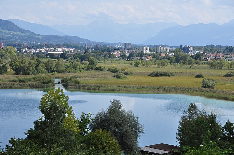
| Description | Pfäffikersee, Wetzikon, Aabach and Robenhuserriet, as seen from Seegräben in Switzerland. |
| Date | |
| Source | Own work |
| Author | Roland zh |
| Other versions |
|

_-_Pf%C3%A4ffikersee_-_Seegr%C3%A4ben_IMG_4873.JPG)
_-_Pf%C3%A4ffikersee_-_Seegr%C3%A4ben_IMG_4874.JPG)


| Camera location |
| View this and other nearby images on: OpenStreetMap |
|
|---|

|
This image was uploaded as part of
Wiki Loves Monuments 2011.
|
Licensing
I, the copyright holder of this work, hereby publish it under the following license:
This file is licensed under the
Creative Commons
Attribution-Share Alike 3.0 Unported license.
- You are free:
- to share – to copy, distribute and transmit the work
- to remix – to adapt the work
- Under the following conditions:
- attribution – You must give appropriate credit, provide a link to the license, and indicate if changes were made. You may do so in any reasonable manner, but not in any way that suggests the licensor endorses you or your use.
- share alike – If you remix, transform, or build upon the material, you must distribute your contributions under the same or compatible license as the original.
File history
Click on a date/time to view the file as it appeared at that time.
| Date/Time | Thumbnail | Dimensions | User | Comment | |
|---|---|---|---|---|---|
| current | 20:08, 3 September 2011 |
| 4,288 × 2,848 (6.29 MB) | Roland zh | aktualisiert |
| 21:39, 23 March 2010 |
 | 3,188 × 2,390 (2.41 MB) | Roland zh | == {{int:filedesc}} == {{Information |Description= ''Pfäffikersee'' (Lake Pfäffikon), Wetzikon, ''Aabach'' and ''Robenhuserriet'', as seen from [[:Cat |
File usage
The following pages on the English Wikipedia use this file (pages on other projects are not listed):
Global file usage
The following other wikis use this file:
- Usage on arz.wikipedia.org
- Usage on ceb.wikipedia.org
- Usage on de.wikipedia.org
- Usage on fa.wikipedia.org
- Usage on hy.wikipedia.org
- Usage on id.wikipedia.org
- Usage on it.wikipedia.org
- Usage on lmo.wikipedia.org
- Usage on nn.wikipedia.org
- Usage on uk.wikipedia.org
- Usage on www.wikidata.org
Metadata
Size of this preview:
800 × 531 pixels. Other resolutions:
320 × 213 pixels |
640 × 425 pixels |
1,024 × 680 pixels |
1,280 × 850 pixels |
2,560 × 1,700 pixels |
4,288 × 2,848 pixels.
Original file (4,288 × 2,848 pixels, file size: 6.29 MB, MIME type: image/jpeg)
| This is a file from the
Wikimedia Commons. Information from its
description page there is shown below. Commons is a freely licensed media file repository. You can help. |
Summary
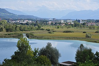
| Description | Pfäffikersee, Wetzikon, Aabach and Robenhuserriet, as seen from Seegräben in Switzerland. |
| Date | |
| Source | Own work |
| Author | Roland zh |
| Other versions |
|
| Camera location |
| View this and other nearby images on: OpenStreetMap |
|
|---|
|
|
This image was uploaded as part of
Wiki Loves Monuments 2011.
|
Licensing
I, the copyright holder of this work, hereby publish it under the following license:
This file is licensed under the
Creative Commons
Attribution-Share Alike 3.0 Unported license.
- You are free:
- to share – to copy, distribute and transmit the work
- to remix – to adapt the work
- Under the following conditions:
- attribution – You must give appropriate credit, provide a link to the license, and indicate if changes were made. You may do so in any reasonable manner, but not in any way that suggests the licensor endorses you or your use.
- share alike – If you remix, transform, or build upon the material, you must distribute your contributions under the same or compatible license as the original.
File history
Click on a date/time to view the file as it appeared at that time.
| Date/Time | Thumbnail | Dimensions | User | Comment | |
|---|---|---|---|---|---|
| current | 20:08, 3 September 2011 |
| 4,288 × 2,848 (6.29 MB) | Roland zh | aktualisiert |
| 21:39, 23 March 2010 |
| 3,188 × 2,390 (2.41 MB) | Roland zh | == {{int:filedesc}} == {{Information |Description= ''Pfäffikersee'' (Lake Pfäffikon), Wetzikon, ''Aabach'' and ''Robenhuserriet'', as seen from [[:Cat |
File usage
The following pages on the English Wikipedia use this file (pages on other projects are not listed):
Global file usage
The following other wikis use this file:
- Usage on arz.wikipedia.org
- Usage on ceb.wikipedia.org
- Usage on de.wikipedia.org
- Usage on fa.wikipedia.org
- Usage on hy.wikipedia.org
- Usage on id.wikipedia.org
- Usage on it.wikipedia.org
- Usage on lmo.wikipedia.org
- Usage on nn.wikipedia.org
- Usage on uk.wikipedia.org
- Usage on www.wikidata.org