
Size of this preview:
479 × 600 pixels. Other resolutions:
192 × 240 pixels |
383 × 480 pixels |
613 × 768 pixels |
818 × 1,024 pixels |
1,503 × 1,882 pixels.
Original file (1,503 × 1,882 pixels, file size: 2.08 MB, MIME type: image/png)
| This is a file from the
Wikimedia Commons. Information from its
description page there is shown below. Commons is a freely licensed media file repository. You can help. |
Summary
| Description |
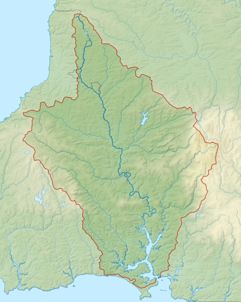
English: Map of the River Tamar and its catchment in Devon and Cornwall, UK. |
| Date | |
| Source |
|
| Author | Nilfanion, created using Ordnance Survey data |
| Permission ( Reusing this file) |
This file is licensed under the
Creative Commons
Attribution-Share Alike 3.0 Unported license. Attribution: Contains Ordnance Survey data © Crown copyright and database right
|
File history
Click on a date/time to view the file as it appeared at that time.
| Date/Time | Thumbnail | Dimensions | User | Comment | |
|---|---|---|---|---|---|
| current | 22:36, 21 February 2014 |
| 1,503 × 1,882 (2.08 MB) | Nilfanion | == {{int:filedesc}} == {{Information |Description= {{en|Map of the River Tamar and its catchment in Devon and Cornwall, UK.}} |Source= Ordnance Survey [https://www.ordnancesurvey.co.uk/opendatadownload/products.html OpenData]. *Rel... |
File usage
The following pages on the English Wikipedia use this file (pages on other projects are not listed):
Global file usage
The following other wikis use this file:
- Usage on de.wikipedia.org
- Usage on es.wikipedia.org
- Usage on fa.wikipedia.org
- Usage on fi.wikipedia.org
- Usage on hu.wikipedia.org
- Usage on io.wikipedia.org
- Usage on nl.wikipedia.org
- Usage on www.wikidata.org
- Usage on zh.wikipedia.org
Metadata
Size of this preview:
479 × 600 pixels. Other resolutions:
192 × 240 pixels |
383 × 480 pixels |
613 × 768 pixels |
818 × 1,024 pixels |
1,503 × 1,882 pixels.
Original file (1,503 × 1,882 pixels, file size: 2.08 MB, MIME type: image/png)
| This is a file from the
Wikimedia Commons. Information from its
description page there is shown below. Commons is a freely licensed media file repository. You can help. |
Summary
| Description |
English: Map of the River Tamar and its catchment in Devon and Cornwall, UK. |
| Date | |
| Source |
|
| Author | Nilfanion, created using Ordnance Survey data |
| Permission ( Reusing this file) |
This file is licensed under the
Creative Commons
Attribution-Share Alike 3.0 Unported license. Attribution: Contains Ordnance Survey data © Crown copyright and database right
|
File history
Click on a date/time to view the file as it appeared at that time.
| Date/Time | Thumbnail | Dimensions | User | Comment | |
|---|---|---|---|---|---|
| current | 22:36, 21 February 2014 |
| 1,503 × 1,882 (2.08 MB) | Nilfanion | == {{int:filedesc}} == {{Information |Description= {{en|Map of the River Tamar and its catchment in Devon and Cornwall, UK.}} |Source= Ordnance Survey [https://www.ordnancesurvey.co.uk/opendatadownload/products.html OpenData]. *Rel... |
File usage
The following pages on the English Wikipedia use this file (pages on other projects are not listed):
Global file usage
The following other wikis use this file:
- Usage on de.wikipedia.org
- Usage on es.wikipedia.org
- Usage on fa.wikipedia.org
- Usage on fi.wikipedia.org
- Usage on hu.wikipedia.org
- Usage on io.wikipedia.org
- Usage on nl.wikipedia.org
- Usage on www.wikidata.org
- Usage on zh.wikipedia.org