
Size of this PNG preview of this SVG file:
292 × 599 pixels. Other resolutions:
117 × 240 pixels |
234 × 480 pixels |
374 × 768 pixels |
499 × 1,024 pixels |
999 × 2,048 pixels |
722 × 1,480 pixels.
Original file (SVG file, nominally 722 × 1,480 pixels, file size: 202 KB)
| This is a file from the
Wikimedia Commons. Information from its
description page there is shown below. Commons is a freely licensed media file repository. You can help. |
Summary
| Description |
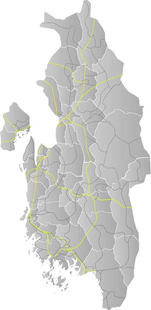
English: Base locator map for roads in Akershus and Østfold |
| Date | |
| Source | Own work by uploader, based on File:Riksveier_Akershus.svg and File:Riksveier_Østfold.svg |
| Author | BjørnN |
Licensing
| I, the copyright holder of this work, release this work into the
public domain. This applies worldwide. In some countries this may not be legally possible; if so: I grant anyone the right to use this work for any purpose, without any conditions, unless such conditions are required by law. |
File history
Click on a date/time to view the file as it appeared at that time.
| Date/Time | Thumbnail | Dimensions | User | Comment | |
|---|---|---|---|---|---|
| current | 19:27, 19 January 2010 |
| 722 × 1,480 (202 KB) | BjørnN | new highway system |
| 17:32, 26 May 2009 |
 | 722 × 1,480 (197 KB) | BjørnN | {{Information |Description={{en|1=Base locator map for roads in Akershus and Østfold}} |Source=Own work by uploader, based on File:Riksveier_Akershus.svg and File:Riksveier_Østfold.svg |Author= BjørnN |Date=2009-05-26 |Permission= |othe |
File usage
The following pages on the English Wikipedia use this file (pages on other projects are not listed):
Global file usage
The following other wikis use this file:
- Usage on nn.wikipedia.org
- Usage on no.wikipedia.org
- Usage on sv.wikipedia.org
Size of this PNG preview of this SVG file:
292 × 599 pixels. Other resolutions:
117 × 240 pixels |
234 × 480 pixels |
374 × 768 pixels |
499 × 1,024 pixels |
999 × 2,048 pixels |
722 × 1,480 pixels.
Original file (SVG file, nominally 722 × 1,480 pixels, file size: 202 KB)
| This is a file from the
Wikimedia Commons. Information from its
description page there is shown below. Commons is a freely licensed media file repository. You can help. |
Summary
| Description |
English: Base locator map for roads in Akershus and Østfold |
| Date | |
| Source | Own work by uploader, based on File:Riksveier_Akershus.svg and File:Riksveier_Østfold.svg |
| Author | BjørnN |
Licensing
| I, the copyright holder of this work, release this work into the
public domain. This applies worldwide. In some countries this may not be legally possible; if so: I grant anyone the right to use this work for any purpose, without any conditions, unless such conditions are required by law. |
File history
Click on a date/time to view the file as it appeared at that time.
| Date/Time | Thumbnail | Dimensions | User | Comment | |
|---|---|---|---|---|---|
| current | 19:27, 19 January 2010 |
| 722 × 1,480 (202 KB) | BjørnN | new highway system |
| 17:32, 26 May 2009 |
| 722 × 1,480 (197 KB) | BjørnN | {{Information |Description={{en|1=Base locator map for roads in Akershus and Østfold}} |Source=Own work by uploader, based on File:Riksveier_Akershus.svg and File:Riksveier_Østfold.svg |Author= BjørnN |Date=2009-05-26 |Permission= |othe |
File usage
The following pages on the English Wikipedia use this file (pages on other projects are not listed):
Global file usage
The following other wikis use this file:
- Usage on nn.wikipedia.org
- Usage on no.wikipedia.org
- Usage on sv.wikipedia.org