Size of this preview:
675 × 600 pixels. Other resolutions:
270 × 240 pixels |
540 × 480 pixels |
864 × 768 pixels |
1,233 × 1,096 pixels.
Original file (1,233 × 1,096 pixels, file size: 1.33 MB, MIME type: image/png)
| This is a file from the
Wikimedia Commons. Information from its
description page there is shown below. Commons is a freely licensed media file repository. You can help. |
| Description |
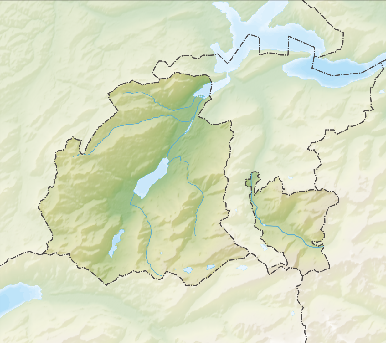
Deutsch: Reliefkarte des Kantons Obwalden
Topographischer Hintergrund:
NASA Shuttle Radar Topography Mission (public domain). SRTM3 v.2. |
||||||||
| Date | |||||||||
| Source | Own work | ||||||||
| Author | Tschubby | ||||||||
| Permission ( Reusing this file) |
I, the copyright holder of this work, hereby publish it under the following licenses:
This file is licensed under the
Creative Commons Attribution-Share Alike
2.5 Generic,
2.0 Generic and
1.0 Generic license.
You may select the license of your choice. |
||||||||
| Other versions |
 |

File history
Click on a date/time to view the file as it appeared at that time.
| Date/Time | Thumbnail | Dimensions | User | Comment | |
|---|---|---|---|---|---|
| current | 08:05, 6 December 2013 |
| 1,233 × 1,096 (1.33 MB) | Tschubby | {{Information |Description= {{de| Reliefkarte des Kantons Obwalden}} Topographischer Hintergrund: [http://www2.jpl.nasa.gov/srtm NASA Shuttle Radar Topography Mission] (public domain). SRTM3 v.2. |Source={{own}} |Date= 2013-12-06 |Author= [[:de:User:Ts... |
File usage
The following pages on the English Wikipedia use this file (pages on other projects are not listed):
- Alpnach
- Alpnach Dorf railway station
- Alpnachstad PB railway station
- Alpnachstad railway station
- Engelberg
- Engelberg railway station
- Ewil Maxon railway station
- Giswil
- Giswil railway station
- Grafenort railway station
- Kaiserstuhl OW railway station
- Kerns, Switzerland
- List of castles and fortresses in Switzerland
- Lungern
- Lungern railway station
- Maria Rickenbach Monastery
- Sachseln
- Sachseln railway station
- Sarnen
- Sarnen Nord railway station
- Sarnen railway station
- Template:List of castles and fortresses in Canton Obwalden/location map
- Module:Location map/data/Canton of Obwalden
- Module:Location map/data/Canton of Obwalden/doc
Global file usage
The following other wikis use this file:
- Usage on de.wikipedia.org
- Laui (Sarner Aa)
- Lungerersee
- Glaubenbielen
- Ächerlipass
- Liste von Burgen und Schlössern in der Schweiz
- Umfahrungstunnel Giswil
- Tannensee (Obwalden)
- Landessender Sarnen
- Gross-Titlis-Schanze
- Hahnen
- Grosse Melchaa
- Wikipedia:Kartenwerkstatt/Positionskarten/Europa
- Umfahrungstunnel Sachseln
- Kraftwerk Unteraa
- Umfahrungstunnel Lungern
- Burgruine Rudenz
- Brünig-Haupt
- Flugplatz Kägiswil
- Klappbrücke Grünenwald
- Kleine Melchaa
- Grosse Schliere
- Vorlage:Positionskarte Schweiz Obwalden
- Kraftwerk Hugschwendi
- Graustock
- Jochstock
- Glogghüs
- Alte Kirche Lungern
- Härzlisee
- Seefeldsee
- Turbinenanlage Stäubiloch
- Panoramalift (Melchsee-Frutt)
- Benutzer:Tschubby/Reliefkarten
- Widderfeld (Pilatus)
- Turmruine Rosenberg
- Kleine Schliere
- Usage on eo.wikipedia.org
- Lago de Sarno
- Titlis
- Lago de Lungern
- Ŝablono:Situo sur mapo Svislando Obvaldo
- Alpnach Dorf (stacidomo)
- Alpnachstad (stacidomo)
- Sarnen (stacidomo)
- Sarnen Nord (stacidomo)
- Sachseln (stacidomo)
- Ewil Maxon (stacidomo)
- Grafenort (stacidomo)
- Engelberg (stacidomo)
- Giswil (stacidomo)
- Kaiserstuhl OW (stacidomo)
- Lungern (stacidomo)
View more global usage of this file.
Metadata
Size of this preview:
675 × 600 pixels. Other resolutions:
270 × 240 pixels |
540 × 480 pixels |
864 × 768 pixels |
1,233 × 1,096 pixels.
Original file (1,233 × 1,096 pixels, file size: 1.33 MB, MIME type: image/png)
| This is a file from the
Wikimedia Commons. Information from its
description page there is shown below. Commons is a freely licensed media file repository. You can help. |
| Description |
Deutsch: Reliefkarte des Kantons Obwalden
Topographischer Hintergrund:
NASA Shuttle Radar Topography Mission (public domain). SRTM3 v.2. |
||||||||
| Date | |||||||||
| Source | Own work | ||||||||
| Author | Tschubby | ||||||||
| Permission ( Reusing this file) |
I, the copyright holder of this work, hereby publish it under the following licenses:
This file is licensed under the
Creative Commons Attribution-Share Alike
2.5 Generic,
2.0 Generic and
1.0 Generic license.
You may select the license of your choice. |
||||||||
| Other versions |
|
File history
Click on a date/time to view the file as it appeared at that time.
| Date/Time | Thumbnail | Dimensions | User | Comment | |
|---|---|---|---|---|---|
| current | 08:05, 6 December 2013 |
| 1,233 × 1,096 (1.33 MB) | Tschubby | {{Information |Description= {{de| Reliefkarte des Kantons Obwalden}} Topographischer Hintergrund: [http://www2.jpl.nasa.gov/srtm NASA Shuttle Radar Topography Mission] (public domain). SRTM3 v.2. |Source={{own}} |Date= 2013-12-06 |Author= [[:de:User:Ts... |
File usage
The following pages on the English Wikipedia use this file (pages on other projects are not listed):
- Alpnach
- Alpnach Dorf railway station
- Alpnachstad PB railway station
- Alpnachstad railway station
- Engelberg
- Engelberg railway station
- Ewil Maxon railway station
- Giswil
- Giswil railway station
- Grafenort railway station
- Kaiserstuhl OW railway station
- Kerns, Switzerland
- List of castles and fortresses in Switzerland
- Lungern
- Lungern railway station
- Maria Rickenbach Monastery
- Sachseln
- Sachseln railway station
- Sarnen
- Sarnen Nord railway station
- Sarnen railway station
- Template:List of castles and fortresses in Canton Obwalden/location map
- Module:Location map/data/Canton of Obwalden
- Module:Location map/data/Canton of Obwalden/doc
Global file usage
The following other wikis use this file:
- Usage on de.wikipedia.org
- Laui (Sarner Aa)
- Lungerersee
- Glaubenbielen
- Ächerlipass
- Liste von Burgen und Schlössern in der Schweiz
- Umfahrungstunnel Giswil
- Tannensee (Obwalden)
- Landessender Sarnen
- Gross-Titlis-Schanze
- Hahnen
- Grosse Melchaa
- Wikipedia:Kartenwerkstatt/Positionskarten/Europa
- Umfahrungstunnel Sachseln
- Kraftwerk Unteraa
- Umfahrungstunnel Lungern
- Burgruine Rudenz
- Brünig-Haupt
- Flugplatz Kägiswil
- Klappbrücke Grünenwald
- Kleine Melchaa
- Grosse Schliere
- Vorlage:Positionskarte Schweiz Obwalden
- Kraftwerk Hugschwendi
- Graustock
- Jochstock
- Glogghüs
- Alte Kirche Lungern
- Härzlisee
- Seefeldsee
- Turbinenanlage Stäubiloch
- Panoramalift (Melchsee-Frutt)
- Benutzer:Tschubby/Reliefkarten
- Widderfeld (Pilatus)
- Turmruine Rosenberg
- Kleine Schliere
- Usage on eo.wikipedia.org
- Lago de Sarno
- Titlis
- Lago de Lungern
- Ŝablono:Situo sur mapo Svislando Obvaldo
- Alpnach Dorf (stacidomo)
- Alpnachstad (stacidomo)
- Sarnen (stacidomo)
- Sarnen Nord (stacidomo)
- Sachseln (stacidomo)
- Ewil Maxon (stacidomo)
- Grafenort (stacidomo)
- Engelberg (stacidomo)
- Giswil (stacidomo)
- Kaiserstuhl OW (stacidomo)
- Lungern (stacidomo)
View more global usage of this file.