
Original file (1,200 × 1,186 pixels, file size: 1.05 MB, MIME type: image/jpeg)
| This is a file from the
Wikimedia Commons. Information from its
description page there is shown below. Commons is a freely licensed media file repository. You can help. |
| Description |
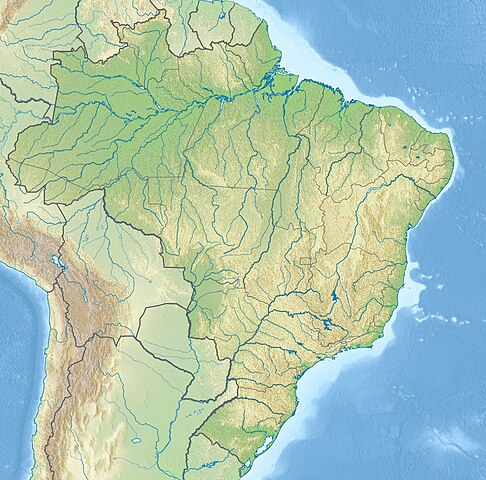
English: Location map of
Brazil Equirectangular projection, N/S stretching 105 %. Geographic limits of the map:
|
|||
| Date | (UTC) | |||
| Source |
|
|||
| Author |
|
|||
| Other versions |
|


| This is a
retouched picture, which means that it has been digitally altered from its original version. The original can be viewed here:
Brazil location map.svg:
|
- You are free:
- to share – to copy, distribute and transmit the work
- to remix – to adapt the work
- Under the following conditions:
- attribution – You must give appropriate credit, provide a link to the license, and indicate if changes were made. You may do so in any reasonable manner, but not in any way that suggests the licensor endorses you or your use.
- share alike – If you remix, transform, or build upon the material, you must distribute your contributions under the same or compatible license as the original.
Original upload log
This image is a derivative work of the following images:
-
File:Brazil_location_map.svg licensed with Cc-by-sa-3.0
- 2009-08-05T19:53:55Z NordNordWest 2008x1984 (1674058 Bytes) {{int:filedesc}} {{Information |Description= {{de|Positionskarte von [[:de:Brasilien|Brasilien]]}} Quadratische Plattkarte, N-S-Streckung 105 %. Geographische Begrenzung der Karte: * N: 6.0° N * S: 34.0° S * W: 74.5° W * O
Uploaded with derivativeFX
File history
Click on a date/time to view the file as it appeared at that time.
| Date/Time | Thumbnail | Dimensions | User | Comment | |
|---|---|---|---|---|---|
| current | 21:46, 14 May 2017 |
| 1,200 × 1,186 (1.05 MB) | Janitoalevic | Added Rincón de Artigas disputed territory |
| 17:55, 27 November 2010 |
 | 1,200 × 1,186 (492 KB) | Виктор В | {{Information |Description={{en|Location map of Brazil}} Equirectangular projection, N/S stretching 105 %. Geographic limits of the map: * N: 6.0° N * S: 34.0° S * W: 74.5° W * E: 32.0° W |Source=* File:Brazil_location_map.svg |
File usage
More than 100 pages use this file. The following list shows the first 100 pages that use this file only. A full list is available.
- Abrolhos Marine National Park
- Agulhas Negras Peak
- Amazônia National Park
- Angelândia
- Aparados da Serra National Park
- Araguaia National Park
- Barrinha
- Bay of All Saints
- Baía de São Marcos
- Belo Horizonte
- Belém
- Borborema Plateau
- Brasília
- Brasília National Park
- Buraco das Araras (Goiás)
- Cabo Orange National Park
- Campos Basin
- Campos Novos Dam
- Caparaó National Park
- Chapada Diamantina National Park
- Chapada dos Guimarães National Park
- Chapada dos Veadeiros National Park
- Corcovado
- Corumbá Lake
- Cuiabá
- Curitiba
- Doce River
- Dragão do Mar Center of Art and Culture
- Emas National Park
- Espinhaço Mountains
- Fernando de Noronha Marine National Park
- Fortaleza
- Goiânia
- Grande Sertão Veredas National Park
- Gruta Rei do Mato
- Guarapiranga
- Gurupí River
- Iguazu Falls
- Iguaçu National Park
- Ilha dos Lobos
- Ilhas Cagarras
- Instituto Butantan
- Itaipu Dam
- Itatiaia National Park
- Jaguaribe River
- Jaú National Park
- João Pessoa, Paraíba
- Jurubatiba Sandbank National Park
- Juruena River
- Lagoa dos Patos
- Lake Pampulha
- Lençóis Maranhenses National Park
- Macapá
- Maceió
- Manaus
- Mantiqueira Mountains
- Mariano Procópio Museum
- Monte Pascoal
- Morro da Igreja
- Morro do Diabo
- Mount Roraima
- Mundaú Lagoon
- Mundaú River
- Museu Paraense Emílio Goeldi
- Natal, Rio Grande do Norte
- Northeastern Space Radio Observatory
- Pantanal
- Paranoá Lake
- Pariconha
- Pedra da Gávea
- Pico da Bandeira
- Pico da Neblina
- Pico da Neblina National Park
- Pico dos Dias Observatory
- Pindaré River
- Piranhas River
- Porto Alegre
- Porto Velho
- Raposa Serra do Sol
- Recife
- Rio Branco, Acre
- Rio de Janeiro
- Ruins of São Miguel das Missões
- Salvador, Bahia
- Santa Catarina Art Museum
- Santarém, Pará
- Serra da Canastra National Park
- Serra da Capivara National Park
- Serra do Cipó National Park
- Serra do Mar
- Serra dos Órgãos National Park
- Sobradinho Reservoir
- São Luís, Maranhão
- São Paulo
- Taim Ecological Station
- Takutu River
- Tijuca National Park
- Tumucumaque Mountains National Park
- Varig Flight 254
- Template:Infobox river
View more links to this file.
Global file usage
The following other wikis use this file:
- Usage on an.wikipedia.org
- Usage on ar.wikipedia.org
- Usage on ban.wikipedia.org
- Usage on bg.wikipedia.org
- Рио де Жанейро
- Итайпу
- Порто Алегри
- Сао Пауло
- Ирара
- Бауру
- Маже
- Айморес (Минаш Жерайс)
- Мост на дружбата (Парагвай - Бразилия)
- Бразилия (град)
- Петрополис
- Ресифи
- Флорианополис
- Анаполис
- Мадейра (река)
- Токантинс (река)
- Рио Негро (приток на Амазонка)
- Манаус
- Такуари
- Салвадор (Баия)
- Сантос
- Сао Бернардо до Кампо
- Розейра
- Ипатинга
- Трес Корасойнс
- Паулиста (Пернамбуко)
- Сао Висенти (Сао Пауло)
- Прадополис
- Белен (Пара)
- Бело Оризонти
- Масейо
- Форталеза
- Витория (Еспирито Санто)
- Гояния
- Кампо Гранди
- Кашоейра до Сул
- Итабуна
- Куритиба
- Арара (Параиба)
View more global usage of this file.
Metadata
Original file (1,200 × 1,186 pixels, file size: 1.05 MB, MIME type: image/jpeg)
| This is a file from the
Wikimedia Commons. Information from its
description page there is shown below. Commons is a freely licensed media file repository. You can help. |
| Description |
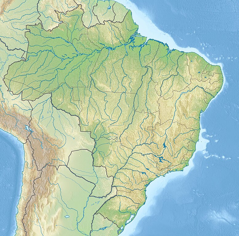
English: Location map of
Brazil Equirectangular projection, N/S stretching 105 %. Geographic limits of the map:
|
|||
| Date | (UTC) | |||
| Source |
|
|||
| Author |
|
|||
| Other versions |
|
| This is a
retouched picture, which means that it has been digitally altered from its original version. The original can be viewed here:
Brazil location map.svg:
|
- You are free:
- to share – to copy, distribute and transmit the work
- to remix – to adapt the work
- Under the following conditions:
- attribution – You must give appropriate credit, provide a link to the license, and indicate if changes were made. You may do so in any reasonable manner, but not in any way that suggests the licensor endorses you or your use.
- share alike – If you remix, transform, or build upon the material, you must distribute your contributions under the same or compatible license as the original.
Original upload log
This image is a derivative work of the following images:
-
File:Brazil_location_map.svg licensed with Cc-by-sa-3.0
- 2009-08-05T19:53:55Z NordNordWest 2008x1984 (1674058 Bytes) {{int:filedesc}} {{Information |Description= {{de|Positionskarte von [[:de:Brasilien|Brasilien]]}} Quadratische Plattkarte, N-S-Streckung 105 %. Geographische Begrenzung der Karte: * N: 6.0° N * S: 34.0° S * W: 74.5° W * O
Uploaded with derivativeFX
File history
Click on a date/time to view the file as it appeared at that time.
| Date/Time | Thumbnail | Dimensions | User | Comment | |
|---|---|---|---|---|---|
| current | 21:46, 14 May 2017 |
| 1,200 × 1,186 (1.05 MB) | Janitoalevic | Added Rincón de Artigas disputed territory |
| 17:55, 27 November 2010 |
| 1,200 × 1,186 (492 KB) | Виктор В | {{Information |Description={{en|Location map of Brazil}} Equirectangular projection, N/S stretching 105 %. Geographic limits of the map: * N: 6.0° N * S: 34.0° S * W: 74.5° W * E: 32.0° W |Source=* File:Brazil_location_map.svg |
File usage
More than 100 pages use this file. The following list shows the first 100 pages that use this file only. A full list is available.
- Abrolhos Marine National Park
- Agulhas Negras Peak
- Amazônia National Park
- Angelândia
- Aparados da Serra National Park
- Araguaia National Park
- Barrinha
- Bay of All Saints
- Baía de São Marcos
- Belo Horizonte
- Belém
- Borborema Plateau
- Brasília
- Brasília National Park
- Buraco das Araras (Goiás)
- Cabo Orange National Park
- Campos Basin
- Campos Novos Dam
- Caparaó National Park
- Chapada Diamantina National Park
- Chapada dos Guimarães National Park
- Chapada dos Veadeiros National Park
- Corcovado
- Corumbá Lake
- Cuiabá
- Curitiba
- Doce River
- Dragão do Mar Center of Art and Culture
- Emas National Park
- Espinhaço Mountains
- Fernando de Noronha Marine National Park
- Fortaleza
- Goiânia
- Grande Sertão Veredas National Park
- Gruta Rei do Mato
- Guarapiranga
- Gurupí River
- Iguazu Falls
- Iguaçu National Park
- Ilha dos Lobos
- Ilhas Cagarras
- Instituto Butantan
- Itaipu Dam
- Itatiaia National Park
- Jaguaribe River
- Jaú National Park
- João Pessoa, Paraíba
- Jurubatiba Sandbank National Park
- Juruena River
- Lagoa dos Patos
- Lake Pampulha
- Lençóis Maranhenses National Park
- Macapá
- Maceió
- Manaus
- Mantiqueira Mountains
- Mariano Procópio Museum
- Monte Pascoal
- Morro da Igreja
- Morro do Diabo
- Mount Roraima
- Mundaú Lagoon
- Mundaú River
- Museu Paraense Emílio Goeldi
- Natal, Rio Grande do Norte
- Northeastern Space Radio Observatory
- Pantanal
- Paranoá Lake
- Pariconha
- Pedra da Gávea
- Pico da Bandeira
- Pico da Neblina
- Pico da Neblina National Park
- Pico dos Dias Observatory
- Pindaré River
- Piranhas River
- Porto Alegre
- Porto Velho
- Raposa Serra do Sol
- Recife
- Rio Branco, Acre
- Rio de Janeiro
- Ruins of São Miguel das Missões
- Salvador, Bahia
- Santa Catarina Art Museum
- Santarém, Pará
- Serra da Canastra National Park
- Serra da Capivara National Park
- Serra do Cipó National Park
- Serra do Mar
- Serra dos Órgãos National Park
- Sobradinho Reservoir
- São Luís, Maranhão
- São Paulo
- Taim Ecological Station
- Takutu River
- Tijuca National Park
- Tumucumaque Mountains National Park
- Varig Flight 254
- Template:Infobox river
View more links to this file.
Global file usage
The following other wikis use this file:
- Usage on an.wikipedia.org
- Usage on ar.wikipedia.org
- Usage on ban.wikipedia.org
- Usage on bg.wikipedia.org
- Рио де Жанейро
- Итайпу
- Порто Алегри
- Сао Пауло
- Ирара
- Бауру
- Маже
- Айморес (Минаш Жерайс)
- Мост на дружбата (Парагвай - Бразилия)
- Бразилия (град)
- Петрополис
- Ресифи
- Флорианополис
- Анаполис
- Мадейра (река)
- Токантинс (река)
- Рио Негро (приток на Амазонка)
- Манаус
- Такуари
- Салвадор (Баия)
- Сантос
- Сао Бернардо до Кампо
- Розейра
- Ипатинга
- Трес Корасойнс
- Паулиста (Пернамбуко)
- Сао Висенти (Сао Пауло)
- Прадополис
- Белен (Пара)
- Бело Оризонти
- Масейо
- Форталеза
- Витория (Еспирито Санто)
- Гояния
- Кампо Гранди
- Кашоейра до Сул
- Итабуна
- Куритиба
- Арара (Параиба)
View more global usage of this file.