
Original file (1,207 × 1,560 pixels, file size: 679 KB, MIME type: image/jpeg)
| This is a file from the
Wikimedia Commons. Information from its
description page there is shown below. Commons is a freely licensed media file repository. You can help. |
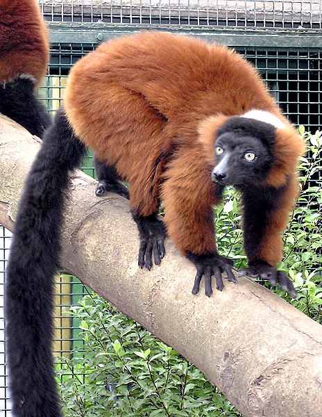
| Description | Red Ruffed Lemur Varecia rubra at Bristol Zoo, Bristol, England . | ||
| Date | |||
| Source | Photographed by Adrian Pingstone | ||
| Author | Adrian Pingstone | ||
| Permission ( Reusing this file) |
|
| Camera location |
| View this and other nearby images on: OpenStreetMap |
|
|---|
File history
Click on a date/time to view the file as it appeared at that time.
| Date/Time | Thumbnail | Dimensions | User | Comment | |
|---|---|---|---|---|---|
| current | 21:48, 12 January 2007 |
| 1,207 × 1,560 (679 KB) | Arpingstone | Lemur |
File usage
Global file usage
The following other wikis use this file:
- Usage on arz.wikipedia.org
- Usage on br.wikipedia.org
- Usage on ceb.wikipedia.org
- Usage on cv.wikipedia.org
- Usage on hu.wikipedia.org
- Usage on ko.wikipedia.org
- Usage on nl.wikipedia.org
- Usage on nv.wikipedia.org
- Usage on ru.wikipedia.org
- Usage on species.wikimedia.org
- Usage on sv.wikipedia.org
- Usage on sw.wikipedia.org
- Usage on vi.wikipedia.org
- Usage on www.wikidata.org
Metadata
Original file (1,207 × 1,560 pixels, file size: 679 KB, MIME type: image/jpeg)
| This is a file from the
Wikimedia Commons. Information from its
description page there is shown below. Commons is a freely licensed media file repository. You can help. |
| Description | Red Ruffed Lemur Varecia rubra at Bristol Zoo, Bristol, England . | ||
| Date | |||
| Source | Photographed by Adrian Pingstone | ||
| Author | Adrian Pingstone | ||
| Permission ( Reusing this file) |
|
| Camera location |
| View this and other nearby images on: OpenStreetMap |
|
|---|
File history
Click on a date/time to view the file as it appeared at that time.
| Date/Time | Thumbnail | Dimensions | User | Comment | |
|---|---|---|---|---|---|
| current | 21:48, 12 January 2007 |
| 1,207 × 1,560 (679 KB) | Arpingstone | Lemur |
File usage
Global file usage
The following other wikis use this file:
- Usage on arz.wikipedia.org
- Usage on br.wikipedia.org
- Usage on ceb.wikipedia.org
- Usage on cv.wikipedia.org
- Usage on hu.wikipedia.org
- Usage on ko.wikipedia.org
- Usage on nl.wikipedia.org
- Usage on nv.wikipedia.org
- Usage on ru.wikipedia.org
- Usage on species.wikimedia.org
- Usage on sv.wikipedia.org
- Usage on sw.wikipedia.org
- Usage on vi.wikipedia.org
- Usage on www.wikidata.org