Photos • Location


Size of this preview:
479 × 600 pixels. Other resolutions:
192 × 240 pixels |
511 × 640 pixels.
Original file (511 × 640 pixels, file size: 187 KB, MIME type: image/jpeg)
| This is a file from the
Wikimedia Commons. Information from its
description page there is shown below. Commons is a freely licensed media file repository. You can help. |
.jpg)
Summary
| Description |
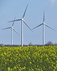
English: Rape and turbines, High Fosham,
Aldbrough,
East Riding of Yorkshire, England. Rapeseed crop coming into flower, with turbines in the distance, seen from the footpath towards Withernwick. |
| Date | |
| Source | From geograph.org.uk |
| Author | Paul Harrop |
| Permission ( Reusing this file) |
Creative Commons Attribution Share-alike license 2.0 |
| Attribution ( required by the license) | Paul Harrop / Rape and turbines, High Fosham, East Yorks / |
| Camera location | | View this and other nearby images on: OpenStreetMap |
|
|---|
.jpg¶ms=053.836117_N_-000.184761_E_globe:Earth_type:camera_source:geograph-osgb36(TA19553929)_heading:67.00&language=en)
| Object location | | View this and other nearby images on: OpenStreetMap |
|
|---|
.jpg¶ms=053.837070_N_-000.182140_E_globe:Earth_class:object_type:object_source:geograph-osgb36(TA19723940)_heading:67.00&language=en)
Licensing

|
This image was taken from the
Geograph project collection. See
this photograph's page on the Geograph website for the photographer's contact details. The copyright on this image is owned by Paul Harrop and is licensed for reuse under the
Creative Commons Attribution-ShareAlike 2.0 license.
|
This file is licensed under the
Creative Commons
Attribution-Share Alike 2.0 Generic license.
Attribution: Paul Harrop
- You are free:
- to share – to copy, distribute and transmit the work
- to remix – to adapt the work
- Under the following conditions:
- attribution – You must give appropriate credit, provide a link to the license, and indicate if changes were made. You may do so in any reasonable manner, but not in any way that suggests the licensor endorses you or your use.
- share alike – If you remix, transform, or build upon the material, you must distribute your contributions under the same or compatible license as the original.
File history
Click on a date/time to view the file as it appeared at that time.
| Date/Time | Thumbnail | Dimensions | User | Comment | |
|---|---|---|---|---|---|
| current | 00:24, 14 January 2021 |
| 511 × 640 (187 KB) | Keith D | == {{int:filedesc}} == {{Information |Description={{en|1=Rape and turbines, High Fosham, Aldbrough, East Riding of Yorkshire, England.<br />Rapeseed crop coming into flower, with turbines in the distance, seen from the footpath towards Withernwick.}} |Source=From [https://www.geograph.org.uk/photo/4439282 geograph.org.uk] |Date=2015-04-20 |Author=[https://www.geograph.org.uk/profile/13364 Paul Har... |
File usage
The following pages on the English Wikipedia use this file (pages on other projects are not listed):
Metadata
.jpg)
Size of this preview:
479 × 600 pixels. Other resolutions:
192 × 240 pixels |
511 × 640 pixels.
Original file (511 × 640 pixels, file size: 187 KB, MIME type: image/jpeg)
| This is a file from the
Wikimedia Commons. Information from its
description page there is shown below. Commons is a freely licensed media file repository. You can help. |
Summary
| Description |
English: Rape and turbines, High Fosham,
Aldbrough,
East Riding of Yorkshire, England. Rapeseed crop coming into flower, with turbines in the distance, seen from the footpath towards Withernwick. |
| Date | |
| Source | From geograph.org.uk |
| Author | Paul Harrop |
| Permission ( Reusing this file) |
Creative Commons Attribution Share-alike license 2.0 |
| Attribution ( required by the license) | Paul Harrop / Rape and turbines, High Fosham, East Yorks / |
| Camera location | | View this and other nearby images on: OpenStreetMap |
|
|---|
| Object location | | View this and other nearby images on: OpenStreetMap |
|
|---|
Licensing
|
|
This image was taken from the
Geograph project collection. See
this photograph's page on the Geograph website for the photographer's contact details. The copyright on this image is owned by Paul Harrop and is licensed for reuse under the
Creative Commons Attribution-ShareAlike 2.0 license.
|
This file is licensed under the
Creative Commons
Attribution-Share Alike 2.0 Generic license.
Attribution: Paul Harrop
- You are free:
- to share – to copy, distribute and transmit the work
- to remix – to adapt the work
- Under the following conditions:
- attribution – You must give appropriate credit, provide a link to the license, and indicate if changes were made. You may do so in any reasonable manner, but not in any way that suggests the licensor endorses you or your use.
- share alike – If you remix, transform, or build upon the material, you must distribute your contributions under the same or compatible license as the original.
File history
Click on a date/time to view the file as it appeared at that time.
| Date/Time | Thumbnail | Dimensions | User | Comment | |
|---|---|---|---|---|---|
| current | 00:24, 14 January 2021 |
| 511 × 640 (187 KB) | Keith D | == {{int:filedesc}} == {{Information |Description={{en|1=Rape and turbines, High Fosham, Aldbrough, East Riding of Yorkshire, England.<br />Rapeseed crop coming into flower, with turbines in the distance, seen from the footpath towards Withernwick.}} |Source=From [https://www.geograph.org.uk/photo/4439282 geograph.org.uk] |Date=2015-04-20 |Author=[https://www.geograph.org.uk/profile/13364 Paul Har... |
File usage
The following pages on the English Wikipedia use this file (pages on other projects are not listed):