Photos • Location


Size of this preview:
800 × 600 pixels. Other resolutions:
320 × 240 pixels |
640 × 480 pixels |
1,024 × 768 pixels |
1,280 × 960 pixels |
2,592 × 1,944 pixels.
Original file (2,592 × 1,944 pixels, file size: 721 KB, MIME type: image/jpeg)
| This is a file from the
Wikimedia Commons. Information from its
description page there is shown below. Commons is a freely licensed media file repository. You can help. |
Summary
| Description |
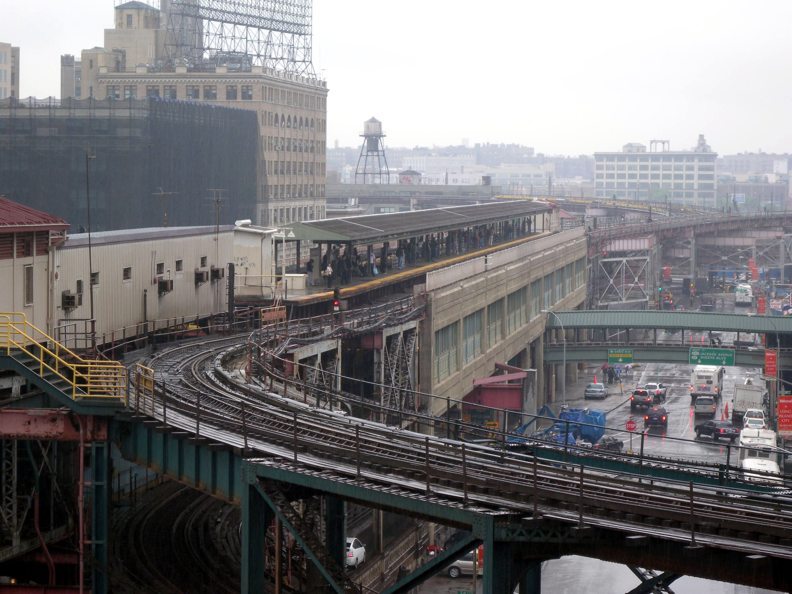
English: Looking east, full zoom, at Queensboro Plaza station, from up-ramp of upper level of
w:Queensboro Bridge during a rainy
en:Five Borough Bike Ride. |
| Date | Taken on 3 May 2009 |
| Source | Own work |
| Author | Jim.henderson |
| Camera location | | View this and other nearby images on: OpenStreetMap |
|
|---|
Licensing
| I, the copyright holder of this work, release this work into the
public domain. This applies worldwide. In some countries this may not be legally possible; if so: I grant anyone the right to use this work for any purpose, without any conditions, unless such conditions are required by law. |
| Annotations | This image is annotated: View the annotations at Commons |

File history
Click on a date/time to view the file as it appeared at that time.
| Date/Time | Thumbnail | Dimensions | User | Comment | |
|---|---|---|---|---|---|
| current | 15:31, 26 May 2009 |
| 2,592 × 1,944 (721 KB) | Jim.henderson | {{Information |Description={{en|1=Looking east along the top level of w:Queensboro Bridge during a rainy en:Five Borough Bike Ride.}} |Source=Own work by uploader |Author= Jim.henderson |Date=2009-05-03 |Permission= |other_ |
File usage
The following pages on the English Wikipedia use this file (pages on other projects are not listed):
Global file usage
The following other wikis use this file:
- Usage on ja.wikipedia.org
- Usage on ru.wikipedia.org
- Usage on zh.wikipedia.org
Metadata
Size of this preview:
800 × 600 pixels. Other resolutions:
320 × 240 pixels |
640 × 480 pixels |
1,024 × 768 pixels |
1,280 × 960 pixels |
2,592 × 1,944 pixels.
Original file (2,592 × 1,944 pixels, file size: 721 KB, MIME type: image/jpeg)
| This is a file from the
Wikimedia Commons. Information from its
description page there is shown below. Commons is a freely licensed media file repository. You can help. |
Summary
| Description |
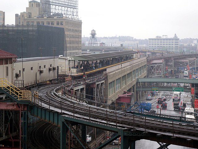
English: Looking east, full zoom, at Queensboro Plaza station, from up-ramp of upper level of
w:Queensboro Bridge during a rainy
en:Five Borough Bike Ride. |
| Date | Taken on 3 May 2009 |
| Source | Own work |
| Author | Jim.henderson |
| Camera location | | View this and other nearby images on: OpenStreetMap |
|
|---|
Licensing
| I, the copyright holder of this work, release this work into the
public domain. This applies worldwide. In some countries this may not be legally possible; if so: I grant anyone the right to use this work for any purpose, without any conditions, unless such conditions are required by law. |
| Annotations | This image is annotated: View the annotations at Commons |
File history
Click on a date/time to view the file as it appeared at that time.
| Date/Time | Thumbnail | Dimensions | User | Comment | |
|---|---|---|---|---|---|
| current | 15:31, 26 May 2009 |
| 2,592 × 1,944 (721 KB) | Jim.henderson | {{Information |Description={{en|1=Looking east along the top level of w:Queensboro Bridge during a rainy en:Five Borough Bike Ride.}} |Source=Own work by uploader |Author= Jim.henderson |Date=2009-05-03 |Permission= |other_ |
File usage
The following pages on the English Wikipedia use this file (pages on other projects are not listed):
Global file usage
The following other wikis use this file:
- Usage on ja.wikipedia.org
- Usage on ru.wikipedia.org
- Usage on zh.wikipedia.org