Original file (5,385 × 3,539 pixels, file size: 11.89 MB, MIME type: image/jpeg)
| This is a file from the
Wikimedia Commons. Information from its
description page there is shown below. Commons is a freely licensed media file repository. You can help. |
| Description |
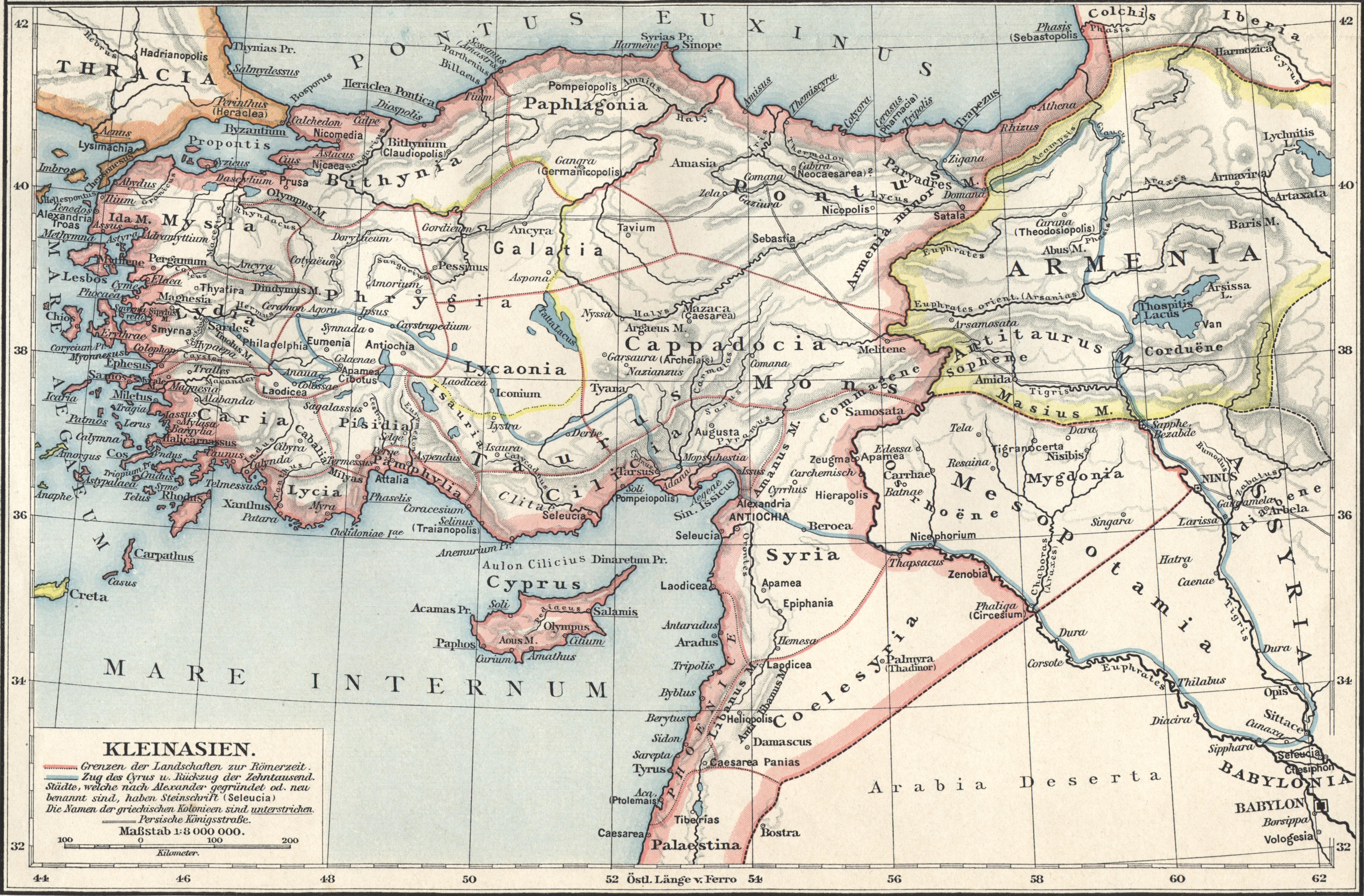
Deutsch: Karte von Kleinasien in der Antike mit römischen Provinzen. |
||||
| Date | |||||
| Source | F. W. Putzgers Historischer Schul-Atlas | ||||
| Author | Friedrich Wilhelm Putzger | ||||
| Permission ( Reusing this file) |
|
||||
| Other versions | Putzger Kleinasien Zuschnitt.jpg | ||||
File history
Click on a date/time to view the file as it appeared at that time.
| Date/Time | Thumbnail | Dimensions | User | Comment | |
|---|---|---|---|---|---|
| current | 18:33, 1 May 2015 |
| 5,385 × 3,539 (11.89 MB) | Oltau | {{Information |Description={{de|1=Karte von Kleinasien in der Antike mit römischen Provinzen.}} |Source=F. W. Putzgers Historischer Schul-Atlas |Author=Friedrich Wilhelm Putzger |Date=1901 |Permission={{PD-old}} |other_versions= }} [[Category:Maps of... |
File usage
Global file usage
The following other wikis use this file:
- Usage on br.wikipedia.org
- Usage on de.wikipedia.org
- Kleinasien
- Geschichte Anatoliens
- Kappadokien
- Galatien
- Kilikien
- Bithynien
- Phrygien
- Lydien
- Ionien
- Lykien
- Karien
- Kommagene
- Troas
- Pamphylien
- Mithridatische Kriege
- Paphlagonien
- Isaurien
- Pisidien
- Mysien
- Lykaonien
- Komana Pontika
- Adiabene
- Ende der Antike
- Römisch-Persische Kriege
- Aiolis
- Trokmer
- Tektosagen
- Pontos (Region)
- Benutzerin:Zaldarie/Mithridatische Kriege
- Vorlage:Navigationsleiste Antike Landschaften (Kleinasien)
- Usage on el.wikipedia.org
- Usage on hu.wikipedia.org
- Usage on hyw.wikipedia.org
- Usage on la.wikipedia.org
- Usage on ru.wikipedia.org
- Usage on tr.wikipedia.org
- Usage on uk.wikipedia.org
Metadata
Original file (5,385 × 3,539 pixels, file size: 11.89 MB, MIME type: image/jpeg)
| This is a file from the
Wikimedia Commons. Information from its
description page there is shown below. Commons is a freely licensed media file repository. You can help. |
| Description |
Deutsch: Karte von Kleinasien in der Antike mit römischen Provinzen. |
||||
| Date | |||||
| Source | F. W. Putzgers Historischer Schul-Atlas | ||||
| Author | Friedrich Wilhelm Putzger | ||||
| Permission ( Reusing this file) |
|
||||
| Other versions | Putzger Kleinasien Zuschnitt.jpg | ||||
File history
Click on a date/time to view the file as it appeared at that time.
| Date/Time | Thumbnail | Dimensions | User | Comment | |
|---|---|---|---|---|---|
| current | 18:33, 1 May 2015 |
| 5,385 × 3,539 (11.89 MB) | Oltau | {{Information |Description={{de|1=Karte von Kleinasien in der Antike mit römischen Provinzen.}} |Source=F. W. Putzgers Historischer Schul-Atlas |Author=Friedrich Wilhelm Putzger |Date=1901 |Permission={{PD-old}} |other_versions= }} [[Category:Maps of... |
File usage
Global file usage
The following other wikis use this file:
- Usage on br.wikipedia.org
- Usage on de.wikipedia.org
- Kleinasien
- Geschichte Anatoliens
- Kappadokien
- Galatien
- Kilikien
- Bithynien
- Phrygien
- Lydien
- Ionien
- Lykien
- Karien
- Kommagene
- Troas
- Pamphylien
- Mithridatische Kriege
- Paphlagonien
- Isaurien
- Pisidien
- Mysien
- Lykaonien
- Komana Pontika
- Adiabene
- Ende der Antike
- Römisch-Persische Kriege
- Aiolis
- Trokmer
- Tektosagen
- Pontos (Region)
- Benutzerin:Zaldarie/Mithridatische Kriege
- Vorlage:Navigationsleiste Antike Landschaften (Kleinasien)
- Usage on el.wikipedia.org
- Usage on hu.wikipedia.org
- Usage on hyw.wikipedia.org
- Usage on la.wikipedia.org
- Usage on ru.wikipedia.org
- Usage on tr.wikipedia.org
- Usage on uk.wikipedia.org