Photos • Location


Size of this preview:
800 × 600 pixels. Other resolutions:
320 × 240 pixels |
640 × 480 pixels |
1,024 × 768 pixels |
1,280 × 960 pixels |
1,564 × 1,173 pixels.
Original file (1,564 × 1,173 pixels, file size: 679 KB, MIME type: image/jpeg)
| This is a file from the
Wikimedia Commons. Information from its
description page there is shown below. Commons is a freely licensed media file repository. You can help. |
Summary
| Description |
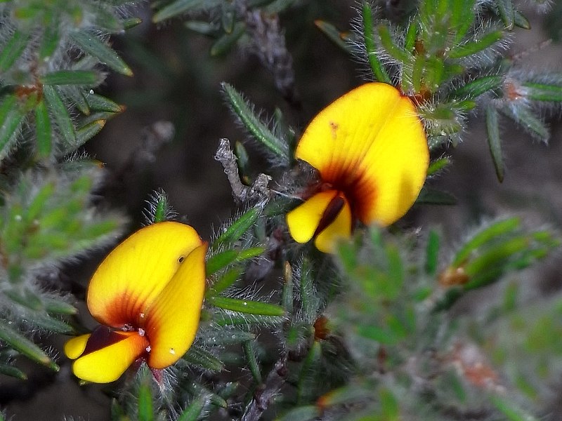
English: Pultenaea tenuifolia near Red Bluff Conservation Area, western Victoria |
| Date | |
| Source | https://biocache.ala.org.au/occurrences/84905523-c13e-48cf-be1d-fb59d1c0b9e6 |
| Author | Russell Best |
| Camera location |
| View this and other nearby images on: OpenStreetMap |
|
|---|
Licensing
This file is licensed under the
Creative Commons
Attribution 2.5 Australia license.
- You are free:
- to share – to copy, distribute and transmit the work
- to remix – to adapt the work
- Under the following conditions:
- attribution – You must give appropriate credit, provide a link to the license, and indicate if changes were made. You may do so in any reasonable manner, but not in any way that suggests the licensor endorses you or your use.
File history
Click on a date/time to view the file as it appeared at that time.
| Date/Time | Thumbnail | Dimensions | User | Comment | |
|---|---|---|---|---|---|
| current | 07:29, 15 September 2021 |
| 1,564 × 1,173 (679 KB) | Gderrin | Uploaded a work by Russell Best from https://biocache.ala.org.au/occurrences/84905523-c13e-48cf-be1d-fb59d1c0b9e6 with UploadWizard |
File usage
The following pages on the English Wikipedia use this file (pages on other projects are not listed):
Global file usage
The following other wikis use this file:
- Usage on ceb.wikipedia.org
- Usage on www.wikidata.org
Metadata
Size of this preview:
800 × 600 pixels. Other resolutions:
320 × 240 pixels |
640 × 480 pixels |
1,024 × 768 pixels |
1,280 × 960 pixels |
1,564 × 1,173 pixels.
Original file (1,564 × 1,173 pixels, file size: 679 KB, MIME type: image/jpeg)
| This is a file from the
Wikimedia Commons. Information from its
description page there is shown below. Commons is a freely licensed media file repository. You can help. |
Summary
| Description |
English: Pultenaea tenuifolia near Red Bluff Conservation Area, western Victoria |
| Date | |
| Source | https://biocache.ala.org.au/occurrences/84905523-c13e-48cf-be1d-fb59d1c0b9e6 |
| Author | Russell Best |
| Camera location |
| View this and other nearby images on: OpenStreetMap |
|
|---|
Licensing
This file is licensed under the
Creative Commons
Attribution 2.5 Australia license.
- You are free:
- to share – to copy, distribute and transmit the work
- to remix – to adapt the work
- Under the following conditions:
- attribution – You must give appropriate credit, provide a link to the license, and indicate if changes were made. You may do so in any reasonable manner, but not in any way that suggests the licensor endorses you or your use.
File history
Click on a date/time to view the file as it appeared at that time.
| Date/Time | Thumbnail | Dimensions | User | Comment | |
|---|---|---|---|---|---|
| current | 07:29, 15 September 2021 |
| 1,564 × 1,173 (679 KB) | Gderrin | Uploaded a work by Russell Best from https://biocache.ala.org.au/occurrences/84905523-c13e-48cf-be1d-fb59d1c0b9e6 with UploadWizard |
File usage
The following pages on the English Wikipedia use this file (pages on other projects are not listed):
Global file usage
The following other wikis use this file:
- Usage on ceb.wikipedia.org
- Usage on www.wikidata.org