Photos • Location


Size of this preview:
800 × 533 pixels. Other resolutions:
320 × 213 pixels |
640 × 427 pixels |
1,024 × 683 pixels |
1,280 × 853 pixels |
2,400 × 1,600 pixels.
Original file (2,400 × 1,600 pixels, file size: 2.51 MB, MIME type: image/jpeg)
| This is a file from the
Wikimedia Commons. Information from its
description page there is shown below. Commons is a freely licensed media file repository. You can help. |
Summary
| Description |
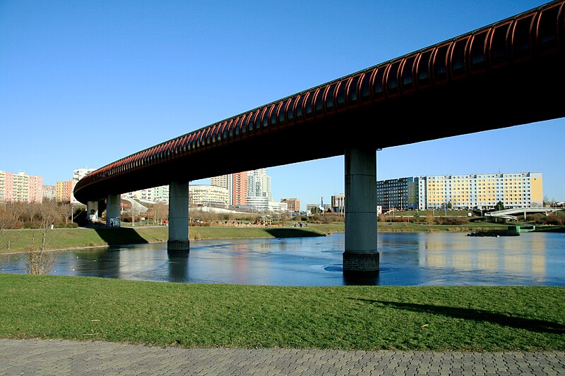
Čeština: Most pro
pražské metro trasy B nad 2. nádrží na Prokopském potoce ve
Stodůlkách,
Jihozápadní Město, Praha 13
English: Bridge for
Prague Metro line B over 2. reservoir on Prokopský potok in
Stodůlky,
Prague, Czech Republic
Polski: Most na
linii B praskiego metra nad 2. zbiornikiem na Prokopskim potoku w dzielnicy Stodůlky, Praga 13,
Czechy |
| Date | |
| Source | Own work |
| Author | Karelj |
| Camera location |
| View this and other nearby images on: OpenStreetMap |
|
|---|
Licensing
| I, the copyright holder of this work, release this work into the
public domain. This applies worldwide. In some countries this may not be legally possible; if so: I grant anyone the right to use this work for any purpose, without any conditions, unless such conditions are required by law. |
File history
Click on a date/time to view the file as it appeared at that time.
| Date/Time | Thumbnail | Dimensions | User | Comment | |
|---|---|---|---|---|---|
| current | 20:37, 7 January 2010 |
| 2,400 × 1,600 (2.51 MB) | Karelj | {{Information |Description={{en|1=Bridge for Prague Metro line B over 2. reservoir on Prokopský potok in Stodůlky, Prague, Czech Republic}} {{cs|1=Most pro [[:cs:B (linka metra v P |
File usage
The following pages on the English Wikipedia use this file (pages on other projects are not listed):
Global file usage
The following other wikis use this file:
- Usage on cs.wikipedia.org
- Usage on da.wikipedia.org
- Usage on fr.wikipedia.org
- Usage on hy.wikipedia.org
- Usage on pl.wikipedia.org
- Usage on sv.wikipedia.org
- Usage on www.wikidata.org
Metadata
Size of this preview:
800 × 533 pixels. Other resolutions:
320 × 213 pixels |
640 × 427 pixels |
1,024 × 683 pixels |
1,280 × 853 pixels |
2,400 × 1,600 pixels.
Original file (2,400 × 1,600 pixels, file size: 2.51 MB, MIME type: image/jpeg)
| This is a file from the
Wikimedia Commons. Information from its
description page there is shown below. Commons is a freely licensed media file repository. You can help. |
Summary
| Description |
Čeština: Most pro
pražské metro trasy B nad 2. nádrží na Prokopském potoce ve
Stodůlkách,
Jihozápadní Město, Praha 13
English: Bridge for
Prague Metro line B over 2. reservoir on Prokopský potok in
Stodůlky,
Prague, Czech Republic
Polski: Most na
linii B praskiego metra nad 2. zbiornikiem na Prokopskim potoku w dzielnicy Stodůlky, Praga 13,
Czechy |
| Date | |
| Source | Own work |
| Author | Karelj |
| Camera location |
| View this and other nearby images on: OpenStreetMap |
|
|---|
Licensing
| I, the copyright holder of this work, release this work into the
public domain. This applies worldwide. In some countries this may not be legally possible; if so: I grant anyone the right to use this work for any purpose, without any conditions, unless such conditions are required by law. |
File history
Click on a date/time to view the file as it appeared at that time.
| Date/Time | Thumbnail | Dimensions | User | Comment | |
|---|---|---|---|---|---|
| current | 20:37, 7 January 2010 |
| 2,400 × 1,600 (2.51 MB) | Karelj | {{Information |Description={{en|1=Bridge for Prague Metro line B over 2. reservoir on Prokopský potok in Stodůlky, Prague, Czech Republic}} {{cs|1=Most pro [[:cs:B (linka metra v P |
File usage
The following pages on the English Wikipedia use this file (pages on other projects are not listed):
Global file usage
The following other wikis use this file:
- Usage on cs.wikipedia.org
- Usage on da.wikipedia.org
- Usage on fr.wikipedia.org
- Usage on hy.wikipedia.org
- Usage on pl.wikipedia.org
- Usage on sv.wikipedia.org
- Usage on www.wikidata.org