
Original file (SVG file, nominally 1,590 × 1,365 pixels, file size: 103 KB)
| This is a file from the
Wikimedia Commons. Information from its
description page there is shown below. Commons is a freely licensed media file repository. You can help. |
Summary
| Description |
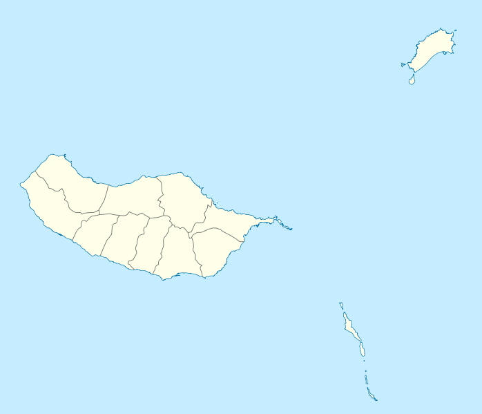
Geographische Begrenzung der Karte:
Geographic limits of the map:
|
||||||||||||
| Date | |||||||||||||
| Source | Own work | ||||||||||||
| Author | NordNordWest | ||||||||||||
| Permission ( Reusing this file) |
|
||||||||||||
| Other versions |
Derivative works of this file: |
||||||||||||
| SVG development | This W3C-invalid
map was created with an unknown SVG tool.
|

File history
Click on a date/time to view the file as it appeared at that time.
| Date/Time | Thumbnail | Dimensions | User | Comment | |
|---|---|---|---|---|---|
| current | 15:41, 19 December 2009 |
| 1,590 × 1,365 (103 KB) | NordNordWest | == {{int:filedesc}} == {{Information |Description= {{de|Positionskarte von Madeira, Portugal}} Geographische Begrenzung der Karte: * N: 33.16° N * S: 32.38° N * W: 17.31° W * O: 16.23° W {{en|Location map of [[:en:Made |
File usage
More than 100 pages use this file. The following list shows the first 100 pages that use this file only. A full list is available.
- 1989–90 Primeira Divisão
- 1990–91 Primeira Divisão
- 1991–92 Primeira Divisão
- 1992–93 Primeira Divisão
- 1993–94 Primeira Divisão
- 1994–95 Primeira Divisão
- 1995–96 Primeira Divisão
- 1996–97 Primeira Divisão
- 1997–98 Primeira Divisão
- 1998–99 Primeira Divisão
- 1999–2000 Primeira Liga
- 2000–01 Primeira Liga
- 2001–02 Primeira Liga
- 2002–03 Primeira Liga
- 2003–04 Primeira Liga
- 2004–05 Primeira Liga
- 2005–06 Primeira Liga
- 2006–07 Primeira Liga
- 2007–08 Primeira Liga
- 2009–10 Primeira Liga
- 2009–10 Segunda Divisão
- 2010–11 Primeira Liga
- 2011–12 Liga de Honra
- 2011–12 Primeira Liga
- 2012–13 Primeira Liga
- 2012–13 Segunda Liga
- 2013–14 Primeira Liga
- 2013–14 Segunda Liga
- 2014–15 Primeira Liga
- 2014–15 Segunda Liga
- 2015–16 Andebol 1
- 2015–16 LPB season
- 2015–16 Primeira Liga
- 2016–17 LigaPro
- 2016–17 Primeira Liga
- 25 Fontes Falls
- ANA Aeroportos de Portugal
- Achadas da Cruz
- Arco da Calheta
- Arco de São Jorge
- Boaventura, São Vicente
- Cabo Girão
- Camacha
- Campanário, Madeira
- Campeonato Nacional Feminino
- Campeonato de Futebol de Praia
- Canhas
- Caniçal
- Caniço (Santa Cruz)
- Casino da Madeira
- Cathedral of Funchal
- Curral das Freiras
- Estreito da Calheta
- Estreito de Câmara de Lobos
- Faial (Santana)
- Fajã da Ovelha
- Gaula (Madeira)
- Ilha (Santana)
- Imaculado Coração de Maria
- Jardim da Serra
- Jardim do Mar
- List of airports in Portugal
- List of top-division football clubs in UEFA countries
- Madalena do Mar
- Madeira Airport
- Madeira Football Association
- Madeira Islands Open
- Monte (Funchal)
- Paul do Mar
- Pico Ruivo
- Pico das Torres
- Pico do Areeiro
- Ponta Delgada, São Vicente
- Ponta do Pargo
- Porto Santo Airport
- Porto da Cruz
- Praia Formosa
- Praia da Calheta
- Prazeres, Madeira
- Quinta Grande
- Ribeira Brava (parish)
- Ribeira da Janela
- Risco waterfall
- Santa Luzia (Funchal)
- Santa Maria Maior (Funchal)
- Santo António (Funchal)
- Santo António da Serra (Machico)
- Seixal (Porto Moniz)
- Serra de Água
- São Gonçalo (Funchal)
- São Jorge (Santana)
- São Martinho (Funchal)
- São Pedro (Funchal)
- São Roque (Funchal)
- São Roque do Faial
- Sé (Funchal)
- Vila Baleira
- Água de Pena
- User:Abdul Qayyum Ahmad/gallery/Maps
- User:Tmnpereira
View more links to this file.
Global file usage
The following other wikis use this file:
- Usage on af.wikipedia.org
- Usage on an.wikipedia.org
- Funchal
- Seu de Funchal
- Calheta (Madeira)
- Câmara de Lobos
- Machico
- Ponta do Sol
- Porto Santo
- Porto Moniz
- Ribeira Brava (Madeira)
- Santa Cruz (Madeira)
- Santana (Madeira)
- São Vicente (Madeira)
- Diocesi de Funchal
- Fortaleza-Palacio de São Lourenço
- Casa d'a Villa de Funchal
- Puent João Gomes
- Mercau dos Lavradores
- Fuerte de São José
- Fortaleza de Nossa Senhora da Conceição do Ilhéu
- Fortaleza de São Tiago do Funchal
- Vila Baleira
- Plantilla:Mapa de localización Madeira
- Usage on ar.wikipedia.org
- Usage on ast.wikipedia.org
- Usage on az.wikipedia.org
- Usage on ba.wikipedia.org
- Usage on be-tarask.wikipedia.org
- Usage on be.wikipedia.org
- Usage on bg.wikipedia.org
- Usage on bs.wikipedia.org
- Usage on ceb.wikipedia.org
- Usage on ce.wikipedia.org
View more global usage of this file.
Metadata
Original file (SVG file, nominally 1,590 × 1,365 pixels, file size: 103 KB)
| This is a file from the
Wikimedia Commons. Information from its
description page there is shown below. Commons is a freely licensed media file repository. You can help. |
Summary
| Description |
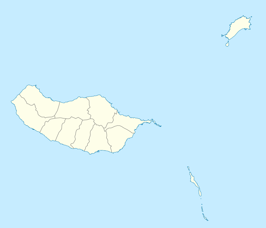
Geographische Begrenzung der Karte:
Geographic limits of the map:
|
||||||||||||
| Date | |||||||||||||
| Source | Own work | ||||||||||||
| Author | NordNordWest | ||||||||||||
| Permission ( Reusing this file) |
|
||||||||||||
| Other versions |
Derivative works of this file: |
||||||||||||
| SVG development | This W3C-invalid
map was created with an unknown SVG tool.
|
File history
Click on a date/time to view the file as it appeared at that time.
| Date/Time | Thumbnail | Dimensions | User | Comment | |
|---|---|---|---|---|---|
| current | 15:41, 19 December 2009 |
| 1,590 × 1,365 (103 KB) | NordNordWest | == {{int:filedesc}} == {{Information |Description= {{de|Positionskarte von Madeira, Portugal}} Geographische Begrenzung der Karte: * N: 33.16° N * S: 32.38° N * W: 17.31° W * O: 16.23° W {{en|Location map of [[:en:Made |
File usage
More than 100 pages use this file. The following list shows the first 100 pages that use this file only. A full list is available.
- 1989–90 Primeira Divisão
- 1990–91 Primeira Divisão
- 1991–92 Primeira Divisão
- 1992–93 Primeira Divisão
- 1993–94 Primeira Divisão
- 1994–95 Primeira Divisão
- 1995–96 Primeira Divisão
- 1996–97 Primeira Divisão
- 1997–98 Primeira Divisão
- 1998–99 Primeira Divisão
- 1999–2000 Primeira Liga
- 2000–01 Primeira Liga
- 2001–02 Primeira Liga
- 2002–03 Primeira Liga
- 2003–04 Primeira Liga
- 2004–05 Primeira Liga
- 2005–06 Primeira Liga
- 2006–07 Primeira Liga
- 2007–08 Primeira Liga
- 2009–10 Primeira Liga
- 2009–10 Segunda Divisão
- 2010–11 Primeira Liga
- 2011–12 Liga de Honra
- 2011–12 Primeira Liga
- 2012–13 Primeira Liga
- 2012–13 Segunda Liga
- 2013–14 Primeira Liga
- 2013–14 Segunda Liga
- 2014–15 Primeira Liga
- 2014–15 Segunda Liga
- 2015–16 Andebol 1
- 2015–16 LPB season
- 2015–16 Primeira Liga
- 2016–17 LigaPro
- 2016–17 Primeira Liga
- 25 Fontes Falls
- ANA Aeroportos de Portugal
- Achadas da Cruz
- Arco da Calheta
- Arco de São Jorge
- Boaventura, São Vicente
- Cabo Girão
- Camacha
- Campanário, Madeira
- Campeonato Nacional Feminino
- Campeonato de Futebol de Praia
- Canhas
- Caniçal
- Caniço (Santa Cruz)
- Casino da Madeira
- Cathedral of Funchal
- Curral das Freiras
- Estreito da Calheta
- Estreito de Câmara de Lobos
- Faial (Santana)
- Fajã da Ovelha
- Gaula (Madeira)
- Ilha (Santana)
- Imaculado Coração de Maria
- Jardim da Serra
- Jardim do Mar
- List of airports in Portugal
- List of top-division football clubs in UEFA countries
- Madalena do Mar
- Madeira Airport
- Madeira Football Association
- Madeira Islands Open
- Monte (Funchal)
- Paul do Mar
- Pico Ruivo
- Pico das Torres
- Pico do Areeiro
- Ponta Delgada, São Vicente
- Ponta do Pargo
- Porto Santo Airport
- Porto da Cruz
- Praia Formosa
- Praia da Calheta
- Prazeres, Madeira
- Quinta Grande
- Ribeira Brava (parish)
- Ribeira da Janela
- Risco waterfall
- Santa Luzia (Funchal)
- Santa Maria Maior (Funchal)
- Santo António (Funchal)
- Santo António da Serra (Machico)
- Seixal (Porto Moniz)
- Serra de Água
- São Gonçalo (Funchal)
- São Jorge (Santana)
- São Martinho (Funchal)
- São Pedro (Funchal)
- São Roque (Funchal)
- São Roque do Faial
- Sé (Funchal)
- Vila Baleira
- Água de Pena
- User:Abdul Qayyum Ahmad/gallery/Maps
- User:Tmnpereira
View more links to this file.
Global file usage
The following other wikis use this file:
- Usage on af.wikipedia.org
- Usage on an.wikipedia.org
- Funchal
- Seu de Funchal
- Calheta (Madeira)
- Câmara de Lobos
- Machico
- Ponta do Sol
- Porto Santo
- Porto Moniz
- Ribeira Brava (Madeira)
- Santa Cruz (Madeira)
- Santana (Madeira)
- São Vicente (Madeira)
- Diocesi de Funchal
- Fortaleza-Palacio de São Lourenço
- Casa d'a Villa de Funchal
- Puent João Gomes
- Mercau dos Lavradores
- Fuerte de São José
- Fortaleza de Nossa Senhora da Conceição do Ilhéu
- Fortaleza de São Tiago do Funchal
- Vila Baleira
- Plantilla:Mapa de localización Madeira
- Usage on ar.wikipedia.org
- Usage on ast.wikipedia.org
- Usage on az.wikipedia.org
- Usage on ba.wikipedia.org
- Usage on be-tarask.wikipedia.org
- Usage on be.wikipedia.org
- Usage on bg.wikipedia.org
- Usage on bs.wikipedia.org
- Usage on ceb.wikipedia.org
- Usage on ce.wikipedia.org
View more global usage of this file.