Photos • Location


Size of this preview:
800 × 600 pixels. Other resolutions:
320 × 240 pixels |
640 × 480 pixels |
1,024 × 768 pixels |
1,280 × 960 pixels |
2,272 × 1,704 pixels.
Original file (2,272 × 1,704 pixels, file size: 1.64 MB, MIME type: image/jpeg)
| This is a file from the
Wikimedia Commons. Information from its
description page there is shown below. Commons is a freely licensed media file repository. You can help. |
Summary
| Description |
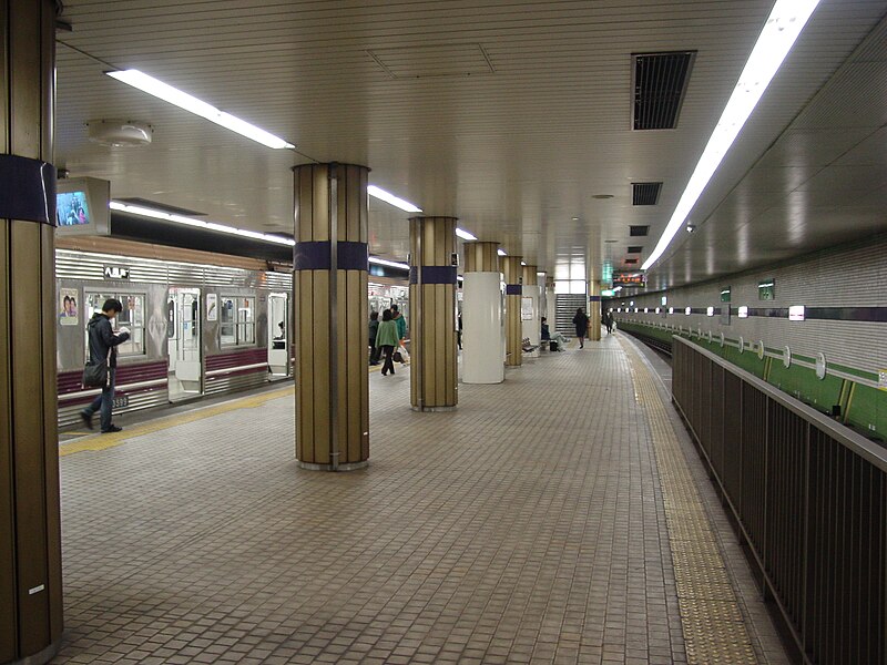
English: Platform of
Deto Station.
日本語: 出戸駅プラットホーム |
| Date | 2009年3月27日 27 May 2009 |
| Source | 投稿者撮影 Self-made |
| Author | もんじゃ |
| Camera location |
| View this and other nearby images on: OpenStreetMap |
|
|---|
Licensing
| I, the copyright holder of this work, release this work into the
public domain. This applies worldwide. In some countries this may not be legally possible; if so: I grant anyone the right to use this work for any purpose, without any conditions, unless such conditions are required by law. |
File history
Click on a date/time to view the file as it appeared at that time.
| Date/Time | Thumbnail | Dimensions | User | Comment | |
|---|---|---|---|---|---|
| current | 14:57, 5 April 2009 |
| 2,272 × 1,704 (1.64 MB) | もんじゃ | {{Information |Description={{en|1=Platform of Deto Station.}} {{ja|1=出戸駅プラットホーム}} |Source=投稿者撮影 Self-made |Author=もんじゃ |Date=2009年3月27日 27 May 2009 |Permission= |other_versions= }} <!--{{Im |
File usage
The following pages on the English Wikipedia use this file (pages on other projects are not listed):
Global file usage
The following other wikis use this file:
- Usage on ja.wikipedia.org
- Usage on ko.wikipedia.org
- Usage on nl.wikipedia.org
- Usage on www.wikidata.org
- Usage on zh.wikipedia.org
Metadata
Size of this preview:
800 × 600 pixels. Other resolutions:
320 × 240 pixels |
640 × 480 pixels |
1,024 × 768 pixels |
1,280 × 960 pixels |
2,272 × 1,704 pixels.
Original file (2,272 × 1,704 pixels, file size: 1.64 MB, MIME type: image/jpeg)
| This is a file from the
Wikimedia Commons. Information from its
description page there is shown below. Commons is a freely licensed media file repository. You can help. |
Summary
| Description |
English: Platform of
Deto Station.
日本語: 出戸駅プラットホーム |
| Date | 2009年3月27日 27 May 2009 |
| Source | 投稿者撮影 Self-made |
| Author | もんじゃ |
| Camera location |
| View this and other nearby images on: OpenStreetMap |
|
|---|
Licensing
| I, the copyright holder of this work, release this work into the
public domain. This applies worldwide. In some countries this may not be legally possible; if so: I grant anyone the right to use this work for any purpose, without any conditions, unless such conditions are required by law. |
File history
Click on a date/time to view the file as it appeared at that time.
| Date/Time | Thumbnail | Dimensions | User | Comment | |
|---|---|---|---|---|---|
| current | 14:57, 5 April 2009 |
| 2,272 × 1,704 (1.64 MB) | もんじゃ | {{Information |Description={{en|1=Platform of Deto Station.}} {{ja|1=出戸駅プラットホーム}} |Source=投稿者撮影 Self-made |Author=もんじゃ |Date=2009年3月27日 27 May 2009 |Permission= |other_versions= }} <!--{{Im |
File usage
The following pages on the English Wikipedia use this file (pages on other projects are not listed):
Global file usage
The following other wikis use this file:
- Usage on ja.wikipedia.org
- Usage on ko.wikipedia.org
- Usage on nl.wikipedia.org
- Usage on www.wikidata.org
- Usage on zh.wikipedia.org