Photos • Location


No higher resolution available.
Plaque_in_south_wing_of_Waldershare_church_-_geograph.org.uk_-_1610090.jpg (437 × 555 pixels, file size: 211 KB, MIME type: image/jpeg)
| This is a file from the
Wikimedia Commons. Information from its
description page there is shown below. Commons is a freely licensed media file repository. You can help. |
Summary
| Description |
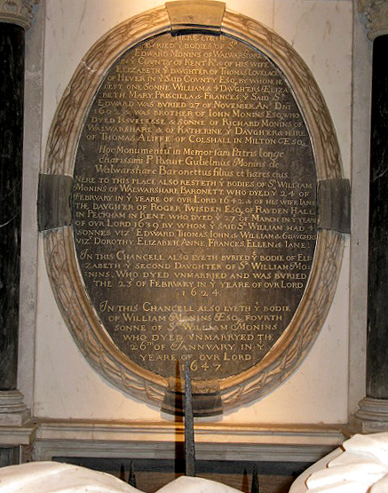
English: Plaque in south wing of Waldershare church Although difficult to read some of the text, the parish was known as Walwarshare in 1642 but this could be an early typo! |
| Date | |
| Source | From geograph.org.uk |
| Author | Nick Smith |
| Attribution ( required by the license) | Nick Smith / Plaque in south wing of Waldershare church / |
| Camera location | | View this and other nearby images on: OpenStreetMap |
|
|---|
_heading:180.00&language=en)
| Object location | | View this and other nearby images on: OpenStreetMap |
|
|---|
_heading:180.00&language=en)
Licensing

|
This image was taken from the
Geograph project collection. See
this photograph's page on the Geograph website for the photographer's contact details. The copyright on this image is owned by Nick Smith and is licensed for reuse under the
Creative Commons Attribution-ShareAlike 2.0 license.
|
This file is licensed under the
Creative Commons
Attribution-Share Alike 2.0 Generic license.
Attribution: Nick Smith
- You are free:
- to share – to copy, distribute and transmit the work
- to remix – to adapt the work
- Under the following conditions:
- attribution – You must give appropriate credit, provide a link to the license, and indicate if changes were made. You may do so in any reasonable manner, but not in any way that suggests the licensor endorses you or your use.
- share alike – If you remix, transform, or build upon the material, you must distribute your contributions under the same or compatible license as the original.
File history
Click on a date/time to view the file as it appeared at that time.
| Date/Time | Thumbnail | Dimensions | User | Comment | |
|---|---|---|---|---|---|
| current | 10:30, 4 March 2011 |
| 437 × 555 (211 KB) | GeographBot | == {{int:filedesc}} == {{Information |description={{en|1=Plaque in south wing of Waldershare church Although difficult to read some of the text, the parish was known as Walwarshare in 1642 but this could be an early typo!}} |date=2009-11-19 |source=From [ |
File usage
The following pages on the English Wikipedia use this file (pages on other projects are not listed):
Global file usage
The following other wikis use this file:
- Usage on es.wikipedia.org
Metadata
No higher resolution available.
Plaque_in_south_wing_of_Waldershare_church_-_geograph.org.uk_-_1610090.jpg (437 × 555 pixels, file size: 211 KB, MIME type: image/jpeg)
| This is a file from the
Wikimedia Commons. Information from its
description page there is shown below. Commons is a freely licensed media file repository. You can help. |
Summary
| Description |
English: Plaque in south wing of Waldershare church Although difficult to read some of the text, the parish was known as Walwarshare in 1642 but this could be an early typo! |
| Date | |
| Source | From geograph.org.uk |
| Author | Nick Smith |
| Attribution ( required by the license) | Nick Smith / Plaque in south wing of Waldershare church / |
| Camera location | | View this and other nearby images on: OpenStreetMap |
|
|---|
| Object location | | View this and other nearby images on: OpenStreetMap |
|
|---|
Licensing
|
|
This image was taken from the
Geograph project collection. See
this photograph's page on the Geograph website for the photographer's contact details. The copyright on this image is owned by Nick Smith and is licensed for reuse under the
Creative Commons Attribution-ShareAlike 2.0 license.
|
This file is licensed under the
Creative Commons
Attribution-Share Alike 2.0 Generic license.
Attribution: Nick Smith
- You are free:
- to share – to copy, distribute and transmit the work
- to remix – to adapt the work
- Under the following conditions:
- attribution – You must give appropriate credit, provide a link to the license, and indicate if changes were made. You may do so in any reasonable manner, but not in any way that suggests the licensor endorses you or your use.
- share alike – If you remix, transform, or build upon the material, you must distribute your contributions under the same or compatible license as the original.
File history
Click on a date/time to view the file as it appeared at that time.
| Date/Time | Thumbnail | Dimensions | User | Comment | |
|---|---|---|---|---|---|
| current | 10:30, 4 March 2011 |
| 437 × 555 (211 KB) | GeographBot | == {{int:filedesc}} == {{Information |description={{en|1=Plaque in south wing of Waldershare church Although difficult to read some of the text, the parish was known as Walwarshare in 1642 but this could be an early typo!}} |date=2009-11-19 |source=From [ |
File usage
The following pages on the English Wikipedia use this file (pages on other projects are not listed):
Global file usage
The following other wikis use this file:
- Usage on es.wikipedia.org