Photos • Location


Size of this preview:
800 × 550 pixels. Other resolutions:
320 × 220 pixels |
640 × 440 pixels |
1,024 × 704 pixels |
1,280 × 880 pixels |
1,600 × 1,100 pixels.
Original file (1,600 × 1,100 pixels, file size: 3.1 MB, MIME type: image/png)
| This is a file from the
Wikimedia Commons. Information from its
description page there is shown below. Commons is a freely licensed media file repository. You can help. |
Summary
| Description |
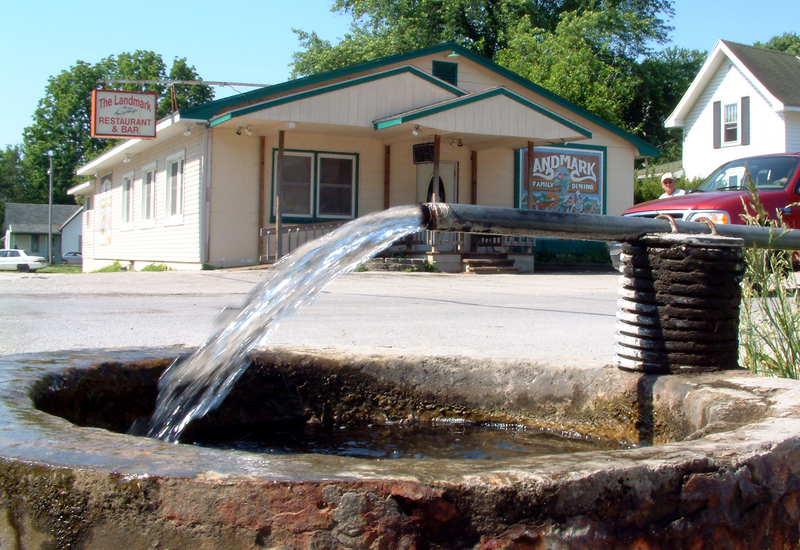
English: A photo of the intersection of Washington Street and Howard Street in the small town of
Pittsburg in
Carroll County, Indiana. In the foreground is the town's spring; behind it is The Landmark Restaurant and Bar. Photo looks southwest. |
| Date | Taken on 2 June 2007 |
| Source | Own work |
| Author | Huw Williams ( Huwmanbeing) |
| Camera location | | View this and other nearby images on: OpenStreetMap |
|
|---|
Licensing
| I, the copyright holder of this work, release this work into the
public domain. This applies worldwide. In some countries this may not be legally possible; if so: I grant anyone the right to use this work for any purpose, without any conditions, unless such conditions are required by law. |
File history
Click on a date/time to view the file as it appeared at that time.
| Date/Time | Thumbnail | Dimensions | User | Comment | |
|---|---|---|---|---|---|
| current | 18:18, 2 June 2007 |
| 1,600 × 1,100 (3.1 MB) | Huwmanbeing | {{Information |Description=A photo of the intersection of Washington Street and Howard Street in the small town of Pittsburg in Carroll County, Indiana. In the foreground is the town's spring; behind it is The Landmark Restaurant and Bar. Photo looks so |
File usage
The following pages on the English Wikipedia use this file (pages on other projects are not listed):
Global file usage
The following other wikis use this file:
- Usage on www.wikidata.org
Metadata
Size of this preview:
800 × 550 pixels. Other resolutions:
320 × 220 pixels |
640 × 440 pixels |
1,024 × 704 pixels |
1,280 × 880 pixels |
1,600 × 1,100 pixels.
Original file (1,600 × 1,100 pixels, file size: 3.1 MB, MIME type: image/png)
| This is a file from the
Wikimedia Commons. Information from its
description page there is shown below. Commons is a freely licensed media file repository. You can help. |
Summary
| Description |
English: A photo of the intersection of Washington Street and Howard Street in the small town of
Pittsburg in
Carroll County, Indiana. In the foreground is the town's spring; behind it is The Landmark Restaurant and Bar. Photo looks southwest. |
| Date | Taken on 2 June 2007 |
| Source | Own work |
| Author | Huw Williams ( Huwmanbeing) |
| Camera location | | View this and other nearby images on: OpenStreetMap |
|
|---|
Licensing
| I, the copyright holder of this work, release this work into the
public domain. This applies worldwide. In some countries this may not be legally possible; if so: I grant anyone the right to use this work for any purpose, without any conditions, unless such conditions are required by law. |
File history
Click on a date/time to view the file as it appeared at that time.
| Date/Time | Thumbnail | Dimensions | User | Comment | |
|---|---|---|---|---|---|
| current | 18:18, 2 June 2007 |
| 1,600 × 1,100 (3.1 MB) | Huwmanbeing | {{Information |Description=A photo of the intersection of Washington Street and Howard Street in the small town of Pittsburg in Carroll County, Indiana. In the foreground is the town's spring; behind it is The Landmark Restaurant and Bar. Photo looks so |
File usage
The following pages on the English Wikipedia use this file (pages on other projects are not listed):
Global file usage
The following other wikis use this file:
- Usage on www.wikidata.org