Photos • Location


Size of this preview:
471 × 599 pixels. Other resolutions:
188 × 240 pixels |
377 × 480 pixels |
603 × 768 pixels |
804 × 1,024 pixels |
1,609 × 2,048 pixels |
4,400 × 5,600 pixels.
Original file (4,400 × 5,600 pixels, file size: 3.91 MB, MIME type: image/jpeg)
| This is a file from the
Wikimedia Commons. Information from its
description page there is shown below. Commons is a freely licensed media file repository. You can help. |
Summary
| Description |
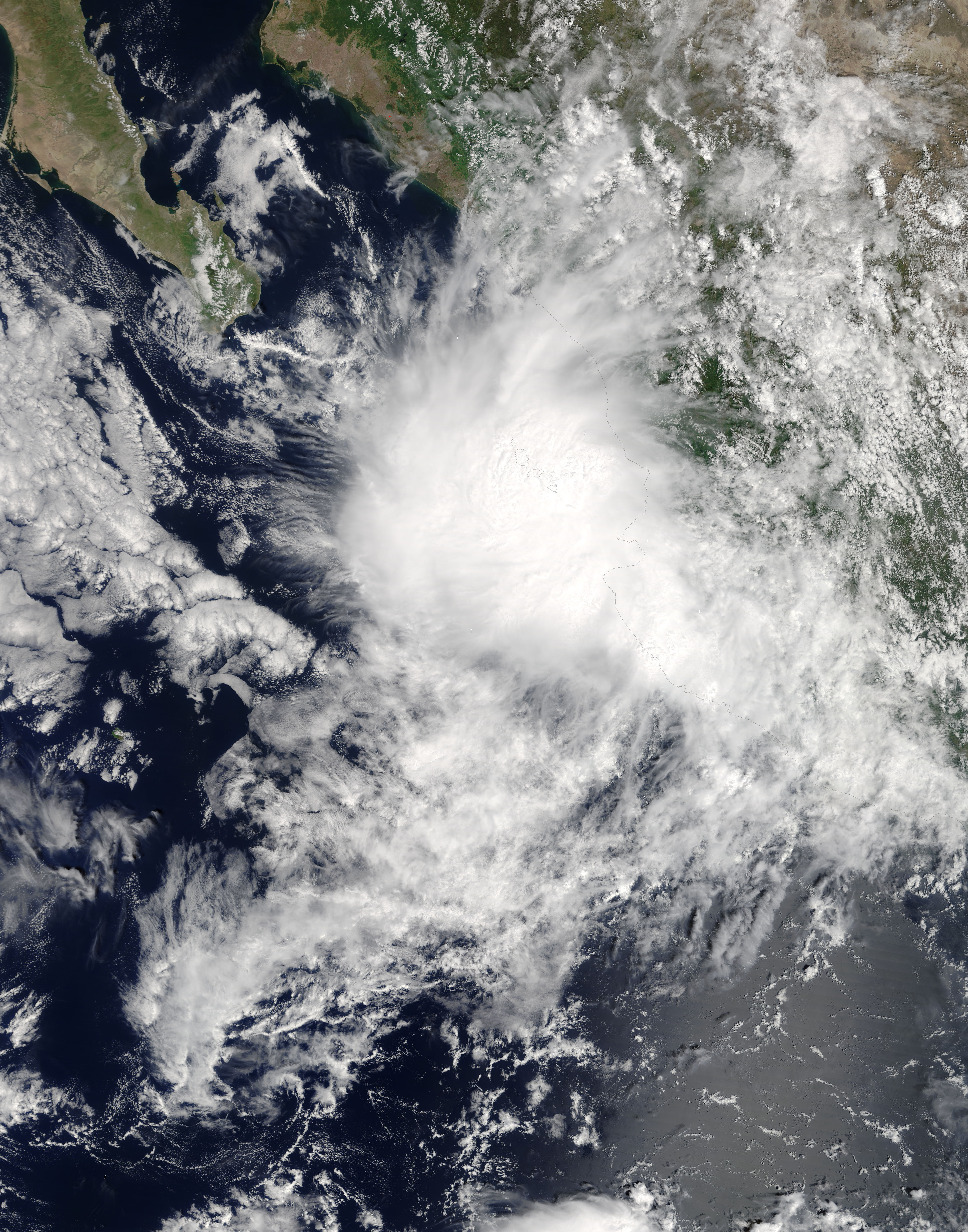
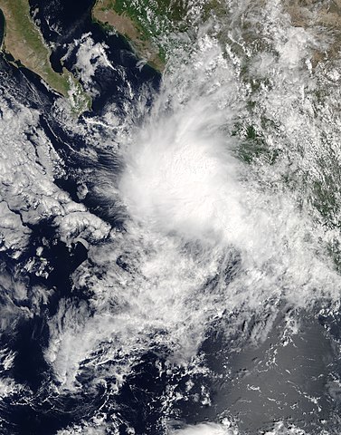
English: Tropical Storm Pilar (18E) off Mexico |
| Date | |
| Source | https://lance-modis.eosdis.nasa.gov/cgi-bin/imagery/single.cgi?image=Pilar.A2017267.1740.250m.jpg |
| Author | National Aeronautics and Space Administration, LANCE/EOSDIS Rapid Response, captured on Terra satellite |
| Metadata | https://lance-modis.eosdis.nasa.gov/cgi-bin/imagery/single.cgi?metadata=Pilar.A2017267.1740.txt |
| Satellite | Terra |
| Camera location |
| View this and other nearby images on: OpenStreetMap |
|
|---|
Licensing
| This file is in the public domain in the United States because it was solely created by NASA. NASA copyright policy states that "NASA material is not protected by copyright unless noted". (See Template:PD-USGov, NASA copyright policy page or JPL Image Use Policy.) | ||
 |
Warnings:
|
File history
Click on a date/time to view the file as it appeared at that time.
| Date/Time | Thumbnail | Dimensions | User | Comment | |
|---|---|---|---|---|---|
| current | 17:26, 25 September 2017 |
| 4,400 × 5,600 (3.91 MB) | Typhoon2013 | 250m res gallery |
| 09:29, 25 September 2017 |
 | 4,641 × 5,969 (3.94 MB) | Typhoon2013 | User created page with UploadWizard |
File usage
The following pages on the English Wikipedia use this file (pages on other projects are not listed):
Global file usage
The following other wikis use this file:
- Usage on es.wikipedia.org
- Usage on ko.wikipedia.org
- Usage on pt.wikipedia.org
- Usage on vi.wikipedia.org
- Usage on zh.wikipedia.org
Size of this preview:
471 × 599 pixels. Other resolutions:
188 × 240 pixels |
377 × 480 pixels |
603 × 768 pixels |
804 × 1,024 pixels |
1,609 × 2,048 pixels |
4,400 × 5,600 pixels.
Original file (4,400 × 5,600 pixels, file size: 3.91 MB, MIME type: image/jpeg)
| This is a file from the
Wikimedia Commons. Information from its
description page there is shown below. Commons is a freely licensed media file repository. You can help. |
Summary
| Description |
English: Tropical Storm Pilar (18E) off Mexico |
| Date | |
| Source | https://lance-modis.eosdis.nasa.gov/cgi-bin/imagery/single.cgi?image=Pilar.A2017267.1740.250m.jpg |
| Author | National Aeronautics and Space Administration, LANCE/EOSDIS Rapid Response, captured on Terra satellite |
| Metadata | https://lance-modis.eosdis.nasa.gov/cgi-bin/imagery/single.cgi?metadata=Pilar.A2017267.1740.txt |
| Satellite | Terra |
| Camera location |
| View this and other nearby images on: OpenStreetMap |
|
|---|
Licensing
| This file is in the public domain in the United States because it was solely created by NASA. NASA copyright policy states that "NASA material is not protected by copyright unless noted". (See Template:PD-USGov, NASA copyright policy page or JPL Image Use Policy.) | ||
|
Warnings:
|
File history
Click on a date/time to view the file as it appeared at that time.
| Date/Time | Thumbnail | Dimensions | User | Comment | |
|---|---|---|---|---|---|
| current | 17:26, 25 September 2017 |
| 4,400 × 5,600 (3.91 MB) | Typhoon2013 | 250m res gallery |
| 09:29, 25 September 2017 |
| 4,641 × 5,969 (3.94 MB) | Typhoon2013 | User created page with UploadWizard |
File usage
The following pages on the English Wikipedia use this file (pages on other projects are not listed):
Global file usage
The following other wikis use this file:
- Usage on es.wikipedia.org
- Usage on ko.wikipedia.org
- Usage on pt.wikipedia.org
- Usage on vi.wikipedia.org
- Usage on zh.wikipedia.org