
Size of this PNG preview of this SVG file:
446 × 599 pixels. Other resolutions:
179 × 240 pixels |
357 × 480 pixels |
572 × 768 pixels |
762 × 1,024 pixels |
1,524 × 2,048 pixels |
859 × 1,154 pixels.
Original file (SVG file, nominally 859 × 1,154 pixels, file size: 1.83 MB)
| This is a file from the
Wikimedia Commons. Information from its
description page there is shown below. Commons is a freely licensed media file repository. You can help. |
Summary
| Description |
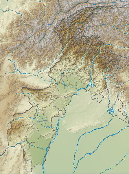
English: Relief map of Khyber Pakhtunwa. Same geolocation parameters as
File:Pakistan Khyber Pakhtunkhwa location map.svg. Elevation data from STRM3. |
| Date | |
| Source | File:Pakistan_Khyber_Pakhtunkhwa_location_map.svg |
| Author | Own work based on Milenioscuro |
Licensing
This file is licensed under the
Creative Commons
Attribution-Share Alike 4.0 International license.
- You are free:
- to share – to copy, distribute and transmit the work
- to remix – to adapt the work
- Under the following conditions:
- attribution – You must give appropriate credit, provide a link to the license, and indicate if changes were made. You may do so in any reasonable manner, but not in any way that suggests the licensor endorses you or your use.
- share alike – If you remix, transform, or build upon the material, you must distribute your contributions under the same or compatible license as the original.
File history
Click on a date/time to view the file as it appeared at that time.
| Date/Time | Thumbnail | Dimensions | User | Comment | |
|---|---|---|---|---|---|
| current | 16:31, 22 April 2024 |
| 859 × 1,154 (1.83 MB) | GrandEscogriffe | north-south stretching |
| 06:05, 3 October 2021 |
 | 859 × 954 (1.83 MB) | C1MM | Added more accurate relief | |
| 05:51, 20 April 2020 |
 | 654 × 841 (1.26 MB) | C1MM | Uploaded a work by Own work based on Milenioscuro from File:Pakistan_Khyber_Pakhtunkhwa_location_map.svg with UploadWizard |
File usage
The following pages on the English Wikipedia use this file (pages on other projects are not listed):
- Ansoo Lake
- Attaki
- Badrai
- Bannu
- Bannu Cantonment
- Barikot
- Bashigram Lake
- Bashkargol Lake
- Biori Valley
- Buni Zom
- Chajian Waterfall
- Chakdara
- Charsadda
- Daral Lake
- Dargai Pal Dam
- Daulat Pura
- Dharamsar
- Dorah Pass
- Dudipatsar
- Falak Sar (Swat)
- Gabral, Kohistan
- Gomal Pass
- Jabba Zomalu Lake
- Kafir Kot
- Katora Lake
- Kharkhari Lake
- Khyber Pass
- Kundol Lake
- Lake Saiful Muluk
- Lulusar
- Mahodand Lake
- Mardan
- Mount Sikaram
- Noshaq
- Panjkora River
- Pari Lake
- Payee Lake
- Peiwar Pass
- Pushkalavati
- Pyala Lake
- Ranigat
- Saidgai Lake
- Saifullah Lake
- Sajikot Waterfall
- Salatura
- Shabqadar
- Shandur Pass
- Shayaz
- Siri Lake
- Tank (city)
- Tarbela Dam
- Terich Mir
- Warsak Dam
- User:ESHAN sirang/sandbox
- Module:Location map/data/Khyber Pakhtunkhwa
- Module:Location map/data/Khyber Pakhtunkhwa/doc
Global file usage
The following other wikis use this file:
- Usage on an.wikipedia.org
- Usage on de.wikipedia.org
- Tirich Mir
- Tarbela-Talsperre
- Istor-o-Nal
- Naran-Tal
- Lowari-Tunnel
- Karambar-Pass
- Akher Tsagh
- Tirich Mir West IV
- Tirich Mir West III
- Tirich Mir West II
- Saraghrar I
- Koyo Zom
- Buni Zom
- Falak Sher
- Thalo Zom
- Ghochhar Sar
- Karka (Berg)
- Chiantar Sar
- Chiantargletscher
- Udren Zom
- Roshgolgletscher
- Atrakgletscher
- Nobaism Zom
- Oberer Tirichgletscher
- Unterer Tirichgletscher
- Elum Ghar
- Thui I
- Thui II
- Shingeik Zom
- Gul Lasht Zom
- Talsperre Dasu
- Vorlage:Positionskarte Pakistan Khyber Pakhtunkhwa
- Usage on eo.wikipedia.org
View more global usage of this file.
Metadata
Size of this PNG preview of this SVG file:
446 × 599 pixels. Other resolutions:
179 × 240 pixels |
357 × 480 pixels |
572 × 768 pixels |
762 × 1,024 pixels |
1,524 × 2,048 pixels |
859 × 1,154 pixels.
Original file (SVG file, nominally 859 × 1,154 pixels, file size: 1.83 MB)
| This is a file from the
Wikimedia Commons. Information from its
description page there is shown below. Commons is a freely licensed media file repository. You can help. |
Summary
| Description |
English: Relief map of Khyber Pakhtunwa. Same geolocation parameters as
File:Pakistan Khyber Pakhtunkhwa location map.svg. Elevation data from STRM3. |
| Date | |
| Source | File:Pakistan_Khyber_Pakhtunkhwa_location_map.svg |
| Author | Own work based on Milenioscuro |
Licensing
This file is licensed under the
Creative Commons
Attribution-Share Alike 4.0 International license.
- You are free:
- to share – to copy, distribute and transmit the work
- to remix – to adapt the work
- Under the following conditions:
- attribution – You must give appropriate credit, provide a link to the license, and indicate if changes were made. You may do so in any reasonable manner, but not in any way that suggests the licensor endorses you or your use.
- share alike – If you remix, transform, or build upon the material, you must distribute your contributions under the same or compatible license as the original.
File history
Click on a date/time to view the file as it appeared at that time.
| Date/Time | Thumbnail | Dimensions | User | Comment | |
|---|---|---|---|---|---|
| current | 16:31, 22 April 2024 |
| 859 × 1,154 (1.83 MB) | GrandEscogriffe | north-south stretching |
| 06:05, 3 October 2021 |
| 859 × 954 (1.83 MB) | C1MM | Added more accurate relief | |
| 05:51, 20 April 2020 |
| 654 × 841 (1.26 MB) | C1MM | Uploaded a work by Own work based on Milenioscuro from File:Pakistan_Khyber_Pakhtunkhwa_location_map.svg with UploadWizard |
File usage
The following pages on the English Wikipedia use this file (pages on other projects are not listed):
- Ansoo Lake
- Attaki
- Badrai
- Bannu
- Bannu Cantonment
- Barikot
- Bashigram Lake
- Bashkargol Lake
- Biori Valley
- Buni Zom
- Chajian Waterfall
- Chakdara
- Charsadda
- Daral Lake
- Dargai Pal Dam
- Daulat Pura
- Dharamsar
- Dorah Pass
- Dudipatsar
- Falak Sar (Swat)
- Gabral, Kohistan
- Gomal Pass
- Jabba Zomalu Lake
- Kafir Kot
- Katora Lake
- Kharkhari Lake
- Khyber Pass
- Kundol Lake
- Lake Saiful Muluk
- Lulusar
- Mahodand Lake
- Mardan
- Mount Sikaram
- Noshaq
- Panjkora River
- Pari Lake
- Payee Lake
- Peiwar Pass
- Pushkalavati
- Pyala Lake
- Ranigat
- Saidgai Lake
- Saifullah Lake
- Sajikot Waterfall
- Salatura
- Shabqadar
- Shandur Pass
- Shayaz
- Siri Lake
- Tank (city)
- Tarbela Dam
- Terich Mir
- Warsak Dam
- User:ESHAN sirang/sandbox
- Module:Location map/data/Khyber Pakhtunkhwa
- Module:Location map/data/Khyber Pakhtunkhwa/doc
Global file usage
The following other wikis use this file:
- Usage on an.wikipedia.org
- Usage on de.wikipedia.org
- Tirich Mir
- Tarbela-Talsperre
- Istor-o-Nal
- Naran-Tal
- Lowari-Tunnel
- Karambar-Pass
- Akher Tsagh
- Tirich Mir West IV
- Tirich Mir West III
- Tirich Mir West II
- Saraghrar I
- Koyo Zom
- Buni Zom
- Falak Sher
- Thalo Zom
- Ghochhar Sar
- Karka (Berg)
- Chiantar Sar
- Chiantargletscher
- Udren Zom
- Roshgolgletscher
- Atrakgletscher
- Nobaism Zom
- Oberer Tirichgletscher
- Unterer Tirichgletscher
- Elum Ghar
- Thui I
- Thui II
- Shingeik Zom
- Gul Lasht Zom
- Talsperre Dasu
- Vorlage:Positionskarte Pakistan Khyber Pakhtunkhwa
- Usage on eo.wikipedia.org
View more global usage of this file.