Photos • Location


Size of this preview:
799 × 600 pixels. Other resolutions:
320 × 240 pixels |
640 × 480 pixels |
1,023 × 768 pixels |
1,107 × 831 pixels.
Original file (1,107 × 831 pixels, file size: 543 KB, MIME type: image/jpeg)
| This is a file from the
Wikimedia Commons. Information from its
description page there is shown below. Commons is a freely licensed media file repository. You can help. |
Summary
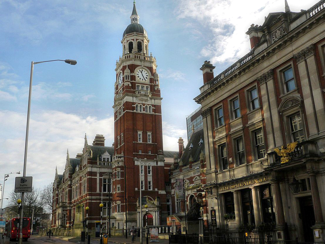
| Description | www.croydon.gov.uk/democracy/themayor/historic/townhall |
| Date | |
| Source | P1490912 The Old Town Hall,Katherine Street.. Croydon.. |
| Author | Tadie88 from Wallington Surrey |
| Camera location |
| View this and other nearby images on: OpenStreetMap |
|
|---|
Licensing
This file is licensed under the
Creative Commons
Attribution-Share Alike 2.0 Generic license.
- You are free:
- to share – to copy, distribute and transmit the work
- to remix – to adapt the work
- Under the following conditions:
- attribution – You must give appropriate credit, provide a link to the license, and indicate if changes were made. You may do so in any reasonable manner, but not in any way that suggests the licensor endorses you or your use.
- share alike – If you remix, transform, or build upon the material, you must distribute your contributions under the same or compatible license as the original.
| This image was originally posted to Flickr by Tadie88 at https://www.flickr.com/photos/68748051@N06/14030374141. It was reviewed on 28 November 2014 by FlickreviewR and was confirmed to be licensed under the terms of the cc-by-sa-2.0. |
File history
Click on a date/time to view the file as it appeared at that time.
| Date/Time | Thumbnail | Dimensions | User | Comment | |
|---|---|---|---|---|---|
| current | 22:08, 20 November 2023 |
| 1,107 × 831 (543 KB) | Beao | Removed watermark |
| 21:09, 26 July 2020 |
 | 1,107 × 831 (964 KB) | Belbury | Cropped 3 % horizontally using CropTool with lossless mode. Crop black border from left. | |
| 01:20, 24 December 2014 |
 | 1,147 × 831 (995 KB) | A P Monblat | cropped | |
| 02:26, 28 November 2014 |
 | 3,209 × 2,396 (1.11 MB) | A P Monblat | {{Information |Description=[http://www.croydon.gov.uk/democracy/themayor/historic/townhall www.croydon.gov.uk/democracy/themayor/historic/townhall] |Source=[https://www.flickr.com/photos/68748051@N06/14030374141/ P1490912 The Old Town Hall,Katherine St... |
File usage
The following pages on the English Wikipedia use this file (pages on other projects are not listed):
Global file usage
The following other wikis use this file:
- Usage on azb.wikipedia.org
- Usage on en.wikinews.org
- Usage on fa.wikipedia.org
- Usage on id.wikipedia.org
- Usage on it.wikipedia.org
- Usage on ko.wikipedia.org
- Usage on lt.wikipedia.org
- Usage on pl.wikipedia.org
- Usage on pt.wikipedia.org
- Usage on simple.wikipedia.org
- Usage on ur.wikipedia.org
Metadata
Size of this preview:
799 × 600 pixels. Other resolutions:
320 × 240 pixels |
640 × 480 pixels |
1,023 × 768 pixels |
1,107 × 831 pixels.
Original file (1,107 × 831 pixels, file size: 543 KB, MIME type: image/jpeg)
| This is a file from the
Wikimedia Commons. Information from its
description page there is shown below. Commons is a freely licensed media file repository. You can help. |
Summary
| Description | www.croydon.gov.uk/democracy/themayor/historic/townhall |
| Date | |
| Source | P1490912 The Old Town Hall,Katherine Street.. Croydon.. |
| Author | Tadie88 from Wallington Surrey |
| Camera location |
| View this and other nearby images on: OpenStreetMap |
|
|---|
Licensing
This file is licensed under the
Creative Commons
Attribution-Share Alike 2.0 Generic license.
- You are free:
- to share – to copy, distribute and transmit the work
- to remix – to adapt the work
- Under the following conditions:
- attribution – You must give appropriate credit, provide a link to the license, and indicate if changes were made. You may do so in any reasonable manner, but not in any way that suggests the licensor endorses you or your use.
- share alike – If you remix, transform, or build upon the material, you must distribute your contributions under the same or compatible license as the original.
| This image was originally posted to Flickr by Tadie88 at https://www.flickr.com/photos/68748051@N06/14030374141. It was reviewed on 28 November 2014 by FlickreviewR and was confirmed to be licensed under the terms of the cc-by-sa-2.0. |
Licensing
This file is licensed under the
Creative Commons
Attribution-Share Alike 2.0 Generic license.
- You are free:
- to share – to copy, distribute and transmit the work
- to remix – to adapt the work
- Under the following conditions:
- attribution – You must give appropriate credit, provide a link to the license, and indicate if changes were made. You may do so in any reasonable manner, but not in any way that suggests the licensor endorses you or your use.
- share alike – If you remix, transform, or build upon the material, you must distribute your contributions under the same or compatible license as the original.
| This image was originally posted to Flickr by Tadie88 at https://www.flickr.com/photos/68748051@N06/14030374141. It was reviewed on 28 November 2014 by FlickreviewR and was confirmed to be licensed under the terms of the cc-by-sa-2.0. |
File history
Click on a date/time to view the file as it appeared at that time.
| Date/Time | Thumbnail | Dimensions | User | Comment | |
|---|---|---|---|---|---|
| current | 22:08, 20 November 2023 |
| 1,107 × 831 (543 KB) | Beao | Removed watermark |
| 21:09, 26 July 2020 |
| 1,107 × 831 (964 KB) | Belbury | Cropped 3 % horizontally using CropTool with lossless mode. Crop black border from left. | |
| 01:20, 24 December 2014 |
| 1,147 × 831 (995 KB) | A P Monblat | cropped | |
| 02:26, 28 November 2014 |
| 3,209 × 2,396 (1.11 MB) | A P Monblat | {{Information |Description=[http://www.croydon.gov.uk/democracy/themayor/historic/townhall www.croydon.gov.uk/democracy/themayor/historic/townhall] |Source=[https://www.flickr.com/photos/68748051@N06/14030374141/ P1490912 The Old Town Hall,Katherine St... |
File usage
The following pages on the English Wikipedia use this file (pages on other projects are not listed):
Global file usage
The following other wikis use this file:
- Usage on azb.wikipedia.org
- Usage on en.wikinews.org
- Usage on fa.wikipedia.org
- Usage on id.wikipedia.org
- Usage on it.wikipedia.org
- Usage on ko.wikipedia.org
- Usage on lt.wikipedia.org
- Usage on pl.wikipedia.org
- Usage on pt.wikipedia.org
- Usage on simple.wikipedia.org
- Usage on ur.wikipedia.org