
Size of this preview:
509 × 599 pixels. Other resolutions:
204 × 240 pixels |
408 × 480 pixels |
653 × 768 pixels |
870 × 1,024 pixels |
2,003 × 2,357 pixels.
Original file (2,003 × 2,357 pixels, file size: 450 KB, MIME type: image/jpeg)
| This is a file from the
Wikimedia Commons. Information from its
description page there is shown below. Commons is a freely licensed media file repository. You can help. |
| Description |
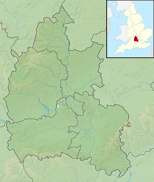
Relief map of Oxfordshire, UK. Equirectangular map projection on WGS 84 datum, with N/S stretched 160% Geographic limits:
|
| Date | |
| Source |
|
| Author | Nilfanion, created using Ordnance Survey data |
| Permission ( Reusing this file) |
This file is licensed under the
Creative Commons
Attribution-Share Alike 3.0 Unported license. Attribution: Contains Ordnance Survey data © Crown copyright and database right
|
| Other versions | File:Oxfordshire UK district map (blank).svg - Blank map |
.svg)
File history
Click on a date/time to view the file as it appeared at that time.
| Date/Time | Thumbnail | Dimensions | User | Comment | |
|---|---|---|---|---|---|
| current | 01:50, 29 November 2011 |
| 2,003 × 2,357 (450 KB) | Nilfanion | {{Information |Description=Relief map of Oxfordshire, UK. Equirectangular map projection on WGS 84 datum, with N/S stretched 160% Geographic limits: *West: 1.74W *East: 0.72W *North: 52.19N *South: 51.44N |Source=[[w:Ordnance Survey|Or |
File usage
The following pages on the English Wikipedia use this file (pages on other projects are not listed):
- Abingdon Reservoir
- Albert Park, Abingdon
- Battle of Chalgrove Field
- Battle of Cropredy Bridge
- Chipping Norton Limestone
- Farmoor Reservoir
- Fritwell Manor
- Garsington Manor
- Grimsbury Reservoir
- Hardwick House, Oxfordshire
- Henley Park
- John Cornwall (died 1414)
- Mill House and The Wharf, Sutton Courtenay
- Redgrave Pinsent Rowing Lake
- Siege of Oxford
- Wayland's Smithy
- Module:Location map/data/Oxfordshire
- Module:Location map/data/United Kingdom Oxfordshire
- Module:Location map/data/United Kingdom Oxfordshire/doc
Global file usage
The following other wikis use this file:
- Usage on ar.wikipedia.org
- Usage on bg.wikipedia.org
- Usage on ceb.wikipedia.org
- Usage on fr.wikipedia.org
- Usage on ja.wikipedia.org
- Usage on kn.wikipedia.org
- Usage on la.wikipedia.org
- Usage on lv.wikipedia.org
- Usage on mk.wikipedia.org
- Usage on nl.wikipedia.org
- Usage on os.wikipedia.org
- Usage on pl.wikipedia.org
- Usage on pl.wikibooks.org
- Usage on sh.wikipedia.org
- Usage on simple.wikipedia.org
- Usage on si.wikipedia.org
- Usage on sv.wikipedia.org
- Usage on tr.wikipedia.org
- Usage on vi.wikipedia.org
- Usage on war.wikipedia.org
- Usage on zh.wikipedia.org
Size of this preview:
509 × 599 pixels. Other resolutions:
204 × 240 pixels |
408 × 480 pixels |
653 × 768 pixels |
870 × 1,024 pixels |
2,003 × 2,357 pixels.
Original file (2,003 × 2,357 pixels, file size: 450 KB, MIME type: image/jpeg)
| This is a file from the
Wikimedia Commons. Information from its
description page there is shown below. Commons is a freely licensed media file repository. You can help. |
| Description |
Relief map of Oxfordshire, UK. Equirectangular map projection on WGS 84 datum, with N/S stretched 160% Geographic limits:
|
| Date | |
| Source |
|
| Author | Nilfanion, created using Ordnance Survey data |
| Permission ( Reusing this file) |
This file is licensed under the
Creative Commons
Attribution-Share Alike 3.0 Unported license. Attribution: Contains Ordnance Survey data © Crown copyright and database right
|
| Other versions | File:Oxfordshire UK district map (blank).svg - Blank map |
File history
Click on a date/time to view the file as it appeared at that time.
| Date/Time | Thumbnail | Dimensions | User | Comment | |
|---|---|---|---|---|---|
| current | 01:50, 29 November 2011 |
| 2,003 × 2,357 (450 KB) | Nilfanion | {{Information |Description=Relief map of Oxfordshire, UK. Equirectangular map projection on WGS 84 datum, with N/S stretched 160% Geographic limits: *West: 1.74W *East: 0.72W *North: 52.19N *South: 51.44N |Source=[[w:Ordnance Survey|Or |
File usage
The following pages on the English Wikipedia use this file (pages on other projects are not listed):
- Abingdon Reservoir
- Albert Park, Abingdon
- Battle of Chalgrove Field
- Battle of Cropredy Bridge
- Chipping Norton Limestone
- Farmoor Reservoir
- Fritwell Manor
- Garsington Manor
- Grimsbury Reservoir
- Hardwick House, Oxfordshire
- Henley Park
- John Cornwall (died 1414)
- Mill House and The Wharf, Sutton Courtenay
- Redgrave Pinsent Rowing Lake
- Siege of Oxford
- Wayland's Smithy
- Module:Location map/data/Oxfordshire
- Module:Location map/data/United Kingdom Oxfordshire
- Module:Location map/data/United Kingdom Oxfordshire/doc
Global file usage
The following other wikis use this file:
- Usage on ar.wikipedia.org
- Usage on bg.wikipedia.org
- Usage on ceb.wikipedia.org
- Usage on fr.wikipedia.org
- Usage on ja.wikipedia.org
- Usage on kn.wikipedia.org
- Usage on la.wikipedia.org
- Usage on lv.wikipedia.org
- Usage on mk.wikipedia.org
- Usage on nl.wikipedia.org
- Usage on os.wikipedia.org
- Usage on pl.wikipedia.org
- Usage on pl.wikibooks.org
- Usage on sh.wikipedia.org
- Usage on simple.wikipedia.org
- Usage on si.wikipedia.org
- Usage on sv.wikipedia.org
- Usage on tr.wikipedia.org
- Usage on vi.wikipedia.org
- Usage on war.wikipedia.org
- Usage on zh.wikipedia.org