
Size of this PNG preview of this SVG file:
412 × 599 pixels. Other resolutions:
165 × 240 pixels |
330 × 480 pixels |
528 × 768 pixels |
704 × 1,024 pixels |
1,407 × 2,048 pixels |
512 × 745 pixels.
Original file (SVG file, nominally 512 × 745 pixels, file size: 166 KB)
| This is a file from the
Wikimedia Commons. Information from its
description page there is shown below. Commons is a freely licensed media file repository. You can help. |
Summary
| Description |
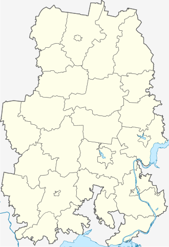
English: Outline map of Udmurtia
Русский: Контурная карта Удмуртии
Українська: Контурна мапа Удмуртії |
| Date | |
| Source | Own work |
| Author | Хинт |
| Other versions |
|


Licensing
| I, the copyright holder of this work, release this work into the
public domain. This applies worldwide. In some countries this may not be legally possible; if so: I grant anyone the right to use this work for any purpose, without any conditions, unless such conditions are required by law. |
File history
Click on a date/time to view the file as it appeared at that time.
| Date/Time | Thumbnail | Dimensions | User | Comment | |
|---|---|---|---|---|---|
| current | 14:42, 15 May 2013 |
| 512 × 745 (166 KB) | Виктор В | Еще небольшая правка структуры |
| 18:31, 13 May 2013 |
 | 512 × 745 (167 KB) | Виктор В | Изменение структуры файла | |
| 12:00, 24 July 2010 |
 | 512 × 745 (156 KB) | Хинт | oops ^^ | |
| 11:59, 24 July 2010 |
 | 512 × 745 (156 KB) | Хинт | добавлены границы городских округов для Воткинска и Можги взамен условной границы городской черты; уточнены границы городского округа Са� | |
| 20:07, 16 April 2010 |
 | 512 × 745 (156 KB) | Виктор В | множественные мелкие правки | |
| 18:31, 5 February 2010 |
 | 701 × 1,051 (112 KB) | Виктор В | background color | |
| 16:41, 16 June 2009 |
 | 701 × 1,051 (122 KB) | Хинт | new colors | |
| 12:57, 31 May 2009 |
 | 533 × 800 (108 KB) | Хинт | {{Information |Description={{en|1=Outline map of Udmurtia}} {{ru|1=Контурная карта Удмуртии}} {{uk|1=Контурна мапа Удмуртії}} |Source=Own work by uploader |Author= Хинт |Date=2009-05-31 |Permi |
File usage
The following pages on the English Wikipedia use this file (pages on other projects are not listed):
- 1205 km
- 1214 km
- 2014 Winter Olympics torch relay
- Abyshevo, Udmurtia
- Buranovo, Udmurt Republic
- Debyosy
- Glazov
- Grakhovo
- Izhevsk Airport
- Izhevsk State Agricultural Academy
- Kambarka
- Kiyasovo, Udmurt Republic
- Kizner (settlement)
- Krasnogorskoye, Udmurt Republic
- Malaya Purga
- Mozhga
- Sarapul
- Sigayevo
- Volga Federal District
- Votkinsk
- Module:Location map/data/Russia Udmurtia
- Module:Location map/data/Russia Udmurtia/doc
Global file usage
The following other wikis use this file:
- Usage on af.wikipedia.org
- Usage on ar.wikipedia.org
- Usage on azb.wikipedia.org
- Usage on ba.wikipedia.org
- Usage on be.wikipedia.org
- Usage on bg.wikipedia.org
- Usage on ceb.wikipedia.org
- Usage on ce.wikipedia.org
- Ижевск
- Кулига (Удмурти)
- Байтуганово (Удмурти)
- Иж-Бобья (Удмурти)
- Мукшур (Удмурти)
- Шаршада (Удмурти)
- Чекан (Удмурти)
- Тутаево (Удмурти)
- Стари Казанка (Удмурти)
- Мещеряково (Удмурти)
- Копки (Удмурти)
- Стари Юмья (Удмурти)
- Поршур (Грахован кӀошт)
- Атабаево (Удмурти)
- Пойкино (Удмурти)
- Сухарево (Удмурти)
- Зюзино (Удмурти)
- Кама (Удмурти)
- Байтеряково (Удмурти)
- Истомино (Удмурти)
- Куликово (Шарканан кӀошт)
- Бажениха (Удмурти)
- Юриха (Удмурти)
- Нижни Слудка (Удмурти)
- Антипино (Удмурти)
- Коньково (Удмурти)
- Ожгихино (Удмурти)
- Володино (Удмурти)
- Смольники (Удмурти)
- Мостови (Удмурти)
- Касаткино (Удмурти)
- Мокино (Удмурти)
- Шляпино (Удмурти)
- Антропиха (Удмурти)
View more global usage of this file.
Metadata
Size of this PNG preview of this SVG file:
412 × 599 pixels. Other resolutions:
165 × 240 pixels |
330 × 480 pixels |
528 × 768 pixels |
704 × 1,024 pixels |
1,407 × 2,048 pixels |
512 × 745 pixels.
Original file (SVG file, nominally 512 × 745 pixels, file size: 166 KB)
| This is a file from the
Wikimedia Commons. Information from its
description page there is shown below. Commons is a freely licensed media file repository. You can help. |
Summary
| Description |
English: Outline map of Udmurtia
Русский: Контурная карта Удмуртии
Українська: Контурна мапа Удмуртії |
| Date | |
| Source | Own work |
| Author | Хинт |
| Other versions |
|
Licensing
| I, the copyright holder of this work, release this work into the
public domain. This applies worldwide. In some countries this may not be legally possible; if so: I grant anyone the right to use this work for any purpose, without any conditions, unless such conditions are required by law. |
File history
Click on a date/time to view the file as it appeared at that time.
| Date/Time | Thumbnail | Dimensions | User | Comment | |
|---|---|---|---|---|---|
| current | 14:42, 15 May 2013 |
| 512 × 745 (166 KB) | Виктор В | Еще небольшая правка структуры |
| 18:31, 13 May 2013 |
| 512 × 745 (167 KB) | Виктор В | Изменение структуры файла | |
| 12:00, 24 July 2010 |
| 512 × 745 (156 KB) | Хинт | oops ^^ | |
| 11:59, 24 July 2010 |
| 512 × 745 (156 KB) | Хинт | добавлены границы городских округов для Воткинска и Можги взамен условной границы городской черты; уточнены границы городского округа Са� | |
| 20:07, 16 April 2010 |
| 512 × 745 (156 KB) | Виктор В | множественные мелкие правки | |
| 18:31, 5 February 2010 |
| 701 × 1,051 (112 KB) | Виктор В | background color | |
| 16:41, 16 June 2009 |
| 701 × 1,051 (122 KB) | Хинт | new colors | |
| 12:57, 31 May 2009 |
| 533 × 800 (108 KB) | Хинт | {{Information |Description={{en|1=Outline map of Udmurtia}} {{ru|1=Контурная карта Удмуртии}} {{uk|1=Контурна мапа Удмуртії}} |Source=Own work by uploader |Author= Хинт |Date=2009-05-31 |Permi |
File usage
The following pages on the English Wikipedia use this file (pages on other projects are not listed):
- 1205 km
- 1214 km
- 2014 Winter Olympics torch relay
- Abyshevo, Udmurtia
- Buranovo, Udmurt Republic
- Debyosy
- Glazov
- Grakhovo
- Izhevsk Airport
- Izhevsk State Agricultural Academy
- Kambarka
- Kiyasovo, Udmurt Republic
- Kizner (settlement)
- Krasnogorskoye, Udmurt Republic
- Malaya Purga
- Mozhga
- Sarapul
- Sigayevo
- Volga Federal District
- Votkinsk
- Module:Location map/data/Russia Udmurtia
- Module:Location map/data/Russia Udmurtia/doc
Global file usage
The following other wikis use this file:
- Usage on af.wikipedia.org
- Usage on ar.wikipedia.org
- Usage on azb.wikipedia.org
- Usage on ba.wikipedia.org
- Usage on be.wikipedia.org
- Usage on bg.wikipedia.org
- Usage on ceb.wikipedia.org
- Usage on ce.wikipedia.org
- Ижевск
- Кулига (Удмурти)
- Байтуганово (Удмурти)
- Иж-Бобья (Удмурти)
- Мукшур (Удмурти)
- Шаршада (Удмурти)
- Чекан (Удмурти)
- Тутаево (Удмурти)
- Стари Казанка (Удмурти)
- Мещеряково (Удмурти)
- Копки (Удмурти)
- Стари Юмья (Удмурти)
- Поршур (Грахован кӀошт)
- Атабаево (Удмурти)
- Пойкино (Удмурти)
- Сухарево (Удмурти)
- Зюзино (Удмурти)
- Кама (Удмурти)
- Байтеряково (Удмурти)
- Истомино (Удмурти)
- Куликово (Шарканан кӀошт)
- Бажениха (Удмурти)
- Юриха (Удмурти)
- Нижни Слудка (Удмурти)
- Антипино (Удмурти)
- Коньково (Удмурти)
- Ожгихино (Удмурти)
- Володино (Удмурти)
- Смольники (Удмурти)
- Мостови (Удмурти)
- Касаткино (Удмурти)
- Мокино (Удмурти)
- Шляпино (Удмурти)
- Антропиха (Удмурти)
View more global usage of this file.