Photos • Location


Size of this preview:
800 × 547 pixels. Other resolutions:
320 × 219 pixels |
640 × 438 pixels |
1,024 × 701 pixels |
1,197 × 819 pixels.
Original file (1,197 × 819 pixels, file size: 290 KB, MIME type: image/jpeg)
| This is a file from the
Wikimedia Commons. Information from its
description page there is shown below. Commons is a freely licensed media file repository. You can help. |
.jpg)
Summary
| Description |
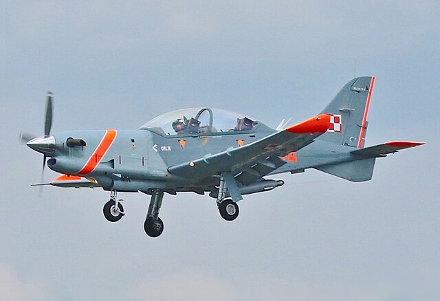
English: Orlik Aerobatic Team over Royal International Air Tattoo 2014 |
| Date | |
| Source | commons.wikimedia |
| Author | Ronnie Macdonald |
.jpg)
| Camera location |
| View this and other nearby images on: OpenStreetMap |
|
|---|
.jpg¶ms=051.681731_N_-001.773467_E_globe:Earth_type:camera__&language=en)
Licensing
This file is licensed under the
Creative Commons
Attribution 2.0 Generic license.
- You are free:
- to share – to copy, distribute and transmit the work
- to remix – to adapt the work
- Under the following conditions:
- attribution – You must give appropriate credit, provide a link to the license, and indicate if changes were made. You may do so in any reasonable manner, but not in any way that suggests the licensor endorses you or your use.
File history
Click on a date/time to view the file as it appeared at that time.
| Date/Time | Thumbnail | Dimensions | User | Comment | |
|---|---|---|---|---|---|
| current | 18:58, 29 December 2021 |
| 1,197 × 819 (290 KB) | FOX 52 | centered |
| 18:52, 29 December 2021 |
 | 1,201 × 842 (445 KB) | FOX 52 | Uploaded a work by [https://www.flickr.com/people/7332125@N04 Ronnie Macdonald from [https://commons.wikimedia.org/wiki/File:Orlik_Aerobatic_Team_03_(14707612712).jpg commons.wikimedia] with UploadWizard |
File usage
The following pages on the English Wikipedia use this file (pages on other projects are not listed):
Global file usage
The following other wikis use this file:
- Usage on cs.wikipedia.org
- Usage on uk.wikipedia.org
- Usage on zh.wikipedia.org
Metadata
.jpg)
Size of this preview:
800 × 547 pixels. Other resolutions:
320 × 219 pixels |
640 × 438 pixels |
1,024 × 701 pixels |
1,197 × 819 pixels.
Original file (1,197 × 819 pixels, file size: 290 KB, MIME type: image/jpeg)
| This is a file from the
Wikimedia Commons. Information from its
description page there is shown below. Commons is a freely licensed media file repository. You can help. |
Summary
| Description |
English: Orlik Aerobatic Team over Royal International Air Tattoo 2014 |
| Date | |
| Source | commons.wikimedia |
| Author | Ronnie Macdonald |
| Camera location |
| View this and other nearby images on: OpenStreetMap |
|
|---|
Licensing
This file is licensed under the
Creative Commons
Attribution 2.0 Generic license.
- You are free:
- to share – to copy, distribute and transmit the work
- to remix – to adapt the work
- Under the following conditions:
- attribution – You must give appropriate credit, provide a link to the license, and indicate if changes were made. You may do so in any reasonable manner, but not in any way that suggests the licensor endorses you or your use.
File history
Click on a date/time to view the file as it appeared at that time.
| Date/Time | Thumbnail | Dimensions | User | Comment | |
|---|---|---|---|---|---|
| current | 18:58, 29 December 2021 |
| 1,197 × 819 (290 KB) | FOX 52 | centered |
| 18:52, 29 December 2021 |
| 1,201 × 842 (445 KB) | FOX 52 | Uploaded a work by [https://www.flickr.com/people/7332125@N04 Ronnie Macdonald from [https://commons.wikimedia.org/wiki/File:Orlik_Aerobatic_Team_03_(14707612712).jpg commons.wikimedia] with UploadWizard |
File usage
The following pages on the English Wikipedia use this file (pages on other projects are not listed):
Global file usage
The following other wikis use this file:
- Usage on cs.wikipedia.org
- Usage on uk.wikipedia.org
- Usage on zh.wikipedia.org