
Size of this preview:
717 × 599 pixels. Other resolutions:
287 × 240 pixels |
574 × 480 pixels |
944 × 789 pixels.
Original file (944 × 789 pixels, file size: 45 KB, MIME type: image/png)
| This is a file from the
Wikimedia Commons. Information from its
description page there is shown below. Commons is a freely licensed media file repository. You can help. |
Summary
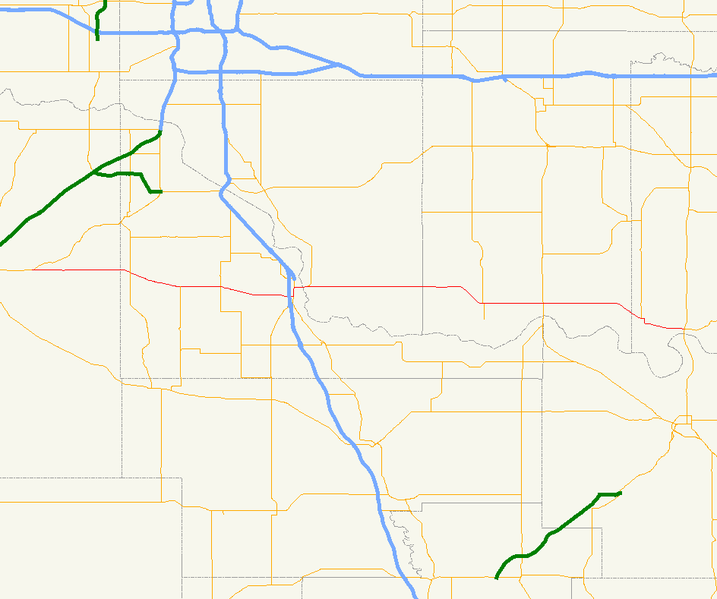
| Description | Map of Oklahoma State Highway 39. |
| Date | |
| Source |
Made from data from the University of Oklahoma Geo Information Systems in Quantum GIS 0.8. |
| Author | Scott Nazelrod |
| Permission ( Reusing this file) |
Public domain |
Licensing
| I, the copyright holder of this work, release this work into the
public domain. This applies worldwide. In some countries this may not be legally possible; if so: I grant anyone the right to use this work for any purpose, without any conditions, unless such conditions are required by law. |
File history
Click on a date/time to view the file as it appeared at that time.
| Date/Time | Thumbnail | Dimensions | User | Comment | |
|---|---|---|---|---|---|
| current | 19:18, 6 February 2007 |
| 944 × 789 (45 KB) | Scott5114 | {{Information |Description=Map of Oklahoma State Highway 39. |Source=Made from data from the [http://geo.ou.edu/cgi-bin/redesign.cgi?ft=db&template=Data.htm University of Oklahoma Geo Information Systems] in [[w:Quantum GIS |
File usage
The following pages on the English Wikipedia use this file (pages on other projects are not listed):
Global file usage
The following other wikis use this file:
- Usage on ca.wikipedia.org
- Usage on www.wikidata.org
Size of this preview:
717 × 599 pixels. Other resolutions:
287 × 240 pixels |
574 × 480 pixels |
944 × 789 pixels.
Original file (944 × 789 pixels, file size: 45 KB, MIME type: image/png)
| This is a file from the
Wikimedia Commons. Information from its
description page there is shown below. Commons is a freely licensed media file repository. You can help. |
Summary
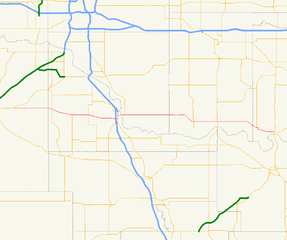
| Description | Map of Oklahoma State Highway 39. |
| Date | |
| Source |
Made from data from the University of Oklahoma Geo Information Systems in Quantum GIS 0.8. |
| Author | Scott Nazelrod |
| Permission ( Reusing this file) |
Public domain |
Licensing
| I, the copyright holder of this work, release this work into the
public domain. This applies worldwide. In some countries this may not be legally possible; if so: I grant anyone the right to use this work for any purpose, without any conditions, unless such conditions are required by law. |
File history
Click on a date/time to view the file as it appeared at that time.
| Date/Time | Thumbnail | Dimensions | User | Comment | |
|---|---|---|---|---|---|
| current | 19:18, 6 February 2007 |
| 944 × 789 (45 KB) | Scott5114 | {{Information |Description=Map of Oklahoma State Highway 39. |Source=Made from data from the [http://geo.ou.edu/cgi-bin/redesign.cgi?ft=db&template=Data.htm University of Oklahoma Geo Information Systems] in [[w:Quantum GIS |
File usage
The following pages on the English Wikipedia use this file (pages on other projects are not listed):
Global file usage
The following other wikis use this file:
- Usage on ca.wikipedia.org
- Usage on www.wikidata.org