No higher resolution available.
OH18_109.PNG (635 × 379 pixels, file size: 41 KB, MIME type: image/png)
| This is a file from the
Wikimedia Commons. Information from its
description page there is shown below. Commons is a freely licensed media file repository. You can help. |
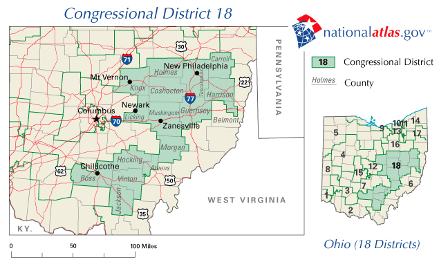
| Description | OH18 109 | |||
| Source | National Atlas of the United States | |||
| Author | National Atlas of the United States | |||
| Permission ( Reusing this file) |
|
File history
Click on a date/time to view the file as it appeared at that time.
| Date/Time | Thumbnail | Dimensions | User | Comment | |
|---|---|---|---|---|---|
| current | 17:17, 1 March 2006 |
| 635 × 379 (41 KB) | Quadell | {{PD-USGov-Atlas}} Category:Maps of Ohio Category:United States congressional district maps |
File usage
The following pages on the English Wikipedia use this file (pages on other projects are not listed):
Global file usage
The following other wikis use this file:
- Usage on es.wikipedia.org
No higher resolution available.
OH18_109.PNG (635 × 379 pixels, file size: 41 KB, MIME type: image/png)
| This is a file from the
Wikimedia Commons. Information from its
description page there is shown below. Commons is a freely licensed media file repository. You can help. |
| Description | OH18 109 | |||
| Source | National Atlas of the United States | |||
| Author | National Atlas of the United States | |||
| Permission ( Reusing this file) |
|
File history
Click on a date/time to view the file as it appeared at that time.
| Date/Time | Thumbnail | Dimensions | User | Comment | |
|---|---|---|---|---|---|
| current | 17:17, 1 March 2006 |
| 635 × 379 (41 KB) | Quadell | {{PD-USGov-Atlas}} Category:Maps of Ohio Category:United States congressional district maps |
File usage
The following pages on the English Wikipedia use this file (pages on other projects are not listed):
Global file usage
The following other wikis use this file:
- Usage on es.wikipedia.org