Original file (1,504 × 1,900 pixels, file size: 3.99 MB, MIME type: image/jpeg)
| This is a file from the
Wikimedia Commons. Information from its
description page there is shown below. Commons is a freely licensed media file repository. You can help. |
Summary
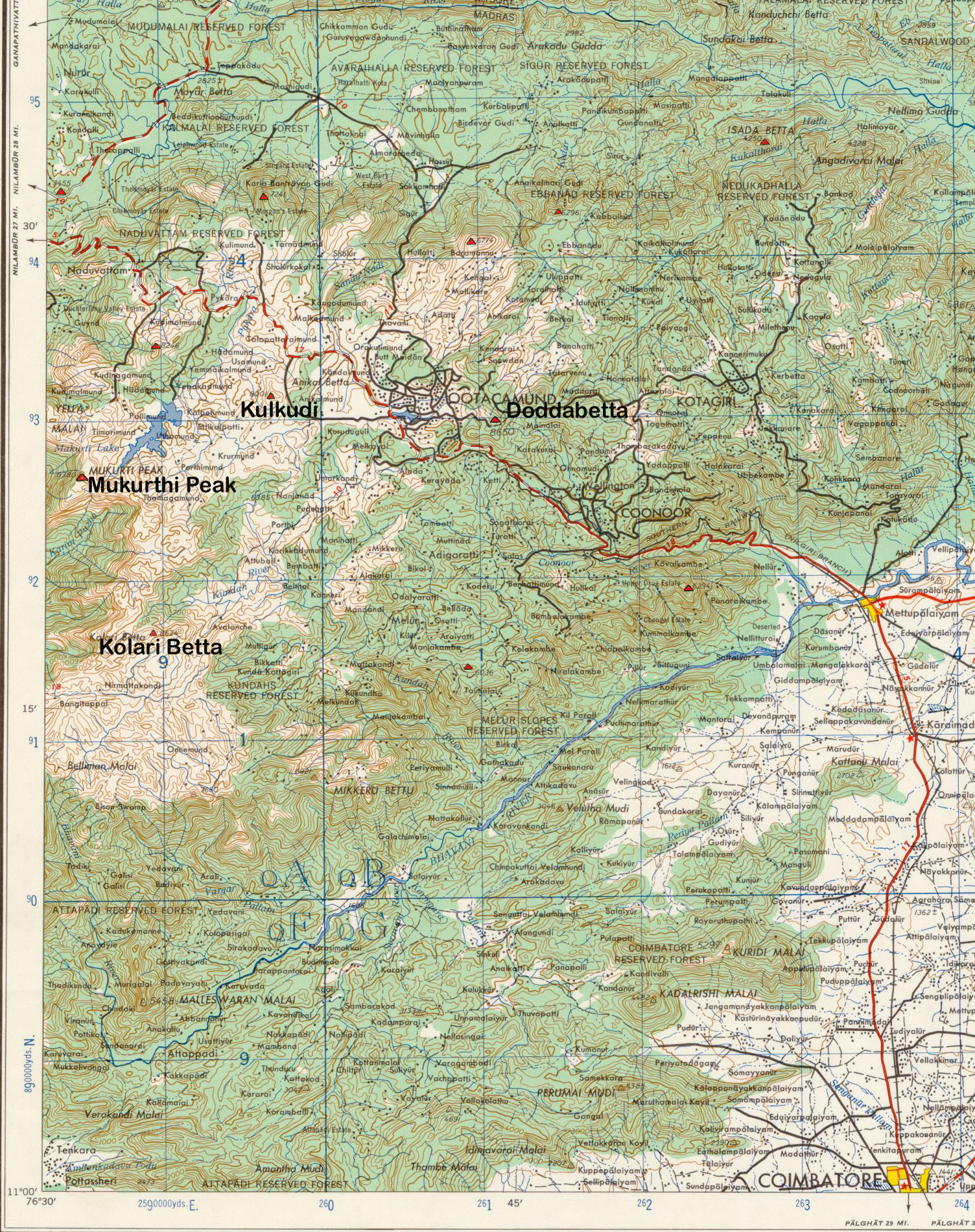
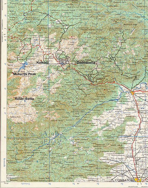
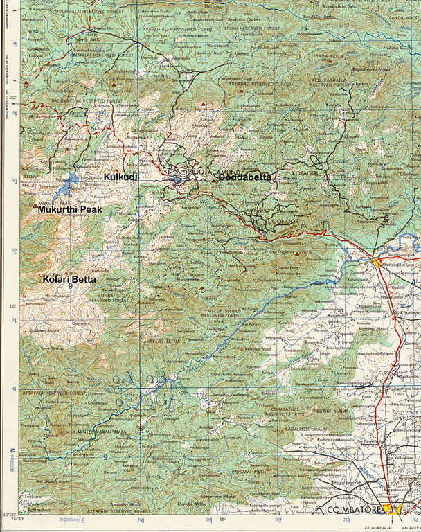
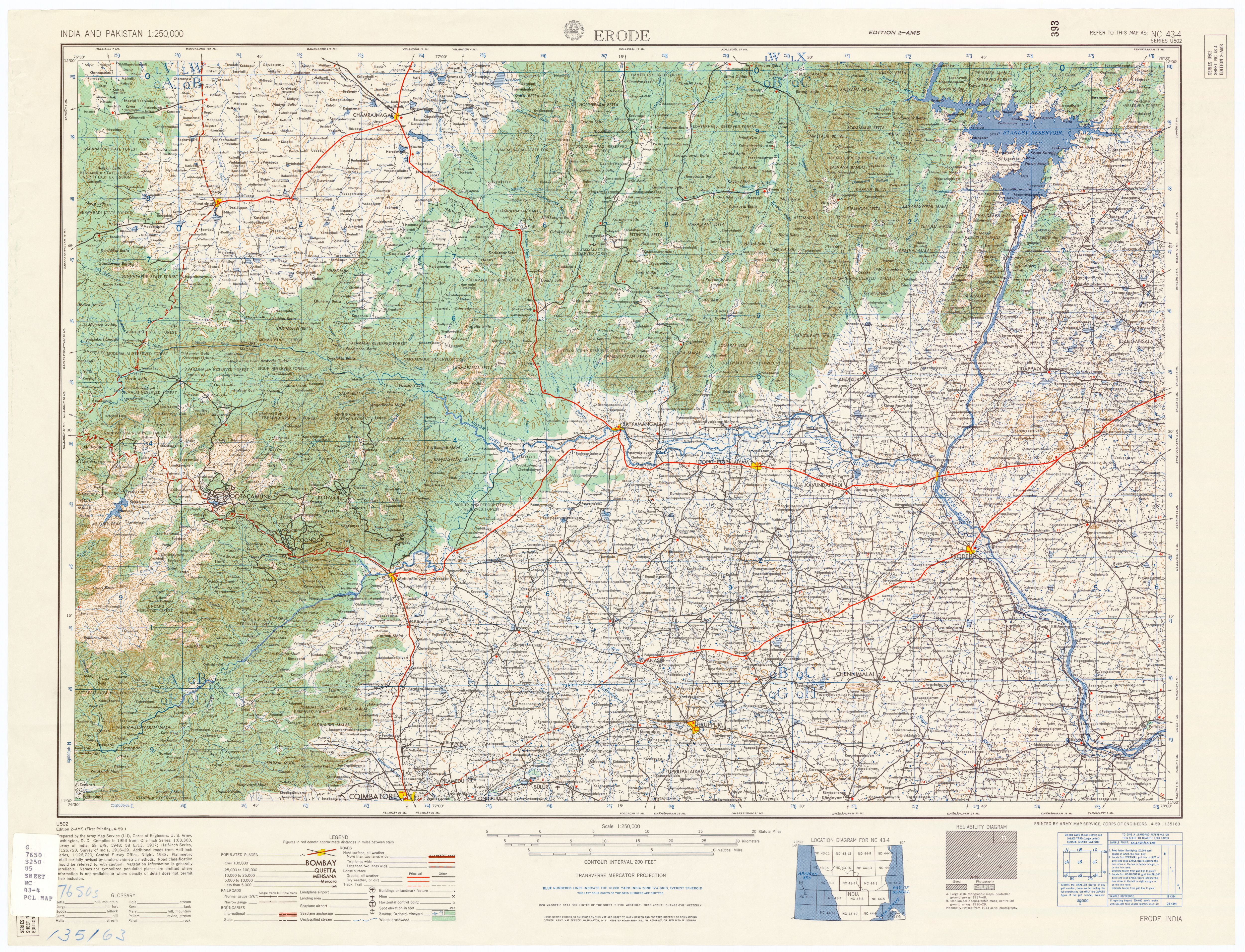
Description: Topo Map, Nilgiri Hills, Tamil Nadu, India.
Source: U.S. Army Topology Command, Erode India, sheet NC 43-4
Date: 1953
Author: U.S. Army Map Service, cropped by Marcus 9/3/2007
Permission: Public Domain
Other versions: Erode India, sheet NC 43-4
Licensing
This file is a work of a
U.S. Army soldier or employee, taken or made as part of that person's official duties. As a
work of the
U.S. federal government, it is in the
public domain in the United States.
|
 |
File history
Click on a date/time to view the file as it appeared at that time.
| Date/Time | Thumbnail | Dimensions | User | Comment | |
|---|---|---|---|---|---|
| current | 04:02, 4 September 2007 |
| 1,504 × 1,900 (3.99 MB) | Marcus334 | Description: Topo Map, Nilgiri Hills, Tamil Nadu, India. Source: U.S. Army Topology Command, Erode India, sheet NC 43-4 Date: 1953 Author: U.S. Army Map Service, cropped by Marcus 9/3/2007 Permission: Public Domain Other versions: [www.utexas.ed |
File usage
Global file usage
The following other wikis use this file:
- Usage on es.wikipedia.org
- Usage on fi.wikipedia.org
- Usage on it.wikipedia.org
- Usage on sl.wikipedia.org
- Usage on ta.wikipedia.org
- Usage on ur.wikipedia.org
Metadata
Original file (1,504 × 1,900 pixels, file size: 3.99 MB, MIME type: image/jpeg)
| This is a file from the
Wikimedia Commons. Information from its
description page there is shown below. Commons is a freely licensed media file repository. You can help. |
Summary
Description: Topo Map, Nilgiri Hills, Tamil Nadu, India.
Source: U.S. Army Topology Command, Erode India, sheet NC 43-4
Date: 1953
Author: U.S. Army Map Service, cropped by Marcus 9/3/2007
Permission: Public Domain
Other versions: Erode India, sheet NC 43-4
Licensing
This file is a work of a
U.S. Army soldier or employee, taken or made as part of that person's official duties. As a
work of the
U.S. federal government, it is in the
public domain in the United States.
|
|
File history
Click on a date/time to view the file as it appeared at that time.
| Date/Time | Thumbnail | Dimensions | User | Comment | |
|---|---|---|---|---|---|
| current | 04:02, 4 September 2007 |
| 1,504 × 1,900 (3.99 MB) | Marcus334 | Description: Topo Map, Nilgiri Hills, Tamil Nadu, India. Source: U.S. Army Topology Command, Erode India, sheet NC 43-4 Date: 1953 Author: U.S. Army Map Service, cropped by Marcus 9/3/2007 Permission: Public Domain Other versions: [www.utexas.ed |
File usage
Global file usage
The following other wikis use this file:
- Usage on es.wikipedia.org
- Usage on fi.wikipedia.org
- Usage on it.wikipedia.org
- Usage on sl.wikipedia.org
- Usage on ta.wikipedia.org
- Usage on ur.wikipedia.org