Size of this preview:
676 × 600 pixels. Other resolutions:
271 × 240 pixels |
541 × 480 pixels |
866 × 768 pixels |
1,154 × 1,024 pixels |
1,869 × 1,658 pixels.
Original file (1,869 × 1,658 pixels, file size: 125 KB, MIME type: image/png)
| This is a file from the
Wikimedia Commons. Information from its
description page there is shown below. Commons is a freely licensed media file repository. You can help. |
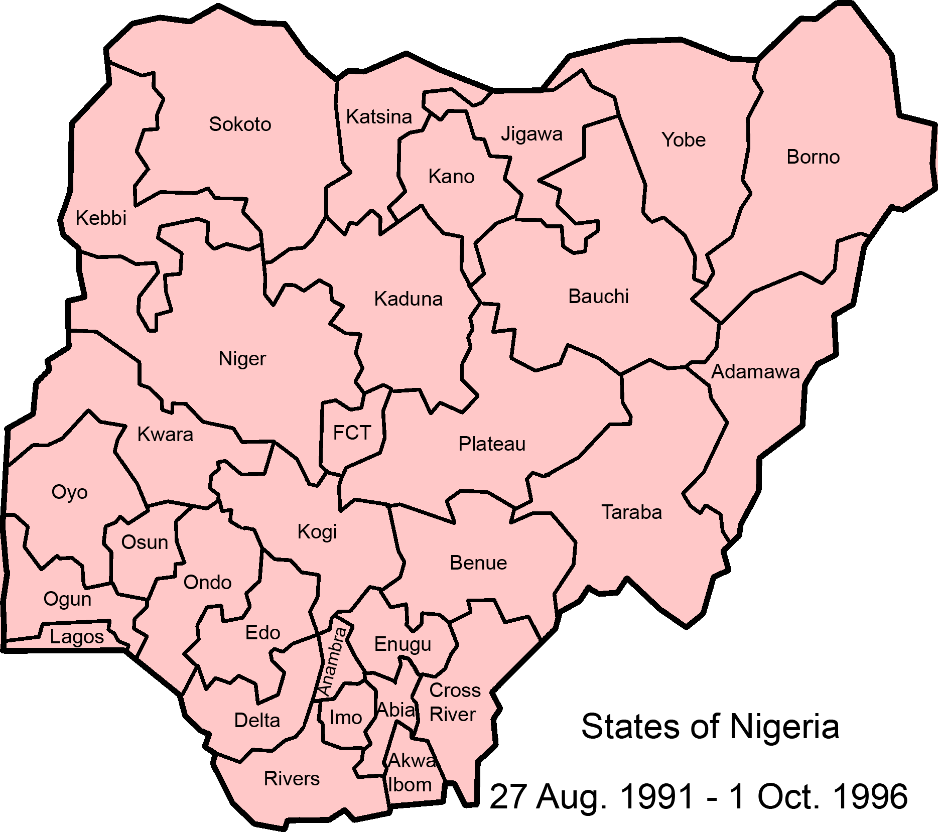
| Description | Map of Nigerian states, 27 August 1991 - . | ||||||||
| Date | |||||||||
| Source | Made from GNU licenced Image:NigeriaCapitalTerritory.png, using information from statoids and w:List of Nigerian states by date of statehood | ||||||||
| Author | self | ||||||||
| Permission ( Reusing this file) |
|
||||||||
| Other versions | 1987-1991 |

File history
Click on a date/time to view the file as it appeared at that time.
| Date/Time | Thumbnail | Dimensions | User | Comment | |
|---|---|---|---|---|---|
| current | 09:03, 27 July 2007 |
| 1,869 × 1,658 (125 KB) | Roke~commonswiki | {{Information |Description=Map of Nigerian states, 27 August 1991 - . |Source=Made from GNU licenced Image:NigeriaCapitalTerritory.png, using information from [http://www.statoids.com/ung.html statoids] and [[w:List of Nigerian states by date of sta |
File usage
The following pages on the English Wikipedia use this file (pages on other projects are not listed):
Global file usage
The following other wikis use this file:
- Usage on als.wikipedia.org
- Usage on bn.wikipedia.org
- Usage on ca.wikipedia.org
- Usage on de.wikipedia.org
- Usage on eo.wikipedia.org
- Usage on es.wikipedia.org
- Usage on ha.wikipedia.org
- Usage on hy.wikipedia.org
- Usage on incubator.wikimedia.org
- Usage on ja.wikipedia.org
- Usage on mrj.wikipedia.org
- Usage on pt.wikipedia.org
- Usage on uk.wikipedia.org
- Usage on vi.wikipedia.org
- Usage on zh.wikipedia.org
Size of this preview:
676 × 600 pixels. Other resolutions:
271 × 240 pixels |
541 × 480 pixels |
866 × 768 pixels |
1,154 × 1,024 pixels |
1,869 × 1,658 pixels.
Original file (1,869 × 1,658 pixels, file size: 125 KB, MIME type: image/png)
| This is a file from the
Wikimedia Commons. Information from its
description page there is shown below. Commons is a freely licensed media file repository. You can help. |
| Description | Map of Nigerian states, 27 August 1991 - . | ||||||||
| Date | |||||||||
| Source | Made from GNU licenced Image:NigeriaCapitalTerritory.png, using information from statoids and w:List of Nigerian states by date of statehood | ||||||||
| Author | self | ||||||||
| Permission ( Reusing this file) |
|
||||||||
| Other versions | 1987-1991 |
File history
Click on a date/time to view the file as it appeared at that time.
| Date/Time | Thumbnail | Dimensions | User | Comment | |
|---|---|---|---|---|---|
| current | 09:03, 27 July 2007 |
| 1,869 × 1,658 (125 KB) | Roke~commonswiki | {{Information |Description=Map of Nigerian states, 27 August 1991 - . |Source=Made from GNU licenced Image:NigeriaCapitalTerritory.png, using information from [http://www.statoids.com/ung.html statoids] and [[w:List of Nigerian states by date of sta |
File usage
The following pages on the English Wikipedia use this file (pages on other projects are not listed):
Global file usage
The following other wikis use this file:
- Usage on als.wikipedia.org
- Usage on bn.wikipedia.org
- Usage on ca.wikipedia.org
- Usage on de.wikipedia.org
- Usage on eo.wikipedia.org
- Usage on es.wikipedia.org
- Usage on ha.wikipedia.org
- Usage on hy.wikipedia.org
- Usage on incubator.wikimedia.org
- Usage on ja.wikipedia.org
- Usage on mrj.wikipedia.org
- Usage on pt.wikipedia.org
- Usage on uk.wikipedia.org
- Usage on vi.wikipedia.org
- Usage on zh.wikipedia.org