Photos • Location


Size of this preview:
800 × 424 pixels. Other resolutions:
320 × 169 pixels |
640 × 339 pixels |
1,024 × 542 pixels |
1,280 × 678 pixels |
2,300 × 1,218 pixels.
Original file (2,300 × 1,218 pixels, file size: 243 KB, MIME type: image/jpeg)
| This is a file from the
Wikimedia Commons. Information from its
description page there is shown below. Commons is a freely licensed media file repository. You can help. |
Summary
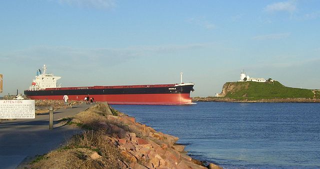
| Description | Bulk carrier Nicole entering Newcastle Harbour. Image was taken at the shore end of the Stockton breakwall on Shipwreck walk |
| Date | |
| Source | Own work |
| Author | AussieLegend |
| Camera location |
| View this and other nearby images on: OpenStreetMap |
|
|---|
Licensing
| I, the copyright holder of this work, release this work into the
public domain. This applies worldwide. In some countries this may not be legally possible; if so: I grant anyone the right to use this work for any purpose, without any conditions, unless such conditions are required by law. |
File history
Click on a date/time to view the file as it appeared at that time.
| Date/Time | Thumbnail | Dimensions | User | Comment | |
|---|---|---|---|---|---|
| current | 10:09, 8 September 2007 |
| 2,300 × 1,218 (243 KB) | AussieLegend | {{Information |Description=Bulk carrier entering Newcastle Harbour. Image was taken at the shore end of the Stockton breakwall on Shipwreck walk |Source=self-made |Date=27 August 2007 |Author= AussieLegend }} {{location dec|-32.91548 |
File usage
The following pages on the English Wikipedia use this file (pages on other projects are not listed):
- Hunter Region
- Hunter River (New South Wales)
- Hunter Valley Coal Chain
- List of rivers of New South Wales (A–K)
- Talk:Newcastle, New South Wales
- User:AussieLegend/Contributions
- Template:Infobox Australian place/Examples
- Template:Infobox Australian place/testcases
- Draft:Sandbox/Innesw/Infobox Australian place/testcases
Global file usage
The following other wikis use this file:
- Usage on arz.wikipedia.org
- Usage on bg.wikipedia.org
- Usage on ceb.wikipedia.org
- Usage on de.wikipedia.org
- Usage on eo.wikipedia.org
- Usage on fa.wikipedia.org
- Usage on fr.wikipedia.org
- Usage on he.wikipedia.org
- Usage on id.wikipedia.org
- Usage on ne.wikipedia.org
- Usage on nl.wikipedia.org
- Usage on no.wikipedia.org
- Usage on simple.wikipedia.org
- Usage on sl.wikipedia.org
- Usage on sv.wikipedia.org
- Usage on uk.wikipedia.org
- Usage on www.wikidata.org
- Usage on zh.wikipedia.org
Size of this preview:
800 × 424 pixels. Other resolutions:
320 × 169 pixels |
640 × 339 pixels |
1,024 × 542 pixels |
1,280 × 678 pixels |
2,300 × 1,218 pixels.
Original file (2,300 × 1,218 pixels, file size: 243 KB, MIME type: image/jpeg)
| This is a file from the
Wikimedia Commons. Information from its
description page there is shown below. Commons is a freely licensed media file repository. You can help. |
Summary
| Description | Bulk carrier Nicole entering Newcastle Harbour. Image was taken at the shore end of the Stockton breakwall on Shipwreck walk |
| Date | |
| Source | Own work |
| Author | AussieLegend |
| Camera location |
| View this and other nearby images on: OpenStreetMap |
|
|---|
Licensing
| I, the copyright holder of this work, release this work into the
public domain. This applies worldwide. In some countries this may not be legally possible; if so: I grant anyone the right to use this work for any purpose, without any conditions, unless such conditions are required by law. |
File history
Click on a date/time to view the file as it appeared at that time.
| Date/Time | Thumbnail | Dimensions | User | Comment | |
|---|---|---|---|---|---|
| current | 10:09, 8 September 2007 |
| 2,300 × 1,218 (243 KB) | AussieLegend | {{Information |Description=Bulk carrier entering Newcastle Harbour. Image was taken at the shore end of the Stockton breakwall on Shipwreck walk |Source=self-made |Date=27 August 2007 |Author= AussieLegend }} {{location dec|-32.91548 |
File usage
The following pages on the English Wikipedia use this file (pages on other projects are not listed):
- Hunter Region
- Hunter River (New South Wales)
- Hunter Valley Coal Chain
- List of rivers of New South Wales (A–K)
- Talk:Newcastle, New South Wales
- User:AussieLegend/Contributions
- Template:Infobox Australian place/Examples
- Template:Infobox Australian place/testcases
- Draft:Sandbox/Innesw/Infobox Australian place/testcases
Global file usage
The following other wikis use this file:
- Usage on arz.wikipedia.org
- Usage on bg.wikipedia.org
- Usage on ceb.wikipedia.org
- Usage on de.wikipedia.org
- Usage on eo.wikipedia.org
- Usage on fa.wikipedia.org
- Usage on fr.wikipedia.org
- Usage on he.wikipedia.org
- Usage on id.wikipedia.org
- Usage on ne.wikipedia.org
- Usage on nl.wikipedia.org
- Usage on no.wikipedia.org
- Usage on simple.wikipedia.org
- Usage on sl.wikipedia.org
- Usage on sv.wikipedia.org
- Usage on uk.wikipedia.org
- Usage on www.wikidata.org
- Usage on zh.wikipedia.org