Size of this preview:
480 × 599 pixels. Other resolutions:
192 × 240 pixels |
384 × 480 pixels |
615 × 768 pixels |
820 × 1,024 pixels |
1,641 × 2,048 pixels |
2,733 × 3,411 pixels.
Original file (2,733 × 3,411 pixels, file size: 216 KB, MIME type: image/png)
| This is a file from the
Wikimedia Commons. Information from its
description page there is shown below. Commons is a freely licensed media file repository. You can help. |
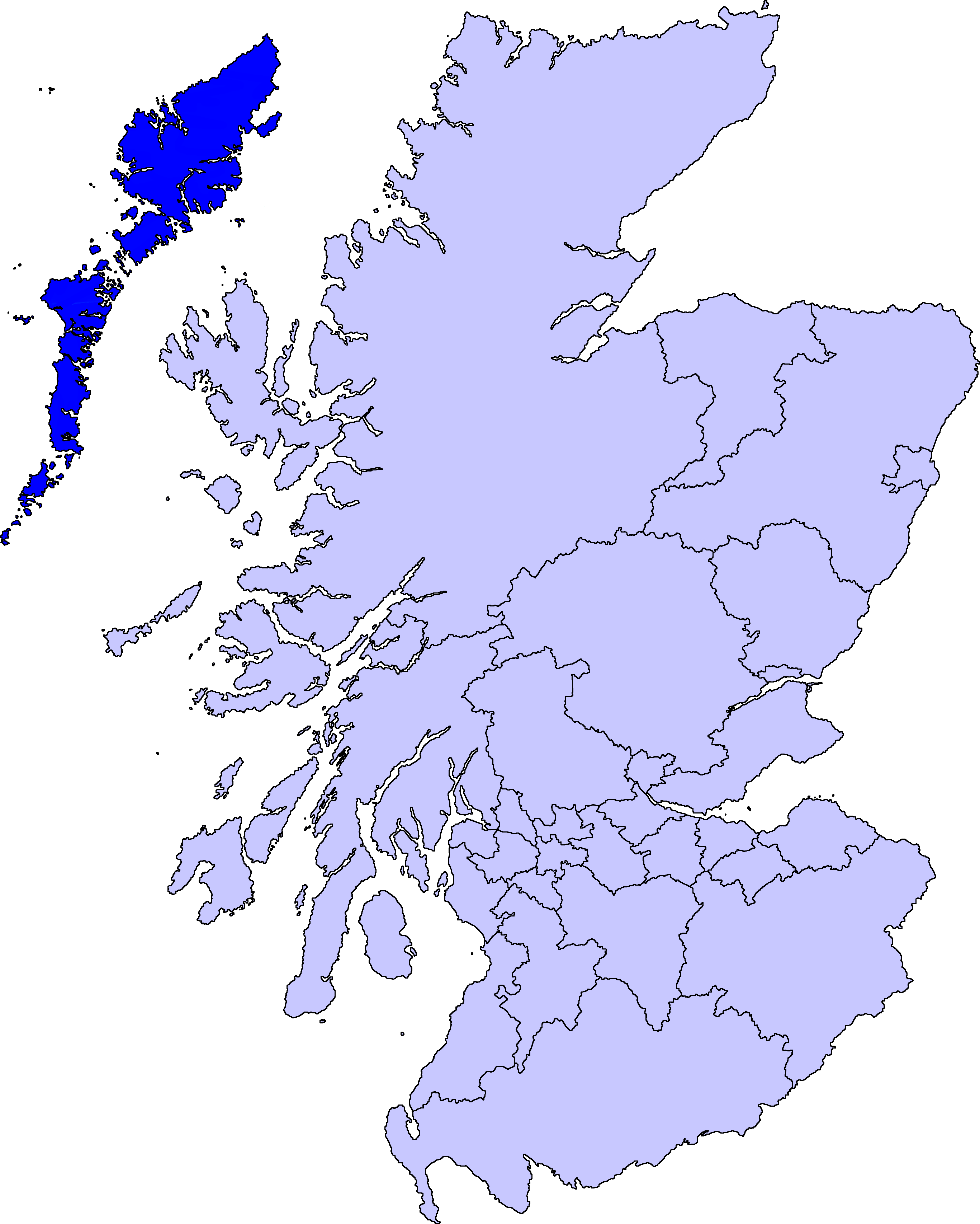
| Description | map of Na h-Eileanan Siar | ||||||||
| Date | |||||||||
| Source |
Barryob, the copyright holder of this work, hereby publishes it under the following license:
|
||||||||
| Author | User:Barryob |

File history
Click on a date/time to view the file as it appeared at that time.
| Date/Time | Thumbnail | Dimensions | User | Comment | |
|---|---|---|---|---|---|
| current | 04:55, 10 April 2007 |
| 2,733 × 3,411 (216 KB) | Barryob | |
| 21:52, 8 April 2007 |
 | 2,733 × 3,411 (217 KB) | Barryob | ||
| 03:32, 31 March 2007 |
 | 2,733 × 3,411 (217 KB) | Barryob | {{Information |Description=map of Na h-Eileanan Siar |Source={{GFDL-user|Barryob}} |Date=2006-03-31 |Author= User:Barryob |Permission= |other_versions= }} Category:Maps of unitary councils of Scotland |
File usage
More than 100 pages use this file. The following list shows the first 100 pages that use this file only. A full list is available.
- Adabroc
- Aird, Lewis
- Aird an Rùnair
- Airidh a' Bhruaich
- Allasdale
- Ardhasaig
- Ardheisker
- Ardroil
- Ardveenish
- Arnamul
- Askernish
- Auratote
- Bail' Iochdrach
- Baile Glas
- Baile an Truiseil
- Balallan
- Balgarva
- Barra Isles
- Barvas
- Bayble
- Bayble Island
- Benbecula Airport
- Biruaslum
- Bogach
- Boreray, North Uist
- Bornish
- Borrowston, Lewis
- Borsham
- Borve, Harris
- Bragar
- Broad Bay, Lewis
- Broker, Lewis
- Cabharstadh
- Calbost
- Callanish II
- Callanish III
- Callanish IV
- Callanish VIII
- Calvay
- Ceann a' Ghàraidh
- Clisham
- Dùn
- Eilean Chaluim Chille
- Eilean Chearstaidh
- Eilean Dòmhnuill
- Eilean Mhuire
- Ensay (Outer Hebrides)
- Flesherin
- Flodaigh
- Fuaigh Mòr
- Fuday
- Garrabost
- Gighay
- Gravir
- Gress
- Grimsay (South East Benbecula)
- Habost
- Heaval
- Hushinish
- Kilaulay
- Kirkibost
- Knock, Isle of Lewis
- Leurbost
- Lingeigh
- Little Bernera
- Loch Erisort
- Loch Seaforth
- Lochboisdale
- Lochmaddy
- Mealista
- Melbost
- NHS Western Isles
- New Tolsta
- North Lochs
- Northbay
- Nunton, Benbecula
- Oronsay, Outer Hebrides
- Pabbay, Harris
- Park, Lewis
- Portnaguran
- Rodel
- Sandray
- Sgarabhaigh
- Sgeotasaigh
- Shillay
- Shulishader
- Skigersta
- Soay Beag
- Soay Mòr
- Soay Sound
- Steinacleit
- Stockinish Island
- Stoneybridge
- Tahay
- Tarbert, Harris
- Tigharry
- Vacsay
- Vallay
- West Loch Tarbert
- West Side, Lewis
View more links to this file.
Global file usage
The following other wikis use this file:
- Usage on af.wikipedia.org
- Usage on ast.wikipedia.org
- Usage on br.wikipedia.org
- Usage on de.wikipedia.org
- Usage on en.wikinews.org
- Usage on fa.wikipedia.org
- Usage on fy.wikipedia.org
- Usage on gd.wikipedia.org
- Usage on hr.wikipedia.org
- Usage on ko.wikipedia.org
- Usage on la.wikipedia.org
- Usage on pnb.wikipedia.org
- Usage on pt.wikipedia.org
- Usage on pt.wiktionary.org
- Usage on sco.wikipedia.org
- Usage on sh.wikipedia.org
- Usage on tr.wikipedia.org
- Usage on www.wikidata.org
- Usage on wo.wikipedia.org
- Usage on zh.wikipedia.org
Size of this preview:
480 × 599 pixels. Other resolutions:
192 × 240 pixels |
384 × 480 pixels |
615 × 768 pixels |
820 × 1,024 pixels |
1,641 × 2,048 pixels |
2,733 × 3,411 pixels.
Original file (2,733 × 3,411 pixels, file size: 216 KB, MIME type: image/png)
| This is a file from the
Wikimedia Commons. Information from its
description page there is shown below. Commons is a freely licensed media file repository. You can help. |
| Description | map of Na h-Eileanan Siar | ||||||||
| Date | |||||||||
| Source |
Barryob, the copyright holder of this work, hereby publishes it under the following license:
|
||||||||
| Author | User:Barryob |
File history
Click on a date/time to view the file as it appeared at that time.
| Date/Time | Thumbnail | Dimensions | User | Comment | |
|---|---|---|---|---|---|
| current | 04:55, 10 April 2007 |
| 2,733 × 3,411 (216 KB) | Barryob | |
| 21:52, 8 April 2007 |
| 2,733 × 3,411 (217 KB) | Barryob | ||
| 03:32, 31 March 2007 |
| 2,733 × 3,411 (217 KB) | Barryob | {{Information |Description=map of Na h-Eileanan Siar |Source={{GFDL-user|Barryob}} |Date=2006-03-31 |Author= User:Barryob |Permission= |other_versions= }} Category:Maps of unitary councils of Scotland |
File usage
More than 100 pages use this file. The following list shows the first 100 pages that use this file only. A full list is available.
- Adabroc
- Aird, Lewis
- Aird an Rùnair
- Airidh a' Bhruaich
- Allasdale
- Ardhasaig
- Ardheisker
- Ardroil
- Ardveenish
- Arnamul
- Askernish
- Auratote
- Bail' Iochdrach
- Baile Glas
- Baile an Truiseil
- Balallan
- Balgarva
- Barra Isles
- Barvas
- Bayble
- Bayble Island
- Benbecula Airport
- Biruaslum
- Bogach
- Boreray, North Uist
- Bornish
- Borrowston, Lewis
- Borsham
- Borve, Harris
- Bragar
- Broad Bay, Lewis
- Broker, Lewis
- Cabharstadh
- Calbost
- Callanish II
- Callanish III
- Callanish IV
- Callanish VIII
- Calvay
- Ceann a' Ghàraidh
- Clisham
- Dùn
- Eilean Chaluim Chille
- Eilean Chearstaidh
- Eilean Dòmhnuill
- Eilean Mhuire
- Ensay (Outer Hebrides)
- Flesherin
- Flodaigh
- Fuaigh Mòr
- Fuday
- Garrabost
- Gighay
- Gravir
- Gress
- Grimsay (South East Benbecula)
- Habost
- Heaval
- Hushinish
- Kilaulay
- Kirkibost
- Knock, Isle of Lewis
- Leurbost
- Lingeigh
- Little Bernera
- Loch Erisort
- Loch Seaforth
- Lochboisdale
- Lochmaddy
- Mealista
- Melbost
- NHS Western Isles
- New Tolsta
- North Lochs
- Northbay
- Nunton, Benbecula
- Oronsay, Outer Hebrides
- Pabbay, Harris
- Park, Lewis
- Portnaguran
- Rodel
- Sandray
- Sgarabhaigh
- Sgeotasaigh
- Shillay
- Shulishader
- Skigersta
- Soay Beag
- Soay Mòr
- Soay Sound
- Steinacleit
- Stockinish Island
- Stoneybridge
- Tahay
- Tarbert, Harris
- Tigharry
- Vacsay
- Vallay
- West Loch Tarbert
- West Side, Lewis
View more links to this file.
Global file usage
The following other wikis use this file:
- Usage on af.wikipedia.org
- Usage on ast.wikipedia.org
- Usage on br.wikipedia.org
- Usage on de.wikipedia.org
- Usage on en.wikinews.org
- Usage on fa.wikipedia.org
- Usage on fy.wikipedia.org
- Usage on gd.wikipedia.org
- Usage on hr.wikipedia.org
- Usage on ko.wikipedia.org
- Usage on la.wikipedia.org
- Usage on pnb.wikipedia.org
- Usage on pt.wikipedia.org
- Usage on pt.wiktionary.org
- Usage on sco.wikipedia.org
- Usage on sh.wikipedia.org
- Usage on tr.wikipedia.org
- Usage on www.wikidata.org
- Usage on wo.wikipedia.org
- Usage on zh.wikipedia.org