Photos • Location


Size of this preview:
737 × 599 pixels. Other resolutions:
295 × 240 pixels |
590 × 480 pixels |
944 × 768 pixels |
1,259 × 1,024 pixels |
2,518 × 2,048 pixels |
5,764 × 4,688 pixels.
Original file (5,764 × 4,688 pixels, file size: 2.06 MB, MIME type: image/jpeg)
| This is a file from the
Wikimedia Commons. Information from its
description page there is shown below. Commons is a freely licensed media file repository. You can help. |
Summary
| Description |
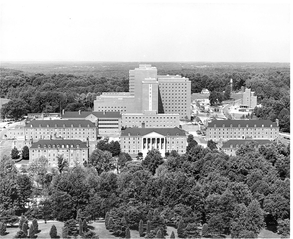
English: c. 1963. The Clinical Center (Building 10) rises behind buildings 1-7 on the NIH campus in Bethesda, Maryland. Photo from the Office of NIH History and Stetten Museum. |
| Date | circa 1963 |
| Source | https://www.pinterest.com/pin/506725395544561473/ |
| Author | U.S. National Institutes of Health |
| Camera location |
| View this and other nearby images on: OpenStreetMap |
|
|---|
Licensing
This image is a work of the
National Institutes of Health, part of the
United States Department of Health and Human Services, taken or made as part of an employee's official duties. As a
work of the
U.S. federal government, the image is in the
public domain.
 |
||
| This file has been identified as being free of known restrictions under copyright law, including all related and neighboring rights. | ||
File history
Click on a date/time to view the file as it appeared at that time.
| Date/Time | Thumbnail | Dimensions | User | Comment | |
|---|---|---|---|---|---|
| current | 03:08, 30 August 2020 |
| 5,764 × 4,688 (2.06 MB) | John P. Sadowski (NIOSH) | Uploaded a work by U.S. National Institutes of Health from https://www.pinterest.com/pin/506725395544561473/ with UploadWizard |
File usage
The following pages on the English Wikipedia use this file (pages on other projects are not listed):
Size of this preview:
737 × 599 pixels. Other resolutions:
295 × 240 pixels |
590 × 480 pixels |
944 × 768 pixels |
1,259 × 1,024 pixels |
2,518 × 2,048 pixels |
5,764 × 4,688 pixels.
Original file (5,764 × 4,688 pixels, file size: 2.06 MB, MIME type: image/jpeg)
| This is a file from the
Wikimedia Commons. Information from its
description page there is shown below. Commons is a freely licensed media file repository. You can help. |
Summary
| Description |
English: c. 1963. The Clinical Center (Building 10) rises behind buildings 1-7 on the NIH campus in Bethesda, Maryland. Photo from the Office of NIH History and Stetten Museum. |
| Date | circa 1963 |
| Source | https://www.pinterest.com/pin/506725395544561473/ |
| Author | U.S. National Institutes of Health |
| Camera location |
| View this and other nearby images on: OpenStreetMap |
|
|---|
Licensing
| This image is a work of the
National Institutes of Health, part of the
United States Department of Health and Human Services, taken or made as part of an employee's official duties. As a
work of the
U.S. federal government, the image is in the
public domain.
|
||
| This file has been identified as being free of known restrictions under copyright law, including all related and neighboring rights. | ||
File history
Click on a date/time to view the file as it appeared at that time.
| Date/Time | Thumbnail | Dimensions | User | Comment | |
|---|---|---|---|---|---|
| current | 03:08, 30 August 2020 |
| 5,764 × 4,688 (2.06 MB) | John P. Sadowski (NIOSH) | Uploaded a work by U.S. National Institutes of Health from https://www.pinterest.com/pin/506725395544561473/ with UploadWizard |
File usage
The following pages on the English Wikipedia use this file (pages on other projects are not listed):