Photos • Location


Size of this preview:
800 × 533 pixels. Other resolutions:
320 × 213 pixels |
640 × 427 pixels |
1,024 × 683 pixels |
1,280 × 853 pixels |
2,560 × 1,707 pixels |
5,340 × 3,560 pixels.
Original file (5,340 × 3,560 pixels, file size: 5.52 MB, MIME type: image/jpeg)
| This is a file from the
Wikimedia Commons. Information from its
description page there is shown below. Commons is a freely licensed media file repository. You can help. |
.jpg)
Summary
| Description |
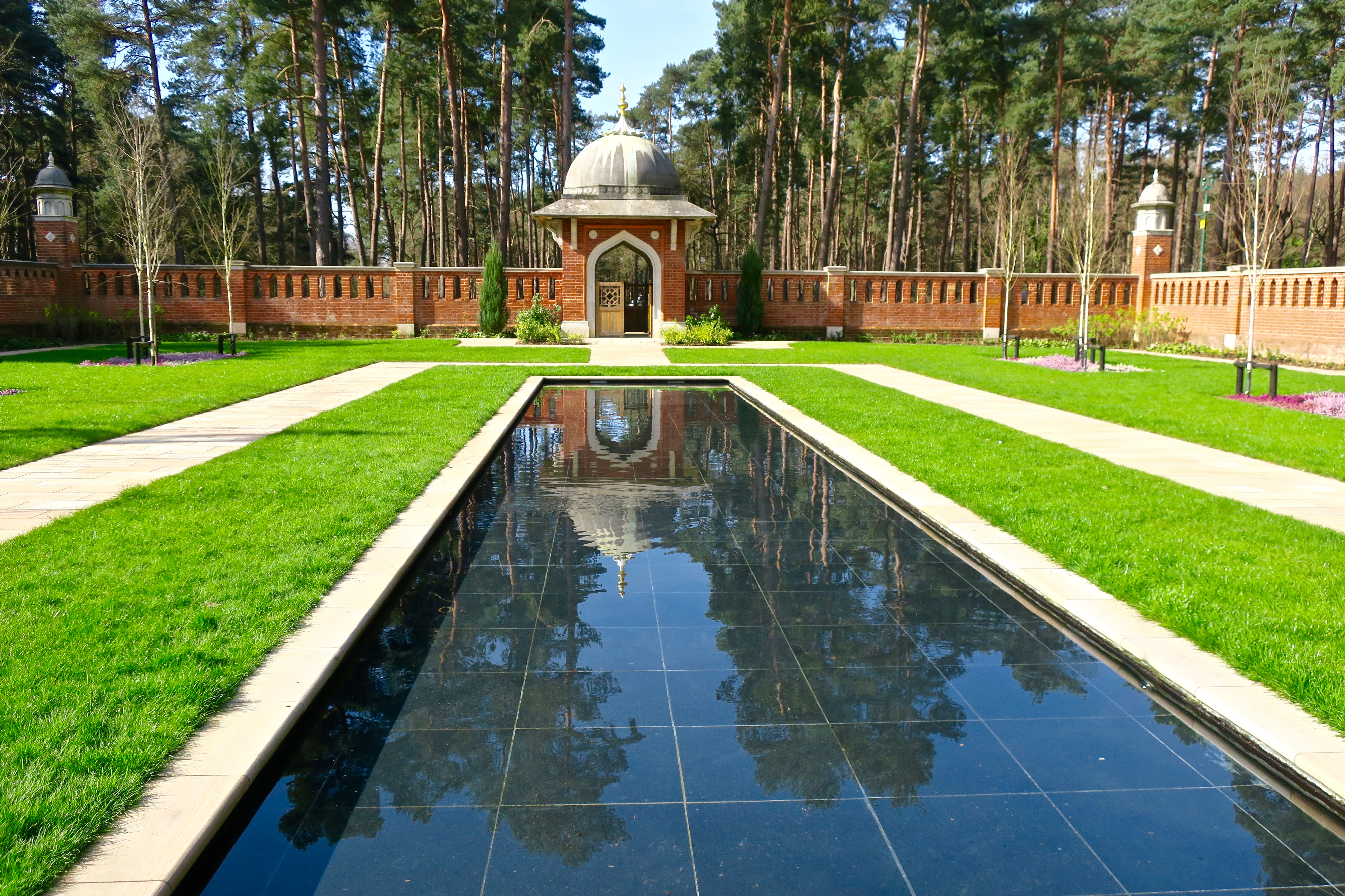
English: Muslim Burial Ground Peace Garden. The original Woking Muslim Military Cemetery was opened in 1917 by the British Government to counteract German propaganda After falling into disuse, it became overgrown and vandalised. It was listed in 1984 by English Heritage as a Grade II structure. Restoration efforts began in the 1990s, and eventually The Peace Garden was officially opened in November 2015. |
| Date | |
| Source | From geograph.org.uk |
| Author | Ibn Musa |
| Permission ( Reusing this file) |
Creative Commons Attribution Share-alike license 2.0 |
| Attribution ( required by the license) | Ibn Musa / Muslim Burial Ground Peace Garden / |
| Camera location | | View this and other nearby images on: OpenStreetMap |
|
|---|
.jpg¶ms=051.329296_N_-000.541836_E_globe:Earth_type:camera_source:geograph-osgb36(TQ01695992)_heading:247.00&language=en)
| Object location | | View this and other nearby images on: OpenStreetMap |
|
|---|
.jpg¶ms=051.329120_N_-000.542420_E_globe:Earth_class:object_type:object_source:geograph-osgb36(TQ01655990)_heading:247.00&language=en)
Licensing

|
This image was taken from the
Geograph project collection. See
this photograph's page on the Geograph website for the photographer's contact details. The copyright on this image is owned by Ibn Musa and is licensed for reuse under the
Creative Commons Attribution-ShareAlike 2.0 license.
|
This file is licensed under the
Creative Commons
Attribution-Share Alike 2.0 Generic license.
Attribution: Ibn Musa
- You are free:
- to share – to copy, distribute and transmit the work
- to remix – to adapt the work
- Under the following conditions:
- attribution – You must give appropriate credit, provide a link to the license, and indicate if changes were made. You may do so in any reasonable manner, but not in any way that suggests the licensor endorses you or your use.
- share alike – If you remix, transform, or build upon the material, you must distribute your contributions under the same or compatible license as the original.
File history
Click on a date/time to view the file as it appeared at that time.
| Date/Time | Thumbnail | Dimensions | User | Comment | |
|---|---|---|---|---|---|
| current | 16:13, 19 February 2018 |
| 5,340 × 3,560 (5.52 MB) | Chris j wood | Transferred from geograph.co.uk using [https://tools.wmflabs.org/geograph2commons/ geograph2commons] |
File usage
The following pages on the English Wikipedia use this file (pages on other projects are not listed):
Global file usage
The following other wikis use this file:
- Usage on www.wikidata.org
Metadata
.jpg)
Size of this preview:
800 × 533 pixels. Other resolutions:
320 × 213 pixels |
640 × 427 pixels |
1,024 × 683 pixels |
1,280 × 853 pixels |
2,560 × 1,707 pixels |
5,340 × 3,560 pixels.
Original file (5,340 × 3,560 pixels, file size: 5.52 MB, MIME type: image/jpeg)
| This is a file from the
Wikimedia Commons. Information from its
description page there is shown below. Commons is a freely licensed media file repository. You can help. |
Summary
| Description |
English: Muslim Burial Ground Peace Garden. The original Woking Muslim Military Cemetery was opened in 1917 by the British Government to counteract German propaganda After falling into disuse, it became overgrown and vandalised. It was listed in 1984 by English Heritage as a Grade II structure. Restoration efforts began in the 1990s, and eventually The Peace Garden was officially opened in November 2015. |
| Date | |
| Source | From geograph.org.uk |
| Author | Ibn Musa |
| Permission ( Reusing this file) |
Creative Commons Attribution Share-alike license 2.0 |
| Attribution ( required by the license) | Ibn Musa / Muslim Burial Ground Peace Garden / |
| Camera location | | View this and other nearby images on: OpenStreetMap |
|
|---|
| Object location | | View this and other nearby images on: OpenStreetMap |
|
|---|
Licensing
|
|
This image was taken from the
Geograph project collection. See
this photograph's page on the Geograph website for the photographer's contact details. The copyright on this image is owned by Ibn Musa and is licensed for reuse under the
Creative Commons Attribution-ShareAlike 2.0 license.
|
This file is licensed under the
Creative Commons
Attribution-Share Alike 2.0 Generic license.
Attribution: Ibn Musa
- You are free:
- to share – to copy, distribute and transmit the work
- to remix – to adapt the work
- Under the following conditions:
- attribution – You must give appropriate credit, provide a link to the license, and indicate if changes were made. You may do so in any reasonable manner, but not in any way that suggests the licensor endorses you or your use.
- share alike – If you remix, transform, or build upon the material, you must distribute your contributions under the same or compatible license as the original.
File history
Click on a date/time to view the file as it appeared at that time.
| Date/Time | Thumbnail | Dimensions | User | Comment | |
|---|---|---|---|---|---|
| current | 16:13, 19 February 2018 |
| 5,340 × 3,560 (5.52 MB) | Chris j wood | Transferred from geograph.co.uk using [https://tools.wmflabs.org/geograph2commons/ geograph2commons] |
File usage
The following pages on the English Wikipedia use this file (pages on other projects are not listed):
Global file usage
The following other wikis use this file:
- Usage on www.wikidata.org