Photos • Location


No higher resolution available.
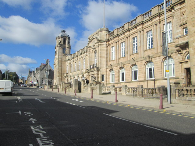
Municipal_buildings_in_Hamilton,_Lanarkshire_(geograph_3693222).jpg (640 × 480 pixels, file size: 82 KB, MIME type: image/jpeg)
| This is a file from the
Wikimedia Commons. Information from its
description page there is shown below. Commons is a freely licensed media file repository. You can help. |
Summary
| Description | Municipal buildings in Hamilton, Lanarkshire | ||
| Date | |||
| Source | geograph.org.uk | ||
| Author | James Denham | ||
| Permission ( Reusing this file) |
This file is licensed under the
Creative Commons
Attribution-Share Alike 2.0 Generic license. Attribution: James Denham
|
||
| Attribution ( required by the license) | James Denham / Municipal buildings in Hamilton, Lanarkshire / | ||

.jpg)
| Camera location | | View this and other nearby images on: OpenStreetMap |
|
|---|
.jpg¶ms=055.777243_N_-004.038459_E_globe:Earth_type:camera_source:geograph-osgb36(NS72245565)_heading:337.00&language=en)
| Object location | | View this and other nearby images on: OpenStreetMap |
|
|---|
.jpg¶ms=055.777420_N_-004.038630_E_globe:Earth_class:object_type:object_source:geograph-osgb36(NS72235567)_heading:337.00&language=en)
File history
Click on a date/time to view the file as it appeared at that time.
| Date/Time | Thumbnail | Dimensions | User | Comment | |
|---|---|---|---|---|---|
| current | 10:28, 14 December 2020 |
| 640 × 480 (82 KB) | Dormskirk | {{Information |Description=Municipal buildings in Hamilton, Lanarkshire |Source=[https://www.geograph.org.uk/photo/3693222 geograph.org.uk] |Date=2013-10-10 |Author=[https://www.geograph.org.uk/profile/21251 James Denham] |Permission={{geograph|3693222|James Denham}} |other_versions= }} {{Location|55.777243|-4.038459|source:geograph-osgb36(NS72245565)_heading:337|prec=10}} {{Object location|55.77742|-4.03863|source:geograph-osgb36(NS72235567)_heading:337|prec=10}} |
File usage
The following pages on the English Wikipedia use this file (pages on other projects are not listed):
.jpg)
No higher resolution available.
Municipal_buildings_in_Hamilton,_Lanarkshire_(geograph_3693222).jpg (640 × 480 pixels, file size: 82 KB, MIME type: image/jpeg)
| This is a file from the
Wikimedia Commons. Information from its
description page there is shown below. Commons is a freely licensed media file repository. You can help. |
Summary
| Description | Municipal buildings in Hamilton, Lanarkshire | ||
| Date | |||
| Source | geograph.org.uk | ||
| Author | James Denham | ||
| Permission ( Reusing this file) |
This file is licensed under the
Creative Commons
Attribution-Share Alike 2.0 Generic license. Attribution: James Denham
|
||
| Attribution ( required by the license) | James Denham / Municipal buildings in Hamilton, Lanarkshire / | ||
| Camera location | | View this and other nearby images on: OpenStreetMap |
|
|---|
| Object location | | View this and other nearby images on: OpenStreetMap |
|
|---|
File history
Click on a date/time to view the file as it appeared at that time.
| Date/Time | Thumbnail | Dimensions | User | Comment | |
|---|---|---|---|---|---|
| current | 10:28, 14 December 2020 |
| 640 × 480 (82 KB) | Dormskirk | {{Information |Description=Municipal buildings in Hamilton, Lanarkshire |Source=[https://www.geograph.org.uk/photo/3693222 geograph.org.uk] |Date=2013-10-10 |Author=[https://www.geograph.org.uk/profile/21251 James Denham] |Permission={{geograph|3693222|James Denham}} |other_versions= }} {{Location|55.777243|-4.038459|source:geograph-osgb36(NS72245565)_heading:337|prec=10}} {{Object location|55.77742|-4.03863|source:geograph-osgb36(NS72235567)_heading:337|prec=10}} |
File usage
The following pages on the English Wikipedia use this file (pages on other projects are not listed):