This is a file from the Wikimedia Commons
From Wikipedia, the free encyclopedia

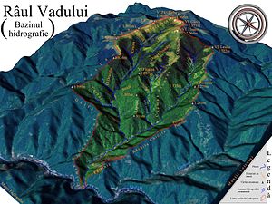
Modelare_3D_pentru_bazinul_hidrografic_al_Raului_Vadului,_afluent_al_Oltului.gif(300 × 214 pixels, file size: 7.17 MB, MIME type: image/gif, looped, 180 frames, 11 s)

Summary

Description
Română: Modelare 3D pentru bazinul hidrografic al Raului Vadului, afluent al Oltului.
Date
Source Topographic data SRTM from NASA and World Imagery - NASA World Wind & 3Dem & Inkscape
Author Asybaris01
Other versions
Vadu River drainage basin 3D map

Clickable map of the (ro:Defileul Oltului)/(en:Defile Olt) drainage basin

Lotrioara drainage basin Megieşul & Pleaşa drainages basins Mărul & Strâmba drainages basins Fratelui & Boul drainages basins Vadul drainage basin Vlad/Stupina/Valea Largă/Scaunelor drainage basin Curpănul & Coţii drainage basin Boia drainage basin Uria and Robeşti drainage basin Călineşti under construction Secu drainage basin Băiaşu drainage basin Lotrişor under construction Brădişor Lake Vidra Lake Latoriţa drainage basin Lotru under construction România Cindrel Mountains Făgăraş Mountains Cozia Massif Căpăţânii Mountains Parâng Mountains Şureanu Mountains Lotrului Mountains
Senzitive map of the Defile Olt drainage basin. (Click on the desired quadrant.)

Licensing

Public domain
This image is in the public domain because it is a screenshot from NASA’s globe software World Wind using a public domain layer, such as Blue Marble, MODIS, Landsat, SRTM, USGS or GLOBE.

العربيَّة | English | فارسی | français | עברית | македонски | മലയാളം | Nederlands | русский | 中文(中国大陆)‎ | +/−

File history

Click on a date/time to view the file as it appeared at that time.

Date/TimeThumbnailDimensionsUserComment
current 06:50, 26 October 2011 Thumbnail for version as of 06:50, 26 October 2011300 × 214 (7.17 MB) Asybaris01{{Information |Description ={{ro|1=Modelare 3D pentru bazinul hidrografic al Raului Vadului, afluent al Oltului.}} |Source =Topographic data SRTM from NASA and World Imagery - NASA World Wind & 3Dem & Inkscape |Author =[[User:Asybaris01
The following pages on the English Wikipedia use this file (pages on other projects are not listed):

Global file usage

The following other wikis use this file:


Videos

Youtube | Vimeo | Bing

Websites

Google | Yahoo | Bing

Encyclopedia

Google | Yahoo | Bing

Facebook