
Size of this preview:
614 × 599 pixels. Other resolutions:
246 × 240 pixels |
492 × 480 pixels.
Original file (800 × 781 pixels, file size: 317 KB, MIME type: image/jpeg)
| This is a file from the
Wikimedia Commons. Information from its
description page there is shown below. Commons is a freely licensed media file repository. You can help. |
Summary
| Description |
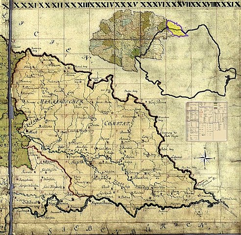
Română: Miniatură pentru background la formatul senzitiv al
harţii iozefine a
Maramureşului, 1782-1785. |
||
| Date | |||
| Source | Own work | ||
| Author | Asybaris01 | ||
| Permission ( Reusing this file) |
I, the copyright holder of this work, hereby publish it under the following licenses: This file is licensed under the
Creative Commons
Attribution-Share Alike 3.0 Unported license.
You may select the license of your choice. |

Clickable Map of the Maramureş County

File history
Click on a date/time to view the file as it appeared at that time.
| Date/Time | Thumbnail | Dimensions | User | Comment | |
|---|---|---|---|---|---|
| current | 21:19, 8 March 2010 |
| 800 × 781 (317 KB) | Asybaris01 | {{Information |Description={{ro|1=Miniatură pentru background la formatul senzitiv al harţii iozefine a Maramureşului, 1782-1785.}} |Source={{own}} |Author= Asybaris01 |Date |
File usage
The following pages on the English Wikipedia use this file (pages on other projects are not listed):
Global file usage
The following other wikis use this file:
- Usage on ar.wikipedia.org
- Usage on ca.wikipedia.org
- Usage on cs.wikipedia.org
- Usage on he.wikipedia.org
- Usage on hr.wikipedia.org
- Usage on hu.wikipedia.org
- Usage on hy.wikipedia.org
- Usage on ko.wikipedia.org
- Usage on ro.wikipedia.org
- Usage on ro.wikivoyage.org
- Usage on ru.wikipedia.org
- Usage on sr.wikipedia.org
- Usage on uk.wikipedia.org
Metadata
Size of this preview:
614 × 599 pixels. Other resolutions:
246 × 240 pixels |
492 × 480 pixels.
Original file (800 × 781 pixels, file size: 317 KB, MIME type: image/jpeg)
| This is a file from the
Wikimedia Commons. Information from its
description page there is shown below. Commons is a freely licensed media file repository. You can help. |
Summary
| Description |
Română: Miniatură pentru background la formatul senzitiv al
harţii iozefine a
Maramureşului, 1782-1785. |
||
| Date | |||
| Source | Own work | ||
| Author | Asybaris01 | ||
| Permission ( Reusing this file) |
I, the copyright holder of this work, hereby publish it under the following licenses: This file is licensed under the
Creative Commons
Attribution-Share Alike 3.0 Unported license.
You may select the license of your choice. |
Clickable Map of the Maramureş County
File history
Click on a date/time to view the file as it appeared at that time.
| Date/Time | Thumbnail | Dimensions | User | Comment | |
|---|---|---|---|---|---|
| current | 21:19, 8 March 2010 |
| 800 × 781 (317 KB) | Asybaris01 | {{Information |Description={{ro|1=Miniatură pentru background la formatul senzitiv al harţii iozefine a Maramureşului, 1782-1785.}} |Source={{own}} |Author= Asybaris01 |Date |
File usage
The following pages on the English Wikipedia use this file (pages on other projects are not listed):
Global file usage
The following other wikis use this file:
- Usage on ar.wikipedia.org
- Usage on ca.wikipedia.org
- Usage on cs.wikipedia.org
- Usage on he.wikipedia.org
- Usage on hr.wikipedia.org
- Usage on hu.wikipedia.org
- Usage on hy.wikipedia.org
- Usage on ko.wikipedia.org
- Usage on ro.wikipedia.org
- Usage on ro.wikivoyage.org
- Usage on ru.wikipedia.org
- Usage on sr.wikipedia.org
- Usage on uk.wikipedia.org