
Original file (SVG file, nominally 400 × 600 pixels, file size: 1.13 MB)
| This is a file from the
Wikimedia Commons. Information from its
description page there is shown below. Commons is a freely licensed media file repository. You can help. |
| Description |
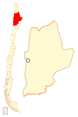
Español: Mapa localizador de la
II Región de Antofagasta |
| Date | |
| Source | Own work |
| Author | B1mbo |
| Permission ( Reusing this file) |
I, the copyright holder of this work, hereby publish it under the following license: This file is licensed under the
Creative Commons
Attribution-Share Alike 2.5 Generic license.
|
|
|
Legal disclaimer
The edition and circulation of maps, geographic charts and other documents about the boundaries and frontiers of Chile, don't have any relation with the Republic of Chile, according to the Article 2 g) of DFL Nº83 of 1979 of the Ministery of Foreign Affairs. La edición y circulación de mapas, cartas geográficas y otros documentos sobre los límites y fronteras de Chile no tienen relación alguna con la República de Chile de acuerdo al artículo 2 g) del DFL Nº83 de 1979 del Ministerio de Relaciones Exteriores. |
File history
Click on a date/time to view the file as it appeared at that time.
| Date/Time | Thumbnail | Dimensions | User | Comment | |
|---|---|---|---|---|---|
| current | 22:35, 5 September 2018 |
| 400 × 600 (1.13 MB) | Janitoalevic | Ñuble Region |
| 23:13, 20 August 2017 |
 | 400 × 600 (1 MB) | Janitoalevic | Reverted to version as of 02:10, 6 October 2007 (UTC) | |
| 03:54, 20 August 2017 |
 | 400 × 600 (1.06 MB) | Janitoalevic | Added Ñuble Region | |
| 02:10, 6 October 2007 |
 | 400 × 600 (1 MB) | B1mbo | {{Information |Description= {{es|Mapa localizador de la II Región de Antofagasta}} |Source=own work |Date=5 de octubre, 2007 |Author= B1mbo |Permission={{self|cc-by-sa-2.5}} |other_versions= }} {{User:B1mbo |
File usage
- Antofagasta
- Antofagasta Province
- Antofagasta Region
- Calama, Chile
- Cerro Dominador Solar Thermal Plant
- El Loa
- María Elena, Chile
- María Elena Solar Power Plant
- Mejillones
- Ollagüe, Chile
- San Pedro de Atacama
- Sierra Gorda, Chile
- Taltal
- Tocopilla
- Tocopilla Province
- Template:Communes in Antofagasta Region
Global file usage
The following other wikis use this file:
- Usage on ba.wikipedia.org
- Usage on bg.wikipedia.org
- Usage on br.wikipedia.org
- Usage on da.wikipedia.org
- Usage on de.wikipedia.org
- Usage on diq.wikipedia.org
- Usage on es.wikipedia.org
- Usage on eu.wikipedia.org
- Usage on fi.wikipedia.org
- Usage on frr.wikipedia.org
- Usage on hr.wikipedia.org
- Usage on hy.wikipedia.org
- Usage on ja.wikipedia.org
- Usage on ka.wikipedia.org
- Usage on ko.wikipedia.org
View more global usage of this file.
Metadata
Original file (SVG file, nominally 400 × 600 pixels, file size: 1.13 MB)
| This is a file from the
Wikimedia Commons. Information from its
description page there is shown below. Commons is a freely licensed media file repository. You can help. |
| Description |
Español: Mapa localizador de la
II Región de Antofagasta |
| Date | |
| Source | Own work |
| Author | B1mbo |
| Permission ( Reusing this file) |
I, the copyright holder of this work, hereby publish it under the following license: This file is licensed under the
Creative Commons
Attribution-Share Alike 2.5 Generic license.
|
|
|
Legal disclaimer
The edition and circulation of maps, geographic charts and other documents about the boundaries and frontiers of Chile, don't have any relation with the Republic of Chile, according to the Article 2 g) of DFL Nº83 of 1979 of the Ministery of Foreign Affairs. La edición y circulación de mapas, cartas geográficas y otros documentos sobre los límites y fronteras de Chile no tienen relación alguna con la República de Chile de acuerdo al artículo 2 g) del DFL Nº83 de 1979 del Ministerio de Relaciones Exteriores. |
File history
Click on a date/time to view the file as it appeared at that time.
| Date/Time | Thumbnail | Dimensions | User | Comment | |
|---|---|---|---|---|---|
| current | 22:35, 5 September 2018 |
| 400 × 600 (1.13 MB) | Janitoalevic | Ñuble Region |
| 23:13, 20 August 2017 |
| 400 × 600 (1 MB) | Janitoalevic | Reverted to version as of 02:10, 6 October 2007 (UTC) | |
| 03:54, 20 August 2017 |
| 400 × 600 (1.06 MB) | Janitoalevic | Added Ñuble Region | |
| 02:10, 6 October 2007 |
| 400 × 600 (1 MB) | B1mbo | {{Information |Description= {{es|Mapa localizador de la II Región de Antofagasta}} |Source=own work |Date=5 de octubre, 2007 |Author= B1mbo |Permission={{self|cc-by-sa-2.5}} |other_versions= }} {{User:B1mbo |
File usage
- Antofagasta
- Antofagasta Province
- Antofagasta Region
- Calama, Chile
- Cerro Dominador Solar Thermal Plant
- El Loa
- María Elena, Chile
- María Elena Solar Power Plant
- Mejillones
- Ollagüe, Chile
- San Pedro de Atacama
- Sierra Gorda, Chile
- Taltal
- Tocopilla
- Tocopilla Province
- Template:Communes in Antofagasta Region
Global file usage
The following other wikis use this file:
- Usage on ba.wikipedia.org
- Usage on bg.wikipedia.org
- Usage on br.wikipedia.org
- Usage on da.wikipedia.org
- Usage on de.wikipedia.org
- Usage on diq.wikipedia.org
- Usage on es.wikipedia.org
- Usage on eu.wikipedia.org
- Usage on fi.wikipedia.org
- Usage on frr.wikipedia.org
- Usage on hr.wikipedia.org
- Usage on hy.wikipedia.org
- Usage on ja.wikipedia.org
- Usage on ka.wikipedia.org
- Usage on ko.wikipedia.org
View more global usage of this file.