
Original file (SVG file, nominally 809 × 709 pixels, file size: 486 KB)
| This is a file from the
Wikimedia Commons. Information from its
description page there is shown below. Commons is a freely licensed media file repository. You can help. |
.svg)
Summary
| Description |
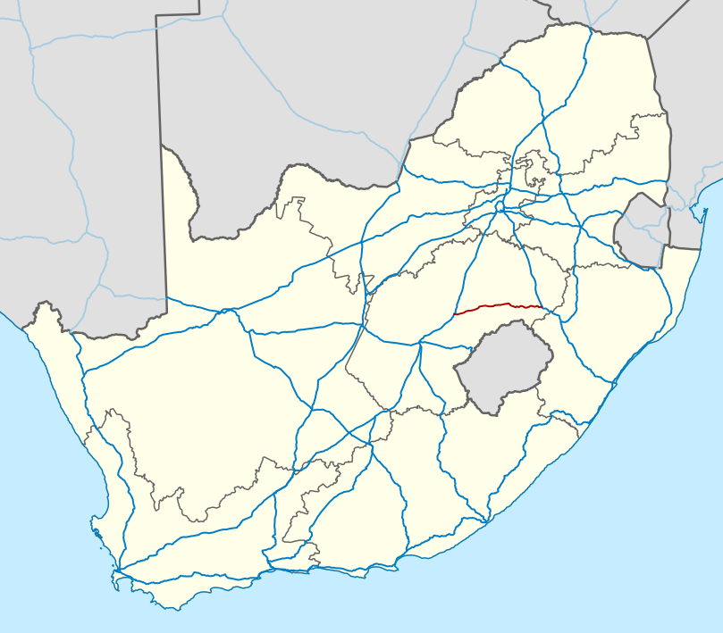
English: Map of the N5 national road in South Africa. |
| Date | |
| Source | Based on File:Map of the National Roads of South Africa.svg |
| Author | Htonl |
| Other versions |
Map of the N5 (South Africa) with labels.svg:
|
| SVG development |
_with_labels.svg)
Licensing
- You are free:
- to share – to copy, distribute and transmit the work
- to remix – to adapt the work
- Under the following conditions:
- attribution – You must give appropriate credit, provide a link to the license, and indicate if changes were made. You may do so in any reasonable manner, but not in any way that suggests the licensor endorses you or your use.
- share alike – If you remix, transform, or build upon the material, you must distribute your contributions under the same or compatible license as the original.
|
|
This work contains information from
OpenStreetMap, which is made available under the
Open Database License (ODbL).
The ODbL does not require any particular license for maps produced from ODbL data. Prior to 1 August 2020, map tiles produced by the OpenStreetMap Foundation were licensed under the CC-BY-SA-2.0 license. Maps produced by other people may be subject to other licences. |
File history
Click on a date/time to view the file as it appeared at that time.
| Date/Time | Thumbnail | Dimensions | User | Comment | |
|---|---|---|---|---|---|
| current | 17:36, 9 February 2014 |
| 809 × 709 (486 KB) | Htonl | update with roads in neighbouring countries |
| 20:18, 10 December 2010 |
 | 757 × 660 (800 KB) | Htonl | use appropriate projection; change basemap style | |
| 13:56, 21 April 2010 |
 | 1,000 × 786 (1.01 MB) | Htonl | new version based on OSM data | |
| 22:11, 23 July 2009 |
 | 1,000 × 786 (1.61 MB) | Htonl | colours, widths | |
| 21:43, 6 November 2008 |
 | 1,000 × 786 (1.59 MB) | Htonl | == Summary == {{Information |Description={{en|1=Map of the N5 national road in South Africa.}} |Source=Own work by uploader |Author= Htonl |Date=2008-11-06 |Permission= |other_versions= }} <!--{{ImageUpload|full}}--> [[Category:Maps of road |
File usage
Global file usage
The following other wikis use this file:
- Usage on af.wikipedia.org
- Usage on de.wikipedia.org
- Usage on ja.wikipedia.org
- Usage on nl.wikipedia.org
- Usage on uk.wikipedia.org
- Usage on www.wikidata.org
- Usage on zh.wikipedia.org
Metadata
.svg)
Original file (SVG file, nominally 809 × 709 pixels, file size: 486 KB)
| This is a file from the
Wikimedia Commons. Information from its
description page there is shown below. Commons is a freely licensed media file repository. You can help. |
Summary
| Description |
English: Map of the N5 national road in South Africa. |
| Date | |
| Source | Based on File:Map of the National Roads of South Africa.svg |
| Author | Htonl |
| Other versions |
Map of the N5 (South Africa) with labels.svg:
|
| SVG development |
Licensing
- You are free:
- to share – to copy, distribute and transmit the work
- to remix – to adapt the work
- Under the following conditions:
- attribution – You must give appropriate credit, provide a link to the license, and indicate if changes were made. You may do so in any reasonable manner, but not in any way that suggests the licensor endorses you or your use.
- share alike – If you remix, transform, or build upon the material, you must distribute your contributions under the same or compatible license as the original.
|
|
This work contains information from
OpenStreetMap, which is made available under the
Open Database License (ODbL).
The ODbL does not require any particular license for maps produced from ODbL data. Prior to 1 August 2020, map tiles produced by the OpenStreetMap Foundation were licensed under the CC-BY-SA-2.0 license. Maps produced by other people may be subject to other licences. |
File history
Click on a date/time to view the file as it appeared at that time.
| Date/Time | Thumbnail | Dimensions | User | Comment | |
|---|---|---|---|---|---|
| current | 17:36, 9 February 2014 |
| 809 × 709 (486 KB) | Htonl | update with roads in neighbouring countries |
| 20:18, 10 December 2010 |
| 757 × 660 (800 KB) | Htonl | use appropriate projection; change basemap style | |
| 13:56, 21 April 2010 |
| 1,000 × 786 (1.01 MB) | Htonl | new version based on OSM data | |
| 22:11, 23 July 2009 |
| 1,000 × 786 (1.61 MB) | Htonl | colours, widths | |
| 21:43, 6 November 2008 |
| 1,000 × 786 (1.59 MB) | Htonl | == Summary == {{Information |Description={{en|1=Map of the N5 national road in South Africa.}} |Source=Own work by uploader |Author= Htonl |Date=2008-11-06 |Permission= |other_versions= }} <!--{{ImageUpload|full}}--> [[Category:Maps of road |
File usage
Global file usage
The following other wikis use this file:
- Usage on af.wikipedia.org
- Usage on de.wikipedia.org
- Usage on ja.wikipedia.org
- Usage on nl.wikipedia.org
- Usage on uk.wikipedia.org
- Usage on www.wikidata.org
- Usage on zh.wikipedia.org